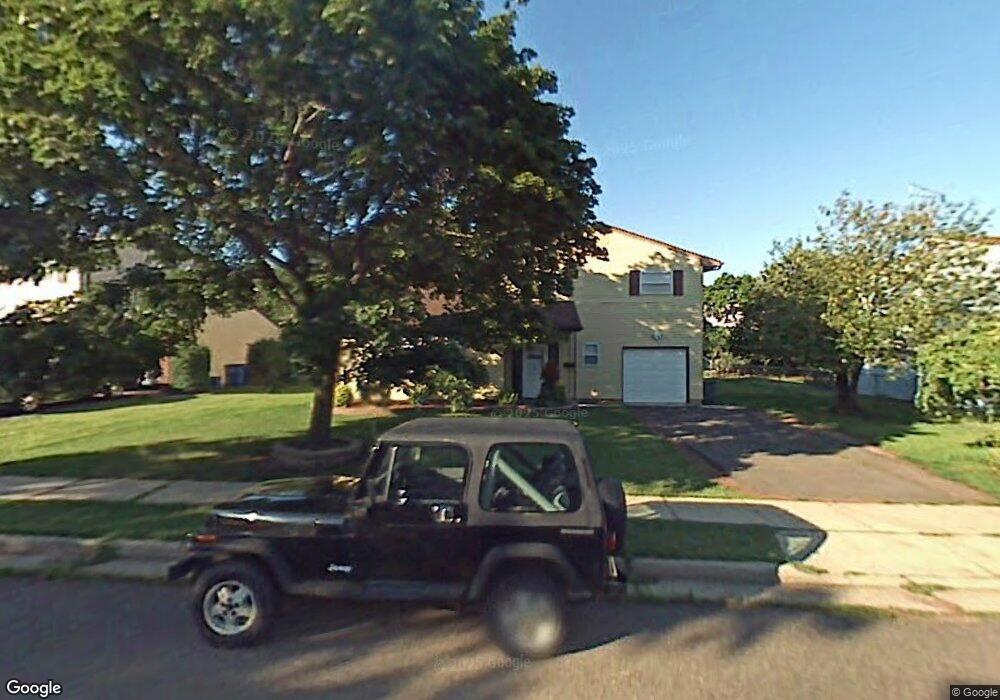
6 Robert C Keri Ct Somerset, NJ 08873
Estimated Value: $495,000 - $516,942
3
Beds
2
Baths
1,609
Sq Ft
$317/Sq Ft
Est. Value
About This Home
This home is located at 6 Robert C Keri Ct, Somerset, NJ 08873 and is currently estimated at $509,736, approximately $316 per square foot. 6 Robert C Keri Ct is a home located in Somerset County with nearby schools including Franklin High School.
Ownership History
Date
Name
Owned For
Owner Type
Purchase Details
Closed on
Aug 5, 2013
Sold by
Romero Florez Luis Alberto and Leal Nisa
Bought by
Leal Nilsa
Current Estimated Value
Purchase Details
Closed on
Jul 24, 2008
Sold by
Leal Nilsa and Estevez Yoni
Bought by
Leal Nilsa and Romero Luis Alberto
Purchase Details
Closed on
May 26, 2006
Sold by
Brown Shirnett Dunn
Bought by
Leal Nilsa and Florez Luis Alberto Romero
Home Financials for this Owner
Home Financials are based on the most recent Mortgage that was taken out on this home.
Original Mortgage
$260,000
Outstanding Balance
$153,286
Interest Rate
6.62%
Estimated Equity
$356,450
Purchase Details
Closed on
Jul 26, 2001
Sold by
Kelley Mary
Bought by
Dunn Shirnet
Home Financials for this Owner
Home Financials are based on the most recent Mortgage that was taken out on this home.
Original Mortgage
$162,500
Interest Rate
7.1%
Create a Home Valuation Report for This Property
The Home Valuation Report is an in-depth analysis detailing your home's value as well as a comparison with similar homes in the area
Home Values in the Area
Average Home Value in this Area
Purchase History
| Date | Buyer | Sale Price | Title Company |
|---|---|---|---|
| Leal Nilsa | -- | None Available | |
| Leal Nilsa | -- | First American Title Ins Co | |
| Leal Nilsa | $325,000 | -- | |
| Dunn Shirnet | $197,500 | -- |
Source: Public Records
Mortgage History
| Date | Status | Borrower | Loan Amount |
|---|---|---|---|
| Open | Leal Nilsa | $260,000 | |
| Previous Owner | Dunn Shirnet | $162,500 |
Source: Public Records
Tax History Compared to Growth
Tax History
| Year | Tax Paid | Tax Assessment Tax Assessment Total Assessment is a certain percentage of the fair market value that is determined by local assessors to be the total taxable value of land and additions on the property. | Land | Improvement |
|---|---|---|---|---|
| 2025 | $6,836 | $449,300 | $214,800 | $234,500 |
| 2024 | $6,836 | $375,200 | $214,800 | $160,400 |
| 2023 | $6,891 | $355,200 | $194,800 | $160,400 |
| 2022 | $6,967 | $340,200 | $179,800 | $160,400 |
| 2021 | $6,691 | $300,200 | $139,800 | $160,400 |
| 2020 | $6,294 | $275,200 | $114,800 | $160,400 |
| 2019 | $6,147 | $265,200 | $104,800 | $160,400 |
| 2018 | $6,211 | $265,200 | $104,800 | $160,400 |
| 2017 | $6,470 | $275,200 | $114,800 | $160,400 |
| 2016 | $6,525 | $275,200 | $114,800 | $160,400 |
| 2015 | $6,481 | $275,200 | $114,800 | $160,400 |
| 2014 | $6,385 | $275,200 | $114,800 | $160,400 |
Source: Public Records
Map
Nearby Homes
- 69 Robbins Ave
- 56 Marvin Ave
- 4 Fraley Dr
- 25 Oakbrook Place
- 30 Whittier Ave
- 240 New York Ave
- 168 Harrison St
- 11 Lincoln Place
- 497 Easton Ave
- 314 Easton Ave
- 32 Hawthorne Dr
- 612 Hamilton St
- 15 Barker Rd
- 225 Irvington Ave
- 7 Old Lane Highwood
- 12 Barker Rd
- 97 Sydney Place
- 94 Main St
- 85 Winston Dr
- 453 Franklin Blvd
- 8 Robert C Keri Ct Unit 2
- 8 Robert C Keri Ct
- 4 Robert C Keri Ct
- 68 Donald Ave
- 62 Donald Ave
- 74 Donald Ave
- 5 Robert C Keri Ct
- 10 Robert C Keri Ct
- 2 Robert C Keri Ct
- 7 Robert C Keri Ct
- 3 Robert C Keri Ct
- 52 Donald Ave
- 78 Donald Ave
- 1 Robert C Keri Ct
- 9 Robert C Keri Ct
- 12 Robert C Keri Ct
- 191 Highland Ave
- 65 Donald Ave
- 57 Donald Ave
- 185 Highland Ave