Estimated Value: $861,000 - $1,040,000
3
Beds
2
Baths
2,143
Sq Ft
$439/Sq Ft
Est. Value
About This Home
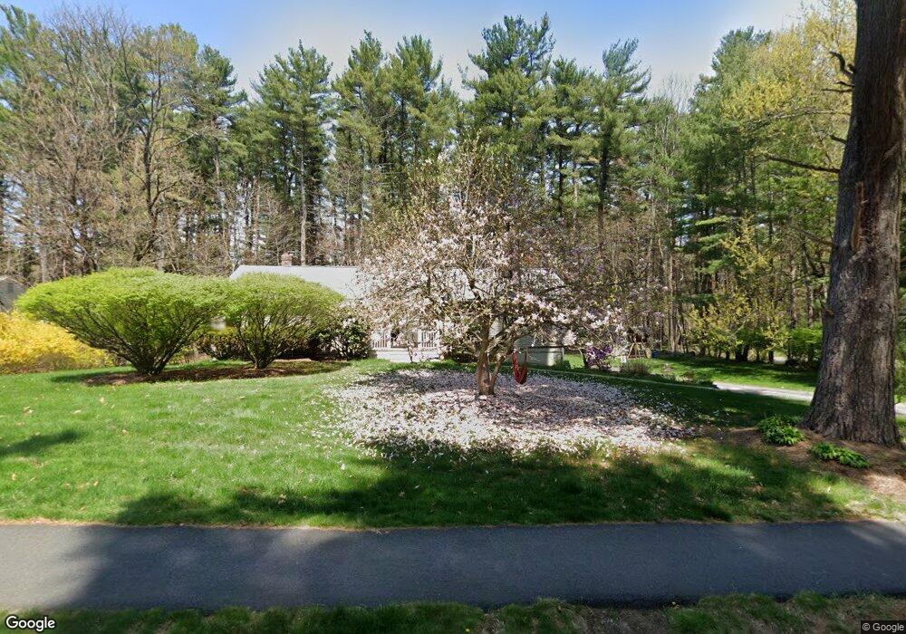
This home is located at 6 Robinwood Rd, Acton, MA 01720 and is currently estimated at $941,283, approximately $439 per square foot. 6 Robinwood Rd is a home located in Middlesex County with nearby schools including Acton-Boxborough Regional High School and The Imago School.
Ownership History
Date
Name
Owned For
Owner Type
Purchase Details
Closed on
Oct 14, 2009
Sold by
Zavaliagkos George and Zavaliagkos Irene
Bought by
Stowe Matthew and Stowe Lin S
Current Estimated Value
Home Financials for this Owner
Home Financials are based on the most recent Mortgage that was taken out on this home.
Original Mortgage
$377,600
Interest Rate
5.14%
Mortgage Type
Purchase Money Mortgage
Purchase Details
Closed on
Feb 16, 1996
Sold by
Caracostas George
Bought by
Zavaliagkos George and Zavaliagkos Irene
Home Financials for this Owner
Home Financials are based on the most recent Mortgage that was taken out on this home.
Original Mortgage
$200,000
Interest Rate
6.99%
Mortgage Type
Purchase Money Mortgage
Purchase Details
Closed on
Aug 29, 1995
Sold by
Jan Min-Der and Jan Mai-Lin
Bought by
Caracostas George
Purchase Details
Closed on
Jul 22, 1991
Sold by
Russo Clemente J and Russo Carol T
Bought by
Jan Min-Der and Jan Mai-Lin
Create a Home Valuation Report for This Property
The Home Valuation Report is an in-depth analysis detailing your home's value as well as a comparison with similar homes in the area
Home Values in the Area
Average Home Value in this Area
Purchase History
| Date | Buyer | Sale Price | Title Company |
|---|---|---|---|
| Stowe Matthew | $472,000 | -- | |
| Zavaliagkos George | $250,500 | -- | |
| Caracostas George | $255,000 | -- | |
| Jan Min-Der | $222,000 | -- |
Source: Public Records
Mortgage History
| Date | Status | Borrower | Loan Amount |
|---|---|---|---|
| Open | Caracostas George | $376,200 | |
| Closed | Stowe Matthew | $377,600 | |
| Previous Owner | Caracostas George | $200,000 |
Source: Public Records
Tax History
| Year | Tax Paid | Tax Assessment Tax Assessment Total Assessment is a certain percentage of the fair market value that is determined by local assessors to be the total taxable value of land and additions on the property. | Land | Improvement |
|---|---|---|---|---|
| 2025 | $13,379 | $780,100 | $347,300 | $432,800 |
| 2024 | $12,866 | $771,800 | $347,300 | $424,500 |
| 2023 | $12,280 | $699,300 | $315,700 | $383,600 |
| 2022 | $12,273 | $631,000 | $274,700 | $356,300 |
| 2021 | $11,705 | $578,600 | $254,100 | $324,500 |
| 2020 | $10,957 | $569,500 | $254,100 | $315,400 |
| 2019 | $10,495 | $541,800 | $254,100 | $287,700 |
| 2018 | $9,698 | $500,400 | $254,100 | $246,300 |
| 2017 | $9,538 | $500,400 | $254,100 | $246,300 |
| 2016 | $8,913 | $463,500 | $254,100 | $209,400 |
| 2015 | $8,496 | $446,000 | $254,100 | $191,900 |
| 2014 | $8,513 | $437,700 | $254,100 | $183,600 |
Source: Public Records
Map
Nearby Homes
- 7 Hillcrest Dr
- 59 Lexington Dr
- 303 School St
- 1 Vanderbelt Rd
- 27 Forest Rd
- 70 River St
- 128 Parker St Unit 3B
- 31 Drummer Rd Unit 31
- 46 Taylor Rd
- 30 Brewster Ln
- 95 Concord Rd
- 1 Drummer Rd Unit A5
- 65 Summit St
- 40 High St
- 245 Oak Hill Cir
- 25 Nylander Way
- 7 Kelley Rd
- 129 Main St Unit 129
- 131 Main St
- 184 Main St Unit 3
Your Personal Tour Guide
Ask me questions while you tour the home.