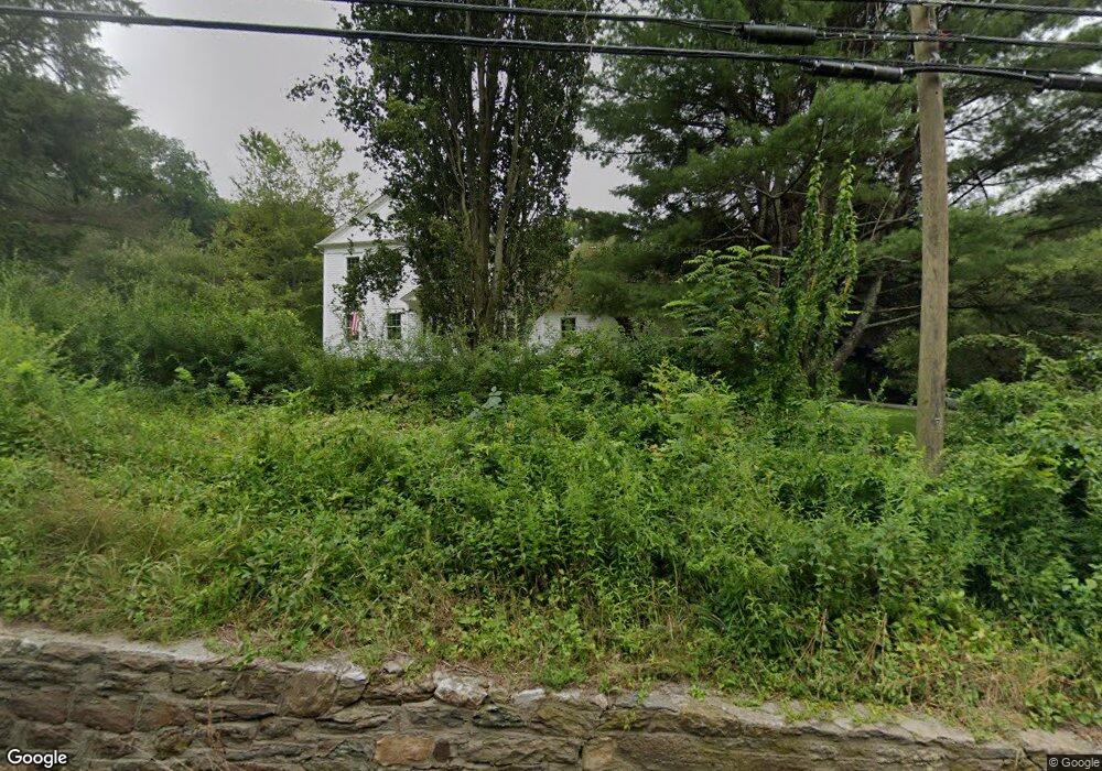
6 Route 37 E Sherman, CT 06784
Estimated Value: $436,000 - $844,000
3
Beds
3
Baths
3,059
Sq Ft
$218/Sq Ft
Est. Value
About This Home
This home is located at 6 Route 37 E, Sherman, CT 06784 and is currently estimated at $668,321, approximately $218 per square foot. 6 Route 37 E is a home located in Fairfield County with nearby schools including Sherman School.
Ownership History
Date
Name
Owned For
Owner Type
Purchase Details
Closed on
Dec 1, 2015
Sold by
Mac Freddie
Bought by
Hadrossek Llc
Current Estimated Value
Purchase Details
Closed on
Aug 11, 2015
Sold by
Us Bank Na
Bought by
Fhlmc
Purchase Details
Closed on
Jul 28, 2015
Sold by
Burns Daniel H
Bought by
Us Bank Na
Purchase Details
Closed on
Aug 13, 1999
Sold by
Phillips Emmitt W and Phillips Lynne J
Bought by
Burns Daniel H
Home Financials for this Owner
Home Financials are based on the most recent Mortgage that was taken out on this home.
Original Mortgage
$208,000
Interest Rate
7.65%
Create a Home Valuation Report for This Property
The Home Valuation Report is an in-depth analysis detailing your home's value as well as a comparison with similar homes in the area
Home Values in the Area
Average Home Value in this Area
Purchase History
| Date | Buyer | Sale Price | Title Company |
|---|---|---|---|
| Hadrossek Llc | $241,500 | -- | |
| Fhlmc | -- | -- | |
| Us Bank Na | -- | -- | |
| Burns Daniel H | $260,000 | -- |
Source: Public Records
Mortgage History
| Date | Status | Borrower | Loan Amount |
|---|---|---|---|
| Previous Owner | Burns Daniel H | $370,000 | |
| Previous Owner | Burns Daniel H | $145,000 | |
| Previous Owner | Burns Daniel H | $208,000 |
Source: Public Records
Tax History
| Year | Tax Paid | Tax Assessment Tax Assessment Total Assessment is a certain percentage of the fair market value that is determined by local assessors to be the total taxable value of land and additions on the property. | Land | Improvement |
|---|---|---|---|---|
| 2025 | $5,771 | $346,200 | $70,500 | $275,700 |
| 2024 | $5,664 | $346,200 | $70,500 | $275,700 |
| 2023 | $6,169 | $346,200 | $70,500 | $275,700 |
| 2022 | $6,294 | $346,200 | $70,500 | $275,700 |
| 2021 | $6,453 | $346,200 | $70,500 | $275,700 |
| 2020 | $5,658 | $296,100 | $70,600 | $225,500 |
| 2019 | $5,785 | $292,000 | $70,600 | $221,400 |
| 2018 | $6,071 | $298,600 | $74,500 | $224,100 |
| 2017 | $6,071 | $298,600 | $74,500 | $224,100 |
| 2016 | $6,102 | $300,160 | $74,480 | $225,680 |
| 2015 | $6,050 | $301,910 | $74,480 | $227,430 |
| 2014 | $5,990 | $301,910 | $74,480 | $227,430 |
Source: Public Records
Map
Nearby Homes
- 6 Brinsmade Ln
- 2 Coburn Road W, She Coburn Rd W
- 11 Gelston Rd
- 0 Sherman Rd
- 8 Candleview Dr
- 12 Shadow Ln
- 0 Candlewood Mountain Rd Unit 24137997
- 0 Candlewood Mountain Rd Unit 24138000
- 9 Duncan Ln
- 3 Duncan Ln
- 20 Zacary Ln
- 0 Rte 39 South State Route
- 0 Wagon Wheel Rd Unit 24065102
- 105 Route 39 N
- 29 Candlewood Common
- 0 Kirby Hill Rd
- 1125 Old Quaker Hill Rd
- 22 Candlewood Common
- 2 Twin Oaks
- 6 Candlewood Common
- 10 Route 37 Center
- 4 Holiday Point Rd
- 2 Holiday Point Rd
- 6 Holiday Point Rd
- 6 Ridge Rd
- 8 Holiday Point Rd
- 1 Jericho Rd S
- 4 Ridge Rd
- 2 Route 39 N
- 1 Holiday Point Rd
- 11 Route 39 N
- 5 Holiday Point Rd
- 2 Ridge Rd
- 27 Hillside Dr
- 29 Hillside Dr
- 11 Holiday Point Rd
- 3 Jericho Rd S
- 8 Sawmill Rd
- 6 Route 39 N
- 10 Sawmill Rd