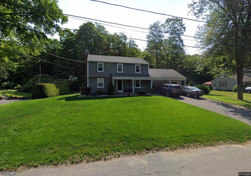
6 Russell Rd Wilbraham, MA 01095
Estimated Value: $421,949 - $589,000
4
Beds
2
Baths
1,891
Sq Ft
$261/Sq Ft
Est. Value
About This Home
This home is located at 6 Russell Rd, Wilbraham, MA 01095 and is currently estimated at $493,237, approximately $260 per square foot. 6 Russell Rd is a home located in Hampden County with nearby schools including Minnechaug Regional High School, Springfield International Charter School, and Wilbraham & Monson Academy.
Ownership History
Date
Name
Owned For
Owner Type
Purchase Details
Closed on
Jun 28, 1999
Sold by
Robertson George A and Robertson Marjorie E
Bought by
Roebuck Jason A and Roebuck Kathleen M
Current Estimated Value
Home Financials for this Owner
Home Financials are based on the most recent Mortgage that was taken out on this home.
Original Mortgage
$164,000
Interest Rate
7.09%
Mortgage Type
Purchase Money Mortgage
Create a Home Valuation Report for This Property
The Home Valuation Report is an in-depth analysis detailing your home's value as well as a comparison with similar homes in the area
Home Values in the Area
Average Home Value in this Area
Purchase History
| Date | Buyer | Sale Price | Title Company |
|---|---|---|---|
| Roebuck Jason A | $180,000 | -- |
Source: Public Records
Mortgage History
| Date | Status | Borrower | Loan Amount |
|---|---|---|---|
| Open | Roebuck Jason A | $167,000 | |
| Closed | Roebuck Jason A | $173,800 | |
| Closed | Roebuck Jason A | $164,000 | |
| Previous Owner | Roebuck Jason A | $40,000 |
Source: Public Records
Tax History Compared to Growth
Tax History
| Year | Tax Paid | Tax Assessment Tax Assessment Total Assessment is a certain percentage of the fair market value that is determined by local assessors to be the total taxable value of land and additions on the property. | Land | Improvement |
|---|---|---|---|---|
| 2025 | $6,237 | $348,800 | $97,500 | $251,300 |
| 2024 | $6,238 | $337,200 | $97,500 | $239,700 |
| 2023 | $5,811 | $311,000 | $97,500 | $213,500 |
| 2022 | $5,811 | $283,600 | $97,500 | $186,100 |
| 2021 | $5,400 | $235,200 | $104,800 | $130,400 |
| 2020 | $5,264 | $235,200 | $104,800 | $130,400 |
| 2019 | $5,130 | $235,300 | $104,800 | $130,500 |
| 2018 | $5,153 | $227,600 | $104,800 | $122,800 |
| 2017 | $5,007 | $227,600 | $104,800 | $122,800 |
| 2016 | $5,009 | $231,900 | $116,400 | $115,500 |
| 2015 | $4,646 | $222,500 | $116,400 | $106,100 |
Source: Public Records
Map
Nearby Homes
- 20 Old Orchard Rd
- 474 Mountain Rd
- 2 Bayberry Dr Unit 51
- 6 Hilltop Park
- 474-480 Mountain Rd
- 8 Patriot Ridge Ln
- 28 Decorie Dr
- 68 Monson Rd
- 79 High Pine Cir
- 69 High Pine Cir
- 54 High Pine Cir
- 2 Vista Rd
- 603 Glendale Rd
- 35 Lake Dr
- 4 Hillcrest Dr
- 182 Mountain Rd
- 46 Washington Rd
- 17 Peak Rd
- 6 Teak Terrace Unit 24
- 99 Sandalwood Dr Unit site 00