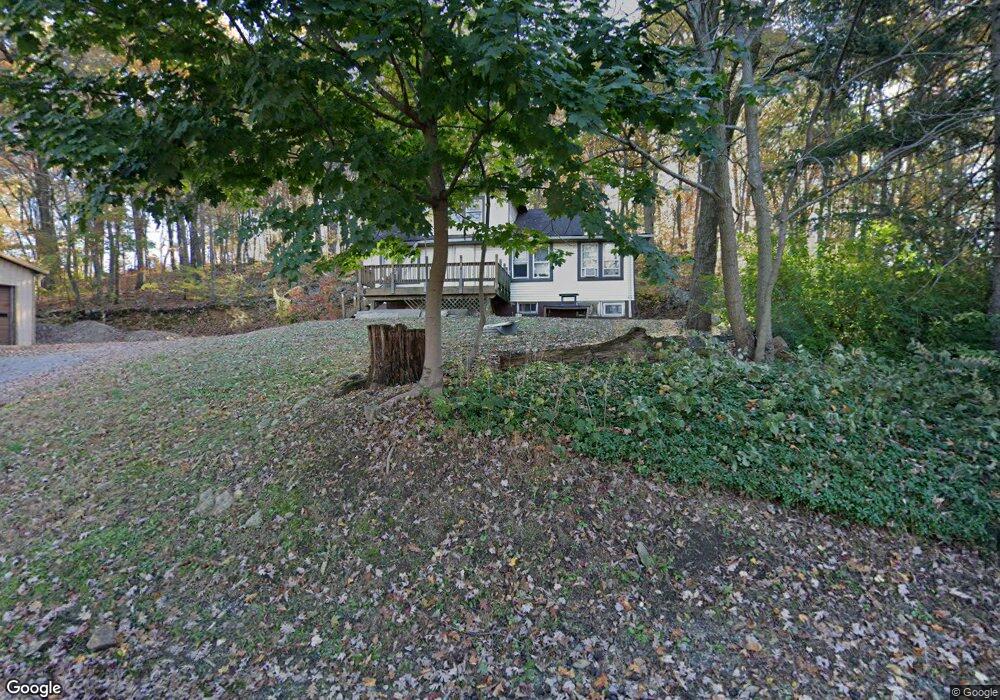
6 Salmon Ln Ledgewood, NJ 07852
Estimated Value: $267,000 - $865,880
--
Bed
--
Bath
1,408
Sq Ft
$392/Sq Ft
Est. Value
About This Home
This home is located at 6 Salmon Ln, Ledgewood, NJ 07852 and is currently estimated at $551,470, approximately $391 per square foot. 6 Salmon Ln is a home located in Morris County with nearby schools including Eisenhower Middle School, Lincoln Roosevelt Elementary School, and Roxbury High School.
Ownership History
Date
Name
Owned For
Owner Type
Purchase Details
Closed on
Dec 31, 2019
Sold by
Gill Petroleum Llc
Bought by
Grealty Group Llc
Current Estimated Value
Purchase Details
Closed on
Jul 24, 2013
Sold by
Bcb Community Bank
Bought by
Gill Petroleum Inc
Home Financials for this Owner
Home Financials are based on the most recent Mortgage that was taken out on this home.
Original Mortgage
$247,500
Interest Rate
4.31%
Mortgage Type
Commercial
Purchase Details
Closed on
Jul 15, 2005
Sold by
Odell George
Bought by
R&R Properties
Home Financials for this Owner
Home Financials are based on the most recent Mortgage that was taken out on this home.
Original Mortgage
$320,000
Interest Rate
5.67%
Mortgage Type
Future Advance Clause Open End Mortgage
Create a Home Valuation Report for This Property
The Home Valuation Report is an in-depth analysis detailing your home's value as well as a comparison with similar homes in the area
Home Values in the Area
Average Home Value in this Area
Purchase History
| Date | Buyer | Sale Price | Title Company |
|---|---|---|---|
| Grealty Group Llc | -- | Couch Braunsdorf Title Inc | |
| Gill Petroleum Inc | $275,000 | Stewart Title | |
| R&R Properties | $400,000 | -- |
Source: Public Records
Mortgage History
| Date | Status | Borrower | Loan Amount |
|---|---|---|---|
| Previous Owner | Gill Petroleum Inc | $247,500 | |
| Previous Owner | R&R Properties | $320,000 |
Source: Public Records
Tax History Compared to Growth
Tax History
| Year | Tax Paid | Tax Assessment Tax Assessment Total Assessment is a certain percentage of the fair market value that is determined by local assessors to be the total taxable value of land and additions on the property. | Land | Improvement |
|---|---|---|---|---|
| 2025 | $15,529 | $564,900 | $383,400 | $181,500 |
| 2024 | $15,286 | $564,900 | $383,400 | $181,500 |
| 2023 | $15,286 | $564,900 | $383,400 | $181,500 |
| 2022 | $14,867 | $564,900 | $383,400 | $181,500 |
| 2021 | $14,867 | $564,900 | $383,400 | $181,500 |
| 2020 | $14,851 | $564,900 | $383,400 | $181,500 |
| 2019 | $14,574 | $564,900 | $383,400 | $181,500 |
| 2018 | $10,521 | $244,100 | $180,100 | $64,000 |
| 2017 | $10,465 | $244,100 | $180,100 | $64,000 |
| 2016 | $10,260 | $244,100 | $180,100 | $64,000 |
| 2015 | $10,006 | $244,100 | $180,100 | $64,000 |
| 2014 | $9,847 | $244,100 | $180,100 | $64,000 |
Source: Public Records
Map
Nearby Homes
- 16 Mount Arlington Rd
- 33 Canal St
- 31 Emmans Rd
- 31 Drake Ln
- 238 Drake Ln Unit 238
- 37 Esposito Ln
- 894 Route46ken
- 37 Lazarus Dr
- 23 Horizon Dr
- 26 Woods Edge Dr
- 30 Woods Edge Dr
- 94 Woods Edge Dr
- 181 Orben Dr
- 85 Autumn Ct
- 72 Crestview Ln Unit 1917
- 117 Woods Edge Dr
- 37 Maple Ln Unit 2601
- 1 High St
- 66 Maple Ln
- 55 Crestview Ln Unit 1827