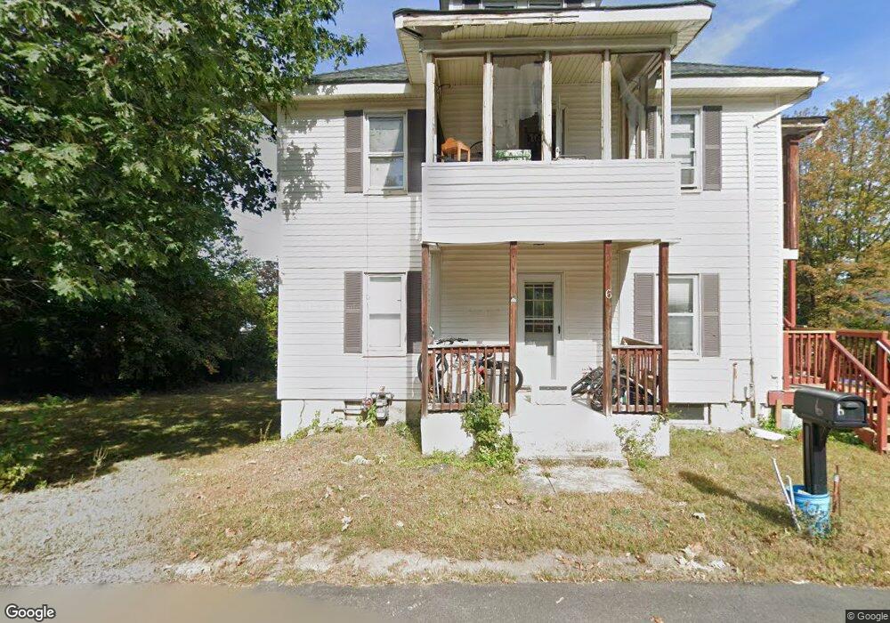
6 Sampson Ave Leominster, MA 01453
Estimated Value: $499,205 - $606,000
5
Beds
2
Baths
2,486
Sq Ft
$221/Sq Ft
Est. Value
About This Home
This home is located at 6 Sampson Ave, Leominster, MA 01453 and is currently estimated at $550,051, approximately $221 per square foot. 6 Sampson Ave is a home located in Worcester County with nearby schools including Leominster High School, St Bernards Elementary School, and St. Leo School.
Ownership History
Date
Name
Owned For
Owner Type
Purchase Details
Closed on
Nov 27, 2024
Sold by
Philbrick Robert D
Bought by
Robert D Philbrick Ret and Philbrick
Current Estimated Value
Purchase Details
Closed on
Jun 4, 2010
Sold by
Sterling Hill Enterpr
Bought by
Philbrick Robert D
Home Financials for this Owner
Home Financials are based on the most recent Mortgage that was taken out on this home.
Original Mortgage
$222,010
Interest Rate
5.5%
Mortgage Type
FHA
Purchase Details
Closed on
Sep 30, 2009
Sold by
Newport T T and Newport Horgan
Bought by
Sterling Hl Enterpris
Purchase Details
Closed on
Jul 21, 2009
Sold by
Deutsche Bank Natl T C and Morgan Stanley T Co In
Bought by
Newport T T and Newport Horgan
Purchase Details
Closed on
Dec 30, 2008
Sold by
Douglass Michael C and Mers
Bought by
Deutsche Bank Natl T C and Morgan Stanley Inc T
Purchase Details
Closed on
Jan 24, 2007
Sold by
Soroka
Bought by
Douglass Michael C
Purchase Details
Closed on
Feb 2, 2000
Sold by
Spaulding Earl E
Bought by
Douglass Michael C
Purchase Details
Closed on
Sep 24, 1997
Sold by
Doiron Roger and Doiron Susan
Bought by
Spaulding Earl E and Mero Doreen E
Purchase Details
Closed on
Mar 30, 1995
Sold by
Siciliano Samuel G and Siciliano Barbara
Bought by
Spaulding Earl E
Purchase Details
Closed on
Aug 1, 1990
Sold by
Higgins George
Bought by
Lomme Robert A
Purchase Details
Closed on
May 2, 1990
Sold by
Siciliano Joseph L
Bought by
Mazzella Kim E
Purchase Details
Closed on
Nov 30, 1989
Sold by
Siciliano Samuel
Bought by
Siciliano S G
Create a Home Valuation Report for This Property
The Home Valuation Report is an in-depth analysis detailing your home's value as well as a comparison with similar homes in the area
Home Values in the Area
Average Home Value in this Area
Purchase History
| Date | Buyer | Sale Price | Title Company |
|---|---|---|---|
| Robert D Philbrick Ret | -- | None Available | |
| Robert D Philbrick Ret | -- | None Available | |
| Philbrick Robert D | $225,000 | -- | |
| Philbrick Robert D | $225,000 | -- | |
| Sterling Hl Enterpris | $77,500 | -- | |
| Enterpris Sterling Hl | $77,500 | -- | |
| Newport T T | $40,000 | -- | |
| Newport T | $40,000 | -- | |
| Deutsche Bank Natl T C | $140,250 | -- | |
| Deutsche Bank Natl T C | $140,250 | -- | |
| Douglass Michael C | -- | -- | |
| Douglass Michael C | -- | -- | |
| Douglass Michael C | -- | -- | |
| Douglass Michael C | $128,000 | -- | |
| Douglass Michael C | $128,000 | -- | |
| Spaulding Earl E | $3,000 | -- | |
| Spaulding Earl E | $3,000 | -- | |
| Spaulding Earl E | $81,900 | -- | |
| Spaulding Earl E | $81,900 | -- | |
| Lomme Robert A | $15,000 | -- | |
| Lomme Robert A | $15,000 | -- | |
| Mazzella Kim E | $5,000 | -- | |
| Mazzella Kim E | $5,000 | -- | |
| Siciliano S G | $29,000 | -- | |
| Siciliano S G | $29,000 | -- |
Source: Public Records
Mortgage History
| Date | Status | Borrower | Loan Amount |
|---|---|---|---|
| Previous Owner | Philbrick Robert D | $222,010 |
Source: Public Records
Tax History Compared to Growth
Tax History
| Year | Tax Paid | Tax Assessment Tax Assessment Total Assessment is a certain percentage of the fair market value that is determined by local assessors to be the total taxable value of land and additions on the property. | Land | Improvement |
|---|---|---|---|---|
| 2025 | $6,003 | $427,900 | $131,300 | $296,600 |
| 2024 | $5,565 | $383,500 | $125,100 | $258,400 |
| 2023 | $5,293 | $340,600 | $108,700 | $231,900 |
| 2022 | $5,029 | $303,700 | $94,500 | $209,200 |
| 2021 | $4,717 | $260,200 | $73,600 | $186,600 |
| 2020 | $4,678 | $260,200 | $73,600 | $186,600 |
| 2019 | $4,268 | $230,200 | $70,100 | $160,100 |
| 2018 | $4,154 | $214,900 | $68,000 | $146,900 |
| 2017 | $3,401 | $172,400 | $63,500 | $108,900 |
| 2016 | $3,223 | $164,600 | $63,500 | $101,100 |
| 2015 | $3,052 | $157,000 | $63,500 | $93,500 |
| 2014 | $3,255 | $172,300 | $66,800 | $105,500 |
Source: Public Records
Map
Nearby Homes
- 138 Princeton St
- 59 Kenniston St
- 0 Palm St
- 30 Palm St
- 1220 Water St
- 1130 Water St
- 20 Pleasantview Ave
- 58 Lindell Ave
- 31 Bemis Rd
- 35 Bemis Rd
- 45 Fruit St Unit B
- 45 Fruit St Unit A
- 12 Lindell Ave
- 22 Fruit St
- 32 Doyle St
- 165 Summer St Unit Lot 2
- 29 Bamford Ave
- 2 Arden Mills Way Unit 2210
- 57 Liberty St Unit 2
- 89 Benjamin St