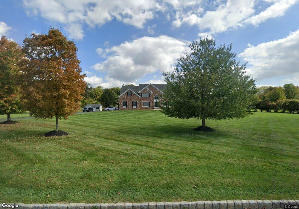
6 Samuel Wilson Ln Pittstown, NJ 08867
Franklin NeighborhoodEstimated Value: $944,119 - $1,027,000
--
Bed
--
Bath
3,882
Sq Ft
$254/Sq Ft
Est. Value
About This Home
This home is located at 6 Samuel Wilson Ln, Pittstown, NJ 08867 and is currently estimated at $986,530, approximately $254 per square foot. 6 Samuel Wilson Ln is a home located in Hunterdon County with nearby schools including Franklin Township School and North Hunterdon High School.
Ownership History
Date
Name
Owned For
Owner Type
Purchase Details
Closed on
Jan 16, 2014
Sold by
Dibiagio Caroline
Bought by
Dibiagio Michael
Current Estimated Value
Purchase Details
Closed on
May 4, 2005
Sold by
Wilmark Building Contractors Inc
Bought by
Dibiagio Michael and Dibiagio Caroline
Home Financials for this Owner
Home Financials are based on the most recent Mortgage that was taken out on this home.
Original Mortgage
$487,200
Outstanding Balance
$246,316
Interest Rate
5.37%
Mortgage Type
Fannie Mae Freddie Mac
Estimated Equity
$740,214
Create a Home Valuation Report for This Property
The Home Valuation Report is an in-depth analysis detailing your home's value as well as a comparison with similar homes in the area
Home Values in the Area
Average Home Value in this Area
Purchase History
| Date | Buyer | Sale Price | Title Company |
|---|---|---|---|
| Dibiagio Michael | $267,500 | None Available | |
| Dibiagio Michael | $609,000 | -- |
Source: Public Records
Mortgage History
| Date | Status | Borrower | Loan Amount |
|---|---|---|---|
| Open | Dibiagio Michael | $487,200 |
Source: Public Records
Tax History Compared to Growth
Tax History
| Year | Tax Paid | Tax Assessment Tax Assessment Total Assessment is a certain percentage of the fair market value that is determined by local assessors to be the total taxable value of land and additions on the property. | Land | Improvement |
|---|---|---|---|---|
| 2025 | $17,796 | $592,000 | $180,300 | $411,700 |
| 2024 | $16,825 | $592,000 | $180,300 | $411,700 |
| 2023 | $16,825 | $592,000 | $180,300 | $411,700 |
| 2022 | $16,718 | $592,000 | $180,300 | $411,700 |
| 2021 | $16,096 | $592,000 | $180,300 | $411,700 |
| 2020 | $16,197 | $592,000 | $180,300 | $411,700 |
| 2019 | $16,357 | $592,000 | $180,300 | $411,700 |
| 2018 | $15,445 | $592,000 | $180,300 | $411,700 |
| 2017 | $15,149 | $592,000 | $180,300 | $411,700 |
| 2016 | $14,717 | $592,000 | $180,300 | $411,700 |
| 2015 | $14,676 | $589,000 | $180,300 | $408,700 |
| 2014 | $14,902 | $589,000 | $180,300 | $408,700 |
Source: Public Records
Map
Nearby Homes
- 12 Baker Rd
- 39 Sky Manor Rd
- 72 Hampton Rd
- 710 County Road 513
- 14 Woodland Rd
- 24 Locust Grove Rd
- 364 Oak Grove Rd
- 1491&1493 Cty Rd 519
- 1 Shy Creek Rd
- 32 Quakertown Rd
- 271 County Road 513
- 554-560 Oak Grove Rd
- 383 Pittstown Rd
- 152 White Bridge Rd
- 7 Maple Springs Rd
- 584 Oak Grove Rd
- 1068 County Road519
- 2 Smoke Run
- 144 Lower Oak Grove Rd
- 617 County Road 579
- 8 Samuel Wilson Ln
- 5 Samuel Wilson Ln
- 3 Samuel Wilson Ln
- 7 Samuel Wilson Ln
- 56 Baker Rd
- 10 Samuel Wilson Ln
- 9 Samuel Wilson Ln
- 52 Baker Rd
- 53 Baker Rd
- 11 Samuel Wilson Ln
- 12 Samuel Wilson Ln
- 91 Sky Manor Rd
- 87 Sky Manor Rd
- 14 Samuel Wilson Ln
- 89 Sky Manor Rd
- 79 Sky Manor Rd
- 93 Sky Manor Rd
- 77 Sky Manor Rd
- 95 Sky Manor Rd
- 75 Sky Manor Rd