J
Seller's Agent in 2012
Janice Cramer
American Real Estate LLC
Estimated Value: $2,273,000 - $2,797,000
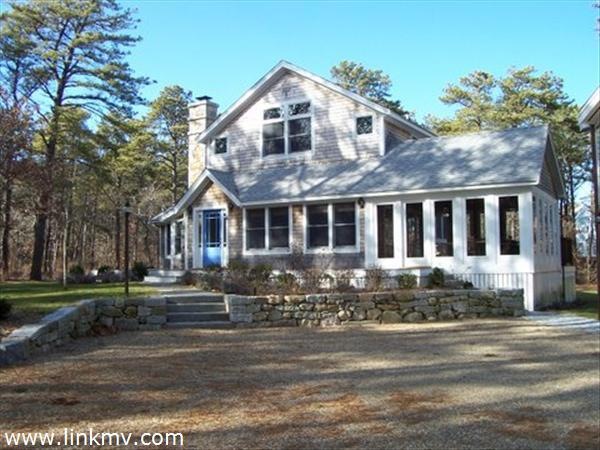
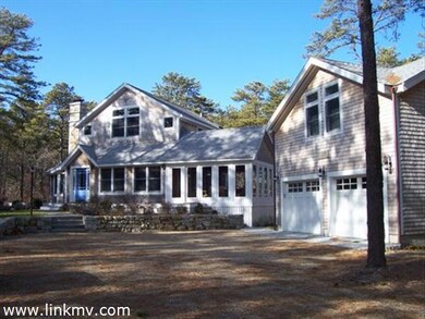
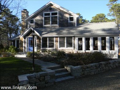
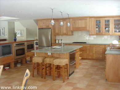
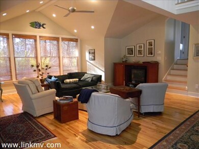
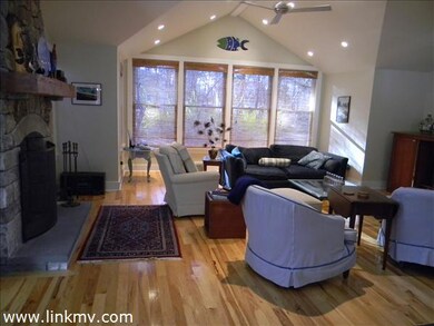
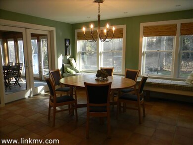
A beautifully renovated property, centrally located to all three island towns. short walk to fresh water beach, salt water Senge Pond, Assoc. tennis courts and clubhouse. ultra modern kitchen with all gourmet features. open dining and living room adjacent to double French doors which lead to the large screened porch. Perfect for a large family who like to entertain.
Last Agent to Sell the Property
Janice Cramer
American Real Estate LLC Listed on: 03/29/2012
| Date | Buyer | Sale Price | Title Company |
|---|---|---|---|
| Vanduk Alexander | $1,076,000 | -- | |
| Hobart David R | $525,000 | -- |
| Date | Status | Borrower | Loan Amount |
|---|---|---|---|
| Open | Vanduk Alexander | $625,000 |
| Date | Event | Price | List to Sale | Price per Sq Ft |
|---|---|---|---|---|
| 11/19/2012 11/19/12 | Sold | $1,076,000 | -28.2% | $307 / Sq Ft |
| 10/20/2012 10/20/12 | Pending | -- | -- | -- |
| 03/29/2012 03/29/12 | For Sale | $1,499,000 | -- | $428 / Sq Ft |
| Year | Tax Paid | Tax Assessment Tax Assessment Total Assessment is a certain percentage of the fair market value that is determined by local assessors to be the total taxable value of land and additions on the property. | Land | Improvement |
|---|---|---|---|---|
| 2025 | $10,803 | $2,139,300 | $855,500 | $1,283,800 |
| 2024 | $10,555 | $2,018,100 | $777,400 | $1,240,700 |
| 2023 | $9,652 | $1,828,100 | $755,400 | $1,072,700 |
| 2022 | $9,194 | $1,354,000 | $586,800 | $767,200 |
| 2021 | $8,806 | $1,194,800 | $447,500 | $747,300 |
| 2020 | $1,725 | $1,124,500 | $426,200 | $698,300 |
| 2019 | $8,274 | $1,075,900 | $389,800 | $686,100 |
| 2018 | $8,748 | $1,117,300 | $352,000 | $765,300 |
| 2017 | $8,254 | $1,012,700 | $322,500 | $690,200 |
| 2016 | $7,685 | $947,600 | $344,000 | $603,600 |
| 2015 | $7,261 | $912,200 | $344,000 | $568,200 |
| 2014 | $6,724 | $861,000 | $342,000 | $519,000 |
J
Seller's Agent in 2012
Janice Cramer
American Real Estate LLC
Source: LINK (Vineyard)
MLS Number: 22872
APN: OAKB-000048-000015
Ask me questions while you tour the home.