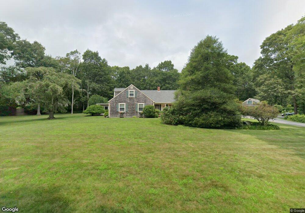
6 Shore Acres Rd South Dartmouth, MA 02748
Cow Yard/Nonquitt NeighborhoodEstimated Value: $1,052,000 - $1,285,000
4
Beds
3
Baths
2,500
Sq Ft
$465/Sq Ft
Est. Value
About This Home
This home is located at 6 Shore Acres Rd, South Dartmouth, MA 02748 and is currently estimated at $1,161,636, approximately $464 per square foot. 6 Shore Acres Rd is a home located in Bristol County with nearby schools including Dartmouth High School.
Ownership History
Date
Name
Owned For
Owner Type
Purchase Details
Closed on
May 1, 2006
Sold by
Siegal Henry D and Siegal Nancy F
Bought by
Hatfield Carla P and Hatfield Stephen F
Current Estimated Value
Home Financials for this Owner
Home Financials are based on the most recent Mortgage that was taken out on this home.
Original Mortgage
$500,000
Outstanding Balance
$289,579
Interest Rate
6.4%
Mortgage Type
Purchase Money Mortgage
Estimated Equity
$872,057
Purchase Details
Closed on
Apr 11, 1996
Sold by
Smith Peter H and Smith Sarah G
Bought by
Siegal Henry D and Siegal Nancy
Home Financials for this Owner
Home Financials are based on the most recent Mortgage that was taken out on this home.
Original Mortgage
$150,000
Interest Rate
7.39%
Mortgage Type
Purchase Money Mortgage
Create a Home Valuation Report for This Property
The Home Valuation Report is an in-depth analysis detailing your home's value as well as a comparison with similar homes in the area
Home Values in the Area
Average Home Value in this Area
Purchase History
| Date | Buyer | Sale Price | Title Company |
|---|---|---|---|
| Hatfield Carla P | $735,000 | -- | |
| Siegal Henry D | $270,000 | -- |
Source: Public Records
Mortgage History
| Date | Status | Borrower | Loan Amount |
|---|---|---|---|
| Open | Hatfield Carla P | $500,000 | |
| Previous Owner | Siegal Henry D | $150,000 |
Source: Public Records
Tax History Compared to Growth
Tax History
| Year | Tax Paid | Tax Assessment Tax Assessment Total Assessment is a certain percentage of the fair market value that is determined by local assessors to be the total taxable value of land and additions on the property. | Land | Improvement |
|---|---|---|---|---|
| 2025 | $7,634 | $886,600 | $481,900 | $404,700 |
| 2024 | $7,574 | $871,600 | $478,200 | $393,400 |
| 2023 | $6,967 | $759,800 | $396,600 | $363,200 |
| 2022 | $7,038 | $710,900 | $396,600 | $314,300 |
| 2021 | $7,081 | $683,500 | $371,600 | $311,900 |
| 2020 | $6,844 | $659,300 | $371,600 | $287,700 |
| 2019 | $6,824 | $656,200 | $371,600 | $284,600 |
| 2018 | $6,292 | $618,100 | $371,600 | $246,500 |
| 2017 | $5,889 | $587,700 | $350,200 | $237,500 |
| 2016 | $5,759 | $566,800 | $331,200 | $235,600 |
| 2015 | $5,512 | $543,600 | $304,800 | $238,800 |
| 2014 | $5,336 | $522,600 | $288,600 | $234,000 |
Source: Public Records
Map
Nearby Homes
- 738 Smith Neck Rd
- 105 Rock Odundee Rd
- 482 Smith Neck Rd
- 24 White Alder Way
- 23 High St
- 24 Eagle Dr
- 40 School St
- 48 N Shore Dr Unit 3&7
- 48 N Shore Dr Unit 8
- 248 Bakerville Rd
- Lot 1 Rafael Rd
- 61 Pardon Hill Rd
- 62 Hetty Green St Unit 62
- 0 Stoneledge Rd
- 76 Shipyard Ln
- 48 Wilson St
- 12 Meadow Shores Rd
- 00 Prospect St
- 158 Little River Rd
- 21 Avis St
- 712 Smith Neck Rd
- 718 Smith Neck Rd
- 720 Smith Neck Rd
- 702 Smith Neck Rd
- 696 Smith Neck Rd
- 732 Smith Neck Rd
- 734 Smith Neck Rd
- 690 Smith Neck Rd
- 726 Smith Neck Rd
- 688 Smith Neck Rd
- 746 Smith Neck Rd
- 730 Smith Neck Rd
- 674 Smith Neck Rd
- 754 Smith Neck Rd
- 668 Smith Neck Rd
- 0 Rental Ave Unit 71799395
- 16 Shore Acres Rd
- 762 Smith Neck Rd
- 7 Grinnell Rd
- 45 Grinnell Rd