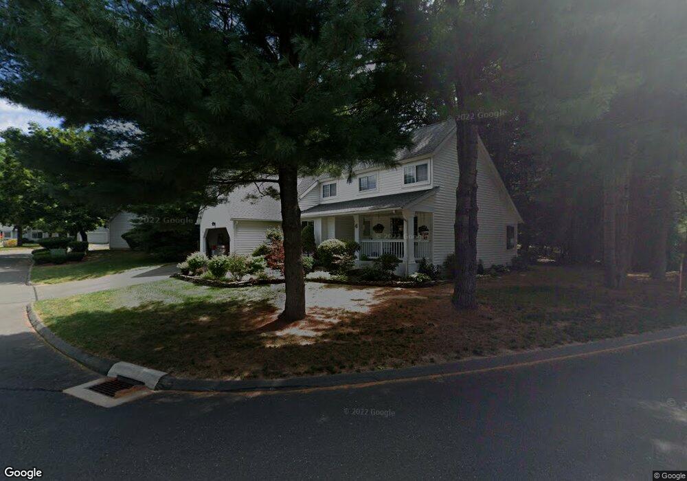
6 Stratton Forest Way Simsbury, CT 06070
Estimated Value: $435,000 - $460,000
2
Beds
3
Baths
1,773
Sq Ft
$253/Sq Ft
Est. Value
About This Home
This home is located at 6 Stratton Forest Way, Simsbury, CT 06070 and is currently estimated at $448,493, approximately $252 per square foot. 6 Stratton Forest Way is a home located in Hartford County with nearby schools including Central School, Henry James Memorial School, and Simsbury High School.
Ownership History
Date
Name
Owned For
Owner Type
Purchase Details
Closed on
Apr 28, 2016
Sold by
Cram Kenneth P
Bought by
Sacher Marc S and Sacher Rhonda F
Current Estimated Value
Purchase Details
Closed on
Jul 13, 2012
Sold by
Nancy S Roby Ret and Roby Nancy S
Bought by
Cram Shirley A
Purchase Details
Closed on
Mar 31, 2006
Sold by
Bogue David L
Bought by
Roby Nancy S
Purchase Details
Closed on
Aug 4, 2003
Sold by
Stawecki Ronald A and Stawecki Marion S
Bought by
Bogue David L
Home Financials for this Owner
Home Financials are based on the most recent Mortgage that was taken out on this home.
Original Mortgage
$150,000
Interest Rate
5.28%
Purchase Details
Closed on
May 6, 1988
Sold by
Stratton Forest Ltd
Bought by
Stawecki Ronald
Create a Home Valuation Report for This Property
The Home Valuation Report is an in-depth analysis detailing your home's value as well as a comparison with similar homes in the area
Home Values in the Area
Average Home Value in this Area
Purchase History
| Date | Buyer | Sale Price | Title Company |
|---|---|---|---|
| Sacher Marc S | $239,900 | -- | |
| Cram Shirley A | $235,000 | -- | |
| Roby Nancy S | $354,900 | -- | |
| Bogue David L | $295,000 | -- | |
| Stawecki Ronald | $277,000 | -- |
Source: Public Records
Mortgage History
| Date | Status | Borrower | Loan Amount |
|---|---|---|---|
| Previous Owner | Stawecki Ronald | $40,000 | |
| Previous Owner | Stawecki Ronald | $150,000 | |
| Previous Owner | Stawecki Ronald | $165,000 |
Source: Public Records
Tax History Compared to Growth
Tax History
| Year | Tax Paid | Tax Assessment Tax Assessment Total Assessment is a certain percentage of the fair market value that is determined by local assessors to be the total taxable value of land and additions on the property. | Land | Improvement |
|---|---|---|---|---|
| 2025 | $9,464 | $277,060 | $0 | $277,060 |
| 2024 | $8,881 | $266,630 | $0 | $266,630 |
| 2023 | $8,484 | $266,630 | $0 | $266,630 |
| 2022 | $6,972 | $180,470 | $0 | $180,470 |
| 2021 | $6,972 | $180,470 | $0 | $180,470 |
| 2020 | $6,694 | $180,470 | $0 | $180,470 |
| 2019 | $6,735 | $180,470 | $0 | $180,470 |
| 2018 | $6,784 | $180,470 | $0 | $180,470 |
| 2017 | $6,623 | $170,870 | $0 | $170,870 |
| 2016 | $6,343 | $170,870 | $0 | $170,870 |
| 2015 | $6,343 | $170,870 | $0 | $170,870 |
| 2014 | $6,346 | $170,870 | $0 | $170,870 |
Source: Public Records
Map
Nearby Homes
- 10 Pepperidge Ct
- 3 Stebbins Brook Ln
- 4 Stebbins Brook Ln
- 40 Firetown Rd Unit 39
- 7 Tamarack Ln
- 48 Library Ln Unit 48
- 18 Meadowlark Rd
- 15 Sand Hill Rd
- 47 Long View Dr
- 308 Hopmeadow St
- 44 Simsbury Manor Dr
- 25 Barry Ln
- 49 Carver Cir
- 301 Bushy Hill Rd
- 3 Cobtail Way
- 15 Pinnacle Mountain Rd
- 29 Minister Brook Dr
- 3 Minister Brook Dr
- 8 Quorn Hunt Rd
- 24 Hunting Ridge Dr
- 6 Stratton Forest Way Unit 6
- 12 Stratton Forest Way
- 6 Southbridge Ct
- 12 Southbridge Ct
- 16 Southbridge Ct
- 14 Southbridge Ct
- 32 Southbridge Ct
- 18 Southbridge Ct
- 10 Southbridge Ct
- 26 Southbridge Ct
- 8 Southbridge Ct
- 24 Southbridge Ct
- 34 Southbridge Ct
- 30 Southbridge Ct
- 28 Southbridge Ct
- 24 Southbridge Ct Unit 24
- 34 Southbridge Ct Unit 34
- 18 Southbridge Ct Unit 18
- 28 Southbridge Ct Unit 28
- 10 Southbridge Ct Unit 10