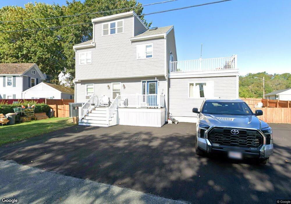
6 Stuart Rd Gloucester, MA 01930
West Gloucester NeighborhoodEstimated Value: $625,000 - $745,000
4
Beds
3
Baths
1,809
Sq Ft
$374/Sq Ft
Est. Value
About This Home
This home is located at 6 Stuart Rd, Gloucester, MA 01930 and is currently estimated at $677,114, approximately $374 per square foot. 6 Stuart Rd is a home located in Essex County with nearby schools including West Parish, Ralph B O'maley Middle School, and Gloucester High School.
Ownership History
Date
Name
Owned For
Owner Type
Purchase Details
Closed on
Sep 28, 2016
Sold by
Muise Laura J
Bought by
Muise Laura J and Muise Jeffrey
Current Estimated Value
Purchase Details
Closed on
Oct 29, 2009
Sold by
Amero Bruce D and Amero Linda J
Bought by
Amero Laura J
Purchase Details
Closed on
Mar 15, 1999
Sold by
Stuart Road Rt
Bought by
Amero Linda J and Amero Bruce D
Purchase Details
Closed on
Sep 12, 1995
Sold by
Ross Shirley M
Bought by
Stuart Road Rt
Create a Home Valuation Report for This Property
The Home Valuation Report is an in-depth analysis detailing your home's value as well as a comparison with similar homes in the area
Home Values in the Area
Average Home Value in this Area
Purchase History
| Date | Buyer | Sale Price | Title Company |
|---|---|---|---|
| Muise Laura J | -- | -- | |
| Amero Laura J | $95,000 | -- | |
| Amero Linda J | $112,000 | -- | |
| Stuart Road Rt | $100,000 | -- |
Source: Public Records
Mortgage History
| Date | Status | Borrower | Loan Amount |
|---|---|---|---|
| Previous Owner | Stuart Road Rt | $236,000 | |
| Previous Owner | Stuart Road Rt | $239,000 |
Source: Public Records
Tax History
| Year | Tax Paid | Tax Assessment Tax Assessment Total Assessment is a certain percentage of the fair market value that is determined by local assessors to be the total taxable value of land and additions on the property. | Land | Improvement |
|---|---|---|---|---|
| 2025 | $6,133 | $631,000 | $172,900 | $458,100 |
| 2024 | $6,082 | $625,100 | $164,700 | $460,400 |
| 2023 | $5,819 | $549,500 | $147,000 | $402,500 |
| 2022 | $5,639 | $480,700 | $127,900 | $352,800 |
| 2021 | $5,423 | $435,900 | $116,300 | $319,600 |
| 2020 | $5,175 | $419,700 | $101,100 | $318,600 |
| 2019 | $4,896 | $385,800 | $101,100 | $284,700 |
| 2018 | $4,642 | $359,000 | $101,100 | $257,900 |
| 2017 | $4,496 | $340,900 | $96,300 | $244,600 |
| 2016 | $4,348 | $319,500 | $100,500 | $219,000 |
| 2015 | $4,133 | $302,800 | $100,500 | $202,300 |
Source: Public Records
Map
Nearby Homes
- 145 Essex Ave Unit 512
- 145 Essex Ave Unit 402
- 24 Cobblestone Ln Unit 603
- 5 Lepage Ln
- 5 Marshfield St
- 13 Leslie o Johnson Rd
- 15 Harvard St
- 5 Samoset Rd Unit B
- 3 Rockland St
- 20 Beacon St
- 20 Beacon St Unit 2
- 20 Beacon St Unit 1
- 6 Monroe Ct
- 120 Washington St
- 18 Lyndale Ave
- 98 Maplewood Ave
- 33 Middle St
- 35 Middle St Unit 4
- 8 Mystic Ave
- 33 Maplewood Ave Unit 310
- 8 Stuart Rd
- 4 Stuart Rd
- 127 Essex Ave
- 9 Stuart Rd
- 3 Stuart Rd
- 11 Stuart Rd
- 125 Essex Ave
- 129 Essex Ave
- 129 Essex Ave Unit 3
- 10 Stuart Rd
- 121 Essex Ave
- 13 Stuart Rd
- 131 Essex Ave
- 119 Essex Ave
- 115 Essex Ave
- 102 Essex Ave
- 133B Essex Ave Unit 1
- 133 Essex Ave Unit 2
- 133 Essex Ave Unit 1
- 133B Essex Ave Unit B
Your Personal Tour Guide
Ask me questions while you tour the home.