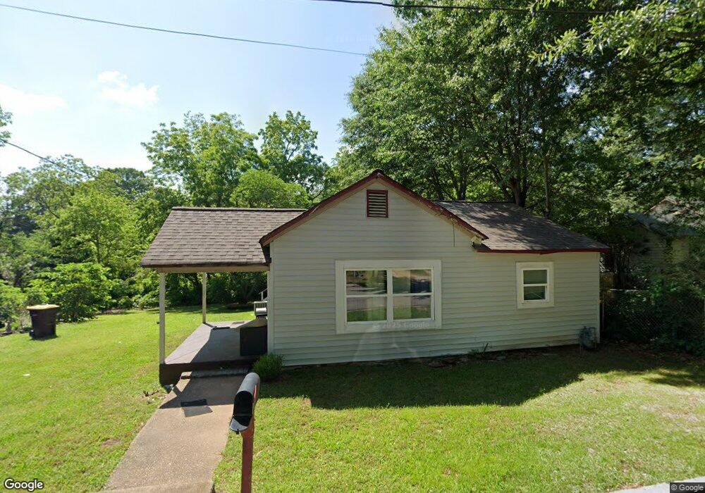
6 Swint St Newnan, GA 30263
Estimated Value: $79,000 - $162,000
3
Beds
1
Bath
1,047
Sq Ft
$122/Sq Ft
Est. Value
About This Home
This home is located at 6 Swint St, Newnan, GA 30263 and is currently estimated at $127,602, approximately $121 per square foot. 6 Swint St is a home located in Coweta County with nearby schools including Jefferson Parkway Elementary School, Arnall Middle School, and East Coweta High School.
Ownership History
Date
Name
Owned For
Owner Type
Purchase Details
Closed on
Jul 24, 2020
Sold by
Guy Willie E
Bought by
Emcab Property Llc
Current Estimated Value
Purchase Details
Closed on
Mar 2, 2010
Sold by
Florence Roderick L
Bought by
Guy Willie E
Purchase Details
Closed on
Dec 21, 2007
Sold by
Guy Willie E
Bought by
Florence Roderick
Home Financials for this Owner
Home Financials are based on the most recent Mortgage that was taken out on this home.
Original Mortgage
$55,000
Interest Rate
6.21%
Mortgage Type
Trade
Purchase Details
Closed on
Oct 31, 1986
Bought by
Guy Willie E
Create a Home Valuation Report for This Property
The Home Valuation Report is an in-depth analysis detailing your home's value as well as a comparison with similar homes in the area
Home Values in the Area
Average Home Value in this Area
Purchase History
| Date | Buyer | Sale Price | Title Company |
|---|---|---|---|
| Emcab Property Llc | $45,000 | -- | |
| Guy Willie E | $32,000 | -- | |
| Florence Roderick | $55,000 | -- | |
| Guy Willie E | $16,000 | -- |
Source: Public Records
Mortgage History
| Date | Status | Borrower | Loan Amount |
|---|---|---|---|
| Previous Owner | Florence Roderick | $55,000 |
Source: Public Records
Tax History Compared to Growth
Tax History
| Year | Tax Paid | Tax Assessment Tax Assessment Total Assessment is a certain percentage of the fair market value that is determined by local assessors to be the total taxable value of land and additions on the property. | Land | Improvement |
|---|---|---|---|---|
| 2025 | $776 | $32,291 | $12,000 | $20,291 |
| 2024 | $716 | $31,331 | $12,000 | $19,331 |
| 2023 | $716 | $25,234 | $3,360 | $21,874 |
| 2022 | $468 | $19,248 | $3,360 | $15,888 |
| 2021 | $470 | $17,474 | $3,360 | $14,114 |
| 2020 | $454 | $16,502 | $3,960 | $12,542 |
| 2019 | $387 | $12,877 | $3,200 | $9,677 |
| 2018 | $389 | $12,877 | $3,200 | $9,677 |
| 2017 | $259 | $8,593 | $2,400 | $6,193 |
| 2016 | $259 | $8,593 | $2,400 | $6,193 |
| 2015 | $259 | $8,593 | $2,400 | $6,193 |
| 2014 | $265 | $8,593 | $2,400 | $6,193 |
Source: Public Records
Map
Nearby Homes
- 0 Highway 34 Unit 20149159
- 89 Farmer St
- 5 Casey Rd
- 0 Georgia 34 Unit 7614778
- 59 Berry Ave
- 144 Jackson St
- 0 N Highway 29 Unit 20115352
- 140 Catalina Ct
- 3 Northside Dr
- 61 Clark St
- 20 Salbide Ave
- 10 Burch Ave
- 294 Tuscany Trace
- 51 Robinson St
- 71 Spring St
- 108 Savannah St
- 77 West St Unit 34
- 68 Spring St
- 1 Ellis Way
- 13 Standish Ct
- 6 Swint St
- 4 Swint St
- 5 Swint St
- 30 Wilcoxon St
- 32 Wilcoxon St
- 7 Swint St Unit 7B
- 7 Swint St
- 7 Swint St Unit A
- 7 Swint Place
- 28 Wilcoxon St
- 34 Wilcoxon St
- 0 Swint Place Unit 7B 8349500
- 9 Sutherland Dr
- 26 Wilcoxon St
- 36 Wilcoxon St
- 29 Wilcoxon St
- 15 Sutherland Dr
- 3 Sutherland Dr
- 31 Wilcoxon St
- 17 Sutherland Dr