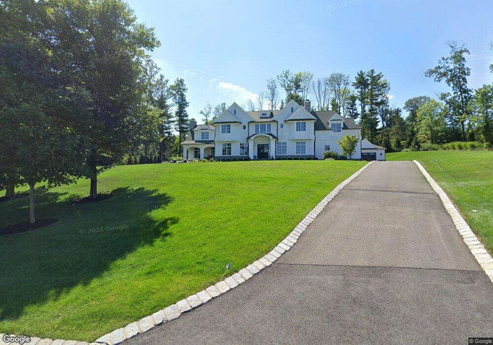
6 Tall Timber Ln Basking Ridge, NJ 07920
Estimated Value: $3,190,809 - $3,379,000
--
Bed
--
Bath
6,351
Sq Ft
$517/Sq Ft
Est. Value
About This Home
This home is located at 6 Tall Timber Ln, Basking Ridge, NJ 07920 and is currently estimated at $3,285,952, approximately $517 per square foot. 6 Tall Timber Ln is a home with nearby schools including Cedar Hill Elementary School, William Annin Middle School, and Ridge High School.
Ownership History
Date
Name
Owned For
Owner Type
Purchase Details
Closed on
Aug 13, 2025
Sold by
Pollak Erika L
Bought by
Levantino Joseph and Levantino Holly
Current Estimated Value
Purchase Details
Closed on
Jul 25, 2016
Sold by
Boulder Construction Llc
Bought by
Pollaki Erika L
Purchase Details
Closed on
Jul 14, 2016
Sold by
Somerset Country Living Properties Llc
Bought by
Boulder Construction Llc
Create a Home Valuation Report for This Property
The Home Valuation Report is an in-depth analysis detailing your home's value as well as a comparison with similar homes in the area
Home Values in the Area
Average Home Value in this Area
Purchase History
| Date | Buyer | Sale Price | Title Company |
|---|---|---|---|
| Levantino Joseph | $3,275,000 | None Listed On Document | |
| Levantino Joseph | $3,275,000 | None Listed On Document | |
| Pollaki Erika L | $2,160,000 | Nrt Title Agency Llc | |
| Boulder Construction Llc | -- | Title Resources Guaranty Co |
Source: Public Records
Tax History Compared to Growth
Tax History
| Year | Tax Paid | Tax Assessment Tax Assessment Total Assessment is a certain percentage of the fair market value that is determined by local assessors to be the total taxable value of land and additions on the property. | Land | Improvement |
|---|---|---|---|---|
| 2025 | $44,690 | $2,581,500 | $682,200 | $1,899,300 |
| 2024 | $44,690 | $2,512,100 | $682,200 | $1,829,900 |
| 2023 | $39,040 | $2,070,000 | $682,200 | $1,387,800 |
| 2022 | $39,886 | $1,983,400 | $682,200 | $1,301,200 |
| 2021 | $39,860 | $1,889,100 | $682,200 | $1,206,900 |
| 2020 | $40,046 | $1,912,400 | $682,200 | $1,230,200 |
| 2019 | $42,539 | $2,091,400 | $697,400 | $1,394,000 |
| 2018 | $41,933 | $2,091,400 | $713,600 | $1,377,800 |
| 2017 | $24,749 | $1,244,300 | $713,600 | $530,700 |
| 2016 | $24,021 | $1,231,200 | $731,200 | $500,000 |
| 2015 | $13,441 | $701,500 | $701,500 | $0 |
| 2014 | $13,567 | $701,500 | $701,500 | $0 |
Source: Public Records
Map
Nearby Homes
- 374 S Maple Ave
- 48 Commonwealth Dr Ondo
- 488 King George Rd
- 41 Smithfield Ct Unit 5
- 1 Joss Way
- 185 Jamestown Rd
- 95 Jamestown Rd Ondo
- 155 Jamestown Rd
- 21 Alexandria Way
- 49 Alexandria Way Unit 5
- 71 Alexandria Way Unit 3
- 1417 Long Hill Rd
- 457 Elm St
- 138 Potomac Dr Condo
- 168 Potomac Dr Condo Unit 168
- 192 Potomac Dr Condo Unit 192
- 23 Hampton Ct
- 138 Alexandria Way Condo Unit 138
- 280 Alexandria Way
- 176 Potomac Dr