Estimated Value: $498,000 - $629,000
4
Beds
2
Baths
1,600
Sq Ft
$339/Sq Ft
Est. Value
About This Home
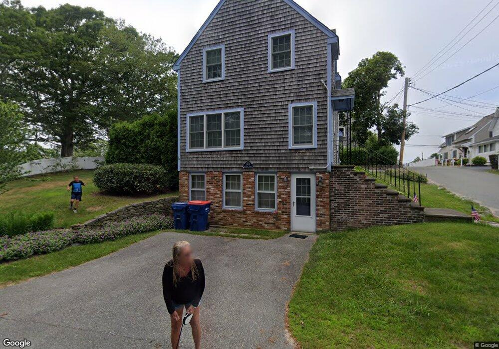
This home is located at 6 Waban Ave, Onset, MA 02558 and is currently estimated at $542,643, approximately $339 per square foot. 6 Waban Ave is a home.
Ownership History
Date
Name
Owned For
Owner Type
Purchase Details
Closed on
Dec 24, 2004
Sold by
Leary Catherine
Bought by
Bys Anthony J and Andrews Bys Ruth
Current Estimated Value
Home Financials for this Owner
Home Financials are based on the most recent Mortgage that was taken out on this home.
Original Mortgage
$160,000
Outstanding Balance
$79,632
Interest Rate
5.74%
Mortgage Type
Purchase Money Mortgage
Estimated Equity
$463,011
Purchase Details
Closed on
Sep 1, 1999
Sold by
Emery Richard S
Bought by
Leary Catherine
Create a Home Valuation Report for This Property
The Home Valuation Report is an in-depth analysis detailing your home's value as well as a comparison with similar homes in the area
Home Values in the Area
Average Home Value in this Area
Purchase History
| Date | Buyer | Sale Price | Title Company |
|---|---|---|---|
| Bys Anthony J | $363,000 | -- | |
| Bys Anthony J | $363,000 | -- | |
| Leary Catherine | $129,900 | -- | |
| Leary Catherine | $129,900 | -- |
Source: Public Records
Mortgage History
| Date | Status | Borrower | Loan Amount |
|---|---|---|---|
| Open | Leary Catherine | $160,000 | |
| Closed | Leary Catherine | $160,000 |
Source: Public Records
Tax History Compared to Growth
Tax History
| Year | Tax Paid | Tax Assessment Tax Assessment Total Assessment is a certain percentage of the fair market value that is determined by local assessors to be the total taxable value of land and additions on the property. | Land | Improvement |
|---|---|---|---|---|
| 2025 | $4,195 | $382,100 | $107,000 | $275,100 |
| 2024 | $4,262 | $364,900 | $82,700 | $282,200 |
| 2023 | $4,152 | $337,600 | $75,200 | $262,400 |
| 2022 | $3,835 | $281,600 | $75,200 | $206,400 |
| 2021 | $3,550 | $253,600 | $75,200 | $178,400 |
| 2020 | $3,375 | $246,200 | $75,200 | $171,000 |
| 2019 | $3,140 | $231,600 | $69,900 | $161,700 |
| 2018 | $2,922 | $208,100 | $69,900 | $138,200 |
| 2017 | $2,883 | $206,200 | $69,900 | $136,300 |
| 2016 | $2,656 | $188,500 | $66,800 | $121,700 |
| 2015 | $2,541 | $185,500 | $66,800 | $118,700 |
| 2014 | $2,501 | $188,200 | $63,500 | $124,700 |
Source: Public Records
Map
Nearby Homes
- 38 Amos Way
- 46 Kins Ct
- 45 Kins Ct
- 52 Starboard Dr Unit 36H
- 2 Beacon St Unit 77
- 10 Beacon St Unit 83
- 9 10th St
- 26 Highland Ave
- 12 Beacon St Unit 84
- 6 Beacon St Unit 79
- 8 Beacon St Unit 80
- 3 Crescent Place
- 4 Beacon St Unit 78
- 12 Grove St
- 17 5th St
- 35 Locust St
- 35 Locust St
- 17 Carleton St Unit 17
- 0 Broad St Off Unit 72362523
- 11 22nd St