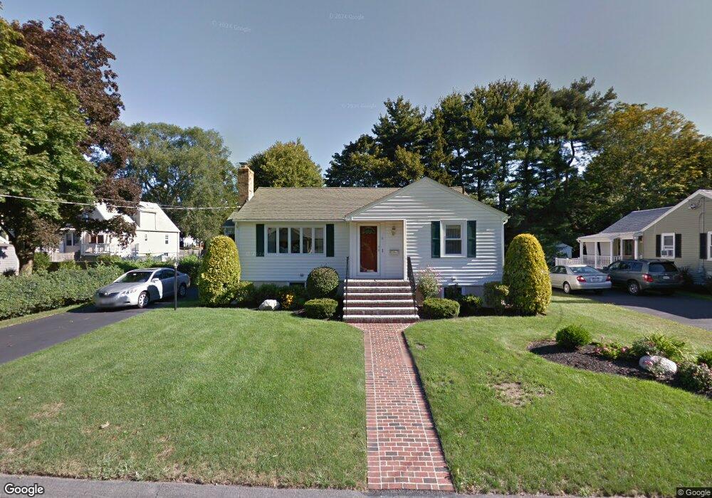
6 Wayland Rd Wakefield, MA 01880
Lakeside NeighborhoodEstimated Value: $713,252 - $783,000
2
Beds
1
Bath
1,450
Sq Ft
$520/Sq Ft
Est. Value
About This Home
This home is located at 6 Wayland Rd, Wakefield, MA 01880 and is currently estimated at $753,313, approximately $519 per square foot. 6 Wayland Rd is a home located in Middlesex County with nearby schools including Wakefield Memorial High School, St Joseph School, and Odyssey Day School.
Ownership History
Date
Name
Owned For
Owner Type
Purchase Details
Closed on
Jul 1, 2002
Sold by
Regan Catherine C
Bought by
Lackey Lorraine
Current Estimated Value
Home Financials for this Owner
Home Financials are based on the most recent Mortgage that was taken out on this home.
Original Mortgage
$50,000
Outstanding Balance
$21,511
Interest Rate
6.92%
Mortgage Type
Purchase Money Mortgage
Estimated Equity
$731,802
Create a Home Valuation Report for This Property
The Home Valuation Report is an in-depth analysis detailing your home's value as well as a comparison with similar homes in the area
Home Values in the Area
Average Home Value in this Area
Purchase History
| Date | Buyer | Sale Price | Title Company |
|---|---|---|---|
| Lackey Lorraine | $339,000 | -- |
Source: Public Records
Mortgage History
| Date | Status | Borrower | Loan Amount |
|---|---|---|---|
| Open | Lackey Lorraine | $50,000 |
Source: Public Records
Tax History Compared to Growth
Tax History
| Year | Tax Paid | Tax Assessment Tax Assessment Total Assessment is a certain percentage of the fair market value that is determined by local assessors to be the total taxable value of land and additions on the property. | Land | Improvement |
|---|---|---|---|---|
| 2025 | $7,021 | $618,600 | $379,000 | $239,600 |
| 2024 | $6,755 | $600,400 | $367,900 | $232,500 |
| 2023 | $6,521 | $555,900 | $340,600 | $215,300 |
| 2022 | $6,227 | $505,400 | $309,700 | $195,700 |
| 2021 | $5,898 | $463,300 | $287,700 | $175,600 |
| 2020 | $5,671 | $444,100 | $275,800 | $168,300 |
| 2019 | $5,502 | $428,800 | $266,300 | $162,500 |
| 2018 | $5,206 | $402,000 | $249,700 | $152,300 |
| 2017 | $4,989 | $382,900 | $237,800 | $145,100 |
| 2016 | $4,873 | $361,200 | $219,800 | $141,400 |
| 2015 | $4,551 | $337,600 | $205,400 | $132,200 |
| 2014 | $4,182 | $327,200 | $199,100 | $128,100 |
Source: Public Records
Map
Nearby Homes