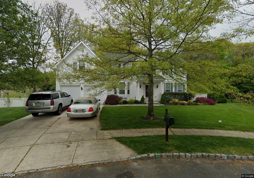
6 Weldon Cir Hainesport, NJ 08036
Estimated Value: $821,345 - $883,000
--
Bed
--
Bath
3,490
Sq Ft
$247/Sq Ft
Est. Value
About This Home
This home is located at 6 Weldon Cir, Hainesport, NJ 08036 and is currently estimated at $863,586, approximately $247 per square foot. 6 Weldon Cir is a home located in Burlington County with nearby schools including Hainesport Township School, Rancocas Valley Regional High School, and Harbor Baptist Academy.
Ownership History
Date
Name
Owned For
Owner Type
Purchase Details
Closed on
Feb 20, 2004
Sold by
K Hovnanian Venture I Llc
Bought by
Brown Christian A and Brown Laura A
Current Estimated Value
Home Financials for this Owner
Home Financials are based on the most recent Mortgage that was taken out on this home.
Original Mortgage
$285,000
Outstanding Balance
$131,712
Interest Rate
5.62%
Mortgage Type
Purchase Money Mortgage
Estimated Equity
$731,874
Purchase Details
Closed on
Mar 31, 2003
Sold by
Quaker Group Burlington Ii Lp
Bought by
K Hovnanian Venture I Llc
Create a Home Valuation Report for This Property
The Home Valuation Report is an in-depth analysis detailing your home's value as well as a comparison with similar homes in the area
Home Values in the Area
Average Home Value in this Area
Purchase History
| Date | Buyer | Sale Price | Title Company |
|---|---|---|---|
| Brown Christian A | $441,090 | Eastern Title Agency Inc | |
| -- | $441,100 | -- | |
| K Hovnanian Venture I Llc | $107,164 | Eastern Title Agency Inc |
Source: Public Records
Mortgage History
| Date | Status | Borrower | Loan Amount |
|---|---|---|---|
| Open | -- | $285,000 |
Source: Public Records
Tax History Compared to Growth
Tax History
| Year | Tax Paid | Tax Assessment Tax Assessment Total Assessment is a certain percentage of the fair market value that is determined by local assessors to be the total taxable value of land and additions on the property. | Land | Improvement |
|---|---|---|---|---|
| 2025 | $11,769 | $441,600 | $72,300 | $369,300 |
| 2024 | $11,274 | $441,600 | $72,300 | $369,300 |
| 2023 | $11,274 | $441,600 | $72,300 | $369,300 |
| 2022 | $11,062 | $441,600 | $72,300 | $369,300 |
| 2021 | $11,062 | $441,600 | $72,300 | $369,300 |
| 2020 | $10,952 | $441,600 | $72,300 | $369,300 |
| 2019 | $10,806 | $441,600 | $72,300 | $369,300 |
| 2018 | $10,445 | $439,400 | $72,300 | $367,100 |
| 2017 | $10,330 | $439,400 | $72,300 | $367,100 |
| 2016 | $10,106 | $439,400 | $72,300 | $367,100 |
| 2015 | $9,887 | $439,400 | $72,300 | $367,100 |
| 2014 | $9,346 | $439,400 | $72,300 | $367,100 |
Source: Public Records
Map
Nearby Homes
- 5 Dorset Cir
- 6 Friendship Ct
- 12 Bancroft Ln
- 70 Easton Way
- 24 Lenox Dr
- 77 Parry Dr
- 5 Quaker Ct
- 5 S Deer Place
- 23 Sunflower Cir
- 25 Sunflower Cir
- 1505 Maine Ave
- 18 Azalea Dr
- 1517 Marne Hwy
- 23 Creek Rd
- 1476 Route 38 Unit 3
- 1476 Route 38 Unit 8
- 14 Amaryllis Ln
- Aria Plan at Longbridge Farms - Longbridge Farms Townhomes
- Cadence Plan at Longbridge Farms - Longbridge Farms Townhomes
- Ballad Plan at Longbridge Farms - Longbridge Farms Townhomes