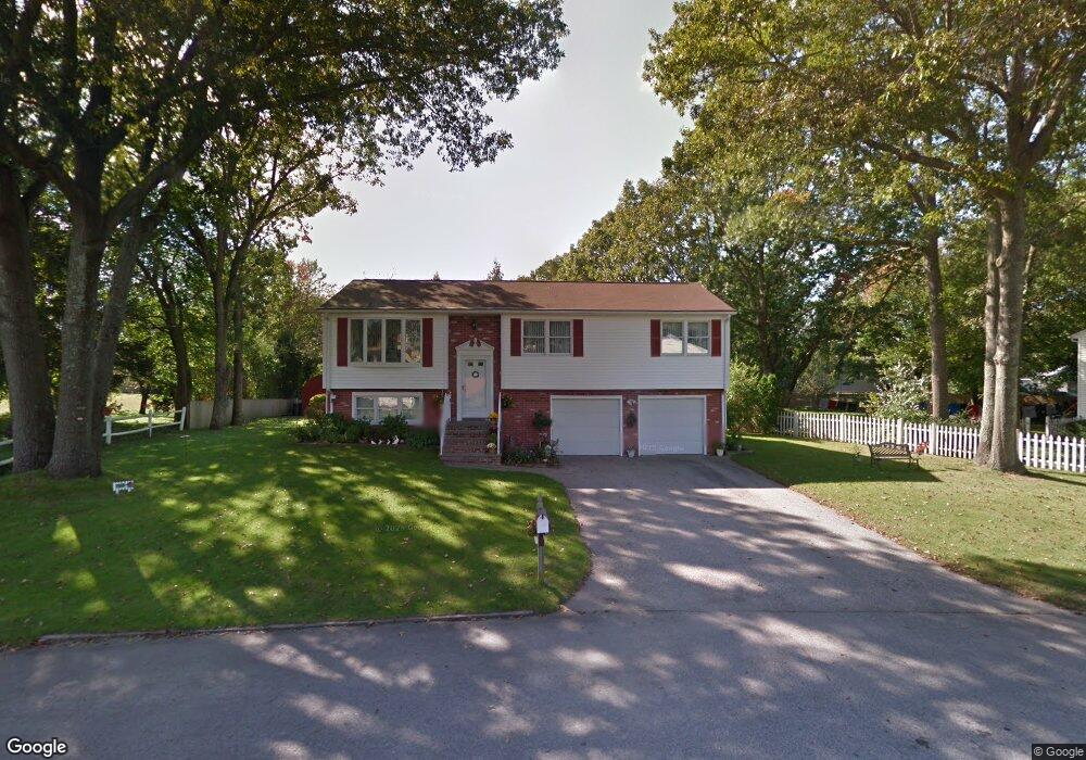
6 Wendy Dr Coventry, RI 02816
Crompton NeighborhoodEstimated Value: $370,000 - $421,501
3
Beds
2
Baths
1,098
Sq Ft
$368/Sq Ft
Est. Value
About This Home
This home is located at 6 Wendy Dr, Coventry, RI 02816 and is currently estimated at $404,125, approximately $368 per square foot. 6 Wendy Dr is a home located in Kent County with nearby schools including Alan Shawn Feinstein Ms Of Cov, Coventry High School, and Father John V. Doyle School.
Ownership History
Date
Name
Owned For
Owner Type
Purchase Details
Closed on
Sep 8, 2005
Sold by
Natick Factor Llc
Bought by
Francis Norman A
Current Estimated Value
Home Financials for this Owner
Home Financials are based on the most recent Mortgage that was taken out on this home.
Original Mortgage
$375,000
Outstanding Balance
$199,869
Interest Rate
5.79%
Mortgage Type
Purchase Money Mortgage
Estimated Equity
$204,256
Purchase Details
Closed on
Jan 1, 1974
Bought by
Blais Edward R and Blais Elaine M
Create a Home Valuation Report for This Property
The Home Valuation Report is an in-depth analysis detailing your home's value as well as a comparison with similar homes in the area
Home Values in the Area
Average Home Value in this Area
Purchase History
| Date | Buyer | Sale Price | Title Company |
|---|---|---|---|
| Francis Norman A | $244,000 | -- | |
| Blais Edward R | -- | -- |
Source: Public Records
Mortgage History
| Date | Status | Borrower | Loan Amount |
|---|---|---|---|
| Open | Blais Edward R | $375,000 |
Source: Public Records
Tax History Compared to Growth
Tax History
| Year | Tax Paid | Tax Assessment Tax Assessment Total Assessment is a certain percentage of the fair market value that is determined by local assessors to be the total taxable value of land and additions on the property. | Land | Improvement |
|---|---|---|---|---|
| 2024 | $4,616 | $291,400 | $113,800 | $177,600 |
| 2023 | $4,467 | $291,400 | $113,800 | $177,600 |
| 2022 | $4,458 | $227,800 | $109,400 | $118,400 |
| 2021 | $4,419 | $227,800 | $109,400 | $118,400 |
| 2020 | $5,066 | $227,800 | $109,400 | $118,400 |
| 2019 | $4,283 | $192,600 | $90,300 | $102,300 |
| 2018 | $4,162 | $192,600 | $90,300 | $102,300 |
| 2017 | $4,041 | $192,600 | $90,300 | $102,300 |
| 2016 | $3,950 | $184,500 | $85,200 | $99,300 |
| 2015 | $3,843 | $184,500 | $85,200 | $99,300 |
| 2014 | $3,416 | $184,500 | $85,200 | $99,300 |
| 2013 | $3,605 | $193,200 | $92,700 | $100,500 |
Source: Public Records
Map
Nearby Homes
- 12 Whittier Dr
- 25 Wescott Way Unit 80
- 0 New London Turnpike
- 65 Angus St
- 12 Longbow Dr
- 105 Scenic Dr
- 10 Minglewood Dr
- 1 Hampton Rd Unit 27
- 32 Wescott Way Unit 53
- 15 Hampton Rd Unit 20
- 19 Hampton Rd Unit 69
- 40 Wescott Way Unit 57
- 211 Tiogue Ave
- 194 Kimberly Ln
- 75 Esmond St Unit 1D
- 24 Seneca St
- 99 Silverwood Ln
- 2500 Division Rd
- 18 Jade Rd
- 40 E Greenwich Ave
- 8 Wendy Dr
- 4 Wendy Dr
- 7 Whittier Dr
- 5 Whittier Dr
- 2 Longfellow Dr
- 2006 New London Turnpike
- 9 Whittier Dr
- 7 Wendy Dr
- 3 Whittier Dr
- 2012 New London Turnpike
- 9 Wendy Dr
- 2008 New London Turnpike
- 2010 New London Turnpike
- 1 Longfellow Dr
- 4 Longfellow Dr
- 2 Martin St
- 2007 New London Turnpike
- 2004 New London Turnpike
- 10 Whittier Dr
- 3 Longfellow Dr