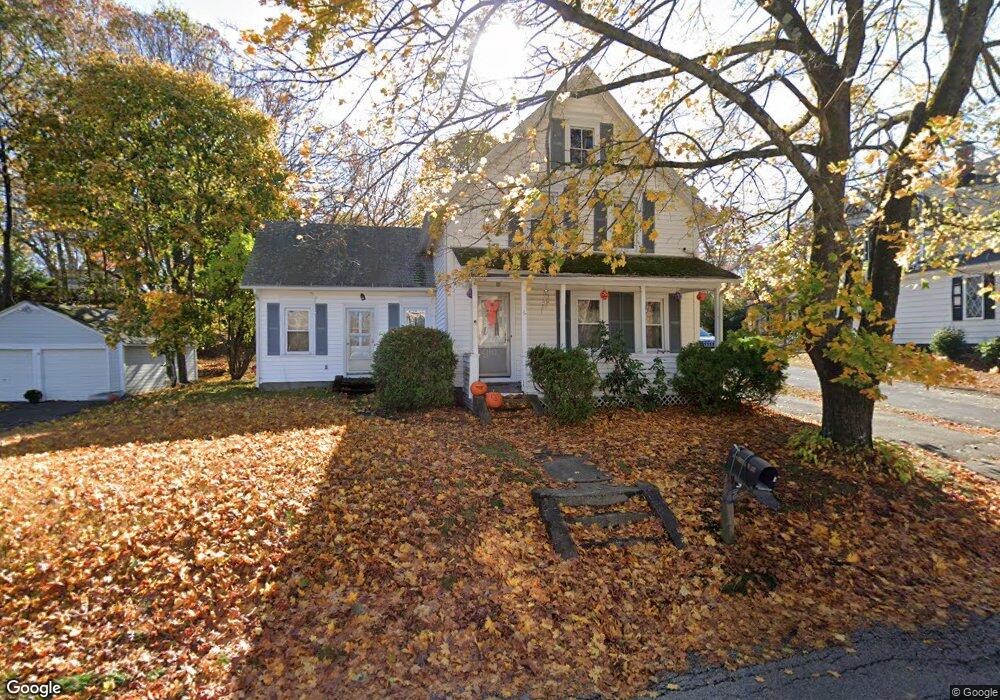
6 Westboro Rd North Grafton, MA 01536
Estimated Value: $410,000 - $444,917
2
Beds
1
Bath
1,456
Sq Ft
$297/Sq Ft
Est. Value
About This Home
This home is located at 6 Westboro Rd, North Grafton, MA 01536 and is currently estimated at $432,729, approximately $297 per square foot. 6 Westboro Rd is a home located in Worcester County with nearby schools including Grafton High School, Al-Hamra Academy, and Silver Spruce Montessori School.
Ownership History
Date
Name
Owned For
Owner Type
Purchase Details
Closed on
Nov 23, 1998
Sold by
Penniman Daniel E and Penniman Elizabeth M
Bought by
Perrault Barbara and Perrault Allan
Current Estimated Value
Home Financials for this Owner
Home Financials are based on the most recent Mortgage that was taken out on this home.
Original Mortgage
$125,051
Outstanding Balance
$27,056
Interest Rate
6.49%
Mortgage Type
Purchase Money Mortgage
Estimated Equity
$405,673
Create a Home Valuation Report for This Property
The Home Valuation Report is an in-depth analysis detailing your home's value as well as a comparison with similar homes in the area
Home Values in the Area
Average Home Value in this Area
Purchase History
| Date | Buyer | Sale Price | Title Company |
|---|---|---|---|
| Perrault Barbara | $126,000 | -- | |
| Perrault Barbara | $126,000 | -- |
Source: Public Records
Mortgage History
| Date | Status | Borrower | Loan Amount |
|---|---|---|---|
| Open | Perrault Barbara | $125,051 | |
| Closed | Perrault Barbara | $125,051 |
Source: Public Records
Tax History Compared to Growth
Tax History
| Year | Tax Paid | Tax Assessment Tax Assessment Total Assessment is a certain percentage of the fair market value that is determined by local assessors to be the total taxable value of land and additions on the property. | Land | Improvement |
|---|---|---|---|---|
| 2025 | $5,055 | $362,600 | $151,600 | $211,000 |
| 2024 | $4,642 | $324,400 | $144,400 | $180,000 |
| 2023 | $4,469 | $284,500 | $144,400 | $140,100 |
| 2022 | $4,438 | $262,900 | $124,000 | $138,900 |
| 2021 | $4,264 | $248,200 | $112,700 | $135,500 |
| 2020 | $4,095 | $248,200 | $112,700 | $135,500 |
| 2019 | $3,873 | $232,500 | $109,500 | $123,000 |
| 2018 | $3,701 | $223,100 | $109,200 | $113,900 |
| 2017 | $3,319 | $202,400 | $82,800 | $119,600 |
| 2016 | $3,466 | $206,900 | $86,600 | $120,300 |
| 2015 | $3,435 | $208,200 | $86,600 | $121,600 |
| 2014 | $3,224 | $211,300 | $96,000 | $115,300 |
Source: Public Records
Map
Nearby Homes
- 4 Westboro Rd
- 15 Windle Ave
- 51 Cortland Grove Dr Unit 51
- 22 Beverly Rd
- 11 Hovey Pond Dr Unit 11
- 7 Hovey Pond Dr Unit 7
- 34 Clews St
- 1 Purinton St
- 194 Worcester St
- 17 Hingham Rd
- 14 Northgate Ct Unit 14
- 0 East St
- 4 Winslow Ln Unit 1410
- 127 Stoney Hill Rd
- Ivywood Plan at Winslow Point - The Building 1 Series
- Hayden Plan at Winslow Point - The Building 1 Series
- 2 Winslow Ln Unit 2302
- 2 Winslow Ln Unit 406
- 30 Falmouth Dr
- 151 Hartford Turnpike Unit 13
- 8 Westboro Rd
- 18 Shrewsbury St
- 2 Westboro Rd
- 1 Oak Terrace
- 5 Westboro Rd
- 5 Westboro Rd
- 3 Westboro Rd
- 3 Westboro Rd
- 10 Westboro Rd
- 10 Westboro Rd Unit 1
- 22 Shrewsbury St
- 9 Westboro Rd
- 8 Shrewsbury St
- 11 Westboro Rd
- 13 Shrewsbury St
- 21 Shrewsbury St
- 19 Shrewsbury St
- 97 N Main St
- 21 Shrewsbury St Rt 140
- 101A N Main St Unit A