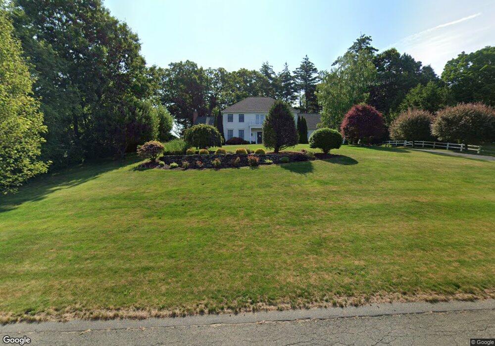
6 Whitford Place Wilbraham, MA 01095
Estimated Value: $748,541 - $815,000
3
Beds
3
Baths
3,200
Sq Ft
$248/Sq Ft
Est. Value
About This Home
This home is located at 6 Whitford Place, Wilbraham, MA 01095 and is currently estimated at $792,180, approximately $247 per square foot. 6 Whitford Place is a home located in Hampden County with nearby schools including Minnechaug Regional High School and Wilbraham & Monson Academy.
Ownership History
Date
Name
Owned For
Owner Type
Purchase Details
Closed on
Jul 12, 2006
Sold by
Knight-Hill Barbara A
Bought by
Denault Maureen E and Denault Scott E
Current Estimated Value
Home Financials for this Owner
Home Financials are based on the most recent Mortgage that was taken out on this home.
Original Mortgage
$200,000
Interest Rate
6.71%
Mortgage Type
Purchase Money Mortgage
Purchase Details
Closed on
Jun 9, 1999
Sold by
Valley Planning Inc
Bought by
Knight Richard M and Knight Barbara A
Create a Home Valuation Report for This Property
The Home Valuation Report is an in-depth analysis detailing your home's value as well as a comparison with similar homes in the area
Home Values in the Area
Average Home Value in this Area
Purchase History
| Date | Buyer | Sale Price | Title Company |
|---|---|---|---|
| Denault Maureen E | $587,500 | -- | |
| Knight Richard M | $83,000 | -- |
Source: Public Records
Mortgage History
| Date | Status | Borrower | Loan Amount |
|---|---|---|---|
| Open | Knight Richard M | $223,100 | |
| Closed | Denault Maureen E | $200,000 |
Source: Public Records
Tax History Compared to Growth
Tax History
| Year | Tax Paid | Tax Assessment Tax Assessment Total Assessment is a certain percentage of the fair market value that is determined by local assessors to be the total taxable value of land and additions on the property. | Land | Improvement |
|---|---|---|---|---|
| 2025 | $12,468 | $697,300 | $157,000 | $540,300 |
| 2024 | $12,338 | $666,900 | $151,100 | $515,800 |
| 2023 | $10,806 | $605,600 | $157,000 | $448,600 |
| 2022 | $10,806 | $527,400 | $139,300 | $388,100 |
| 2021 | $10,922 | $475,700 | $129,400 | $346,300 |
| 2020 | $10,646 | $475,700 | $129,400 | $346,300 |
| 2019 | $10,370 | $475,700 | $129,400 | $346,300 |
| 2018 | $10,306 | $455,200 | $129,400 | $325,800 |
| 2017 | $10,014 | $455,200 | $129,400 | $325,800 |
| 2016 | $9,865 | $456,700 | $143,400 | $313,300 |
| 2015 | $9,536 | $456,700 | $143,400 | $313,300 |
Source: Public Records
Map
Nearby Homes
- 2 Bayberry Dr Unit 51
- 20 Old Orchard Rd
- 28 Decorie Dr
- 8 Patriot Ridge Ln
- 474 Mountain Rd
- 79 High Pine Cir
- 69 High Pine Cir
- 6 Hilltop Park
- 54 High Pine Cir
- 474-480 Mountain Rd
- 68 Monson Rd
- 2 Vista Rd
- 35 Lake Dr
- 4 Hillcrest Dr
- 46 Washington Rd
- 6 Teak Terrace Unit 24
- 99 Sandalwood Dr Unit site 00
- 103 Sandalwood Dr Unit site 00
- 57 Sandalwood Dr Unit site 61
- 111 Sandalwood Dr Unit site 00
- 309 Main St Unit 311
- 319 Main St
- 7 Whitford Place
- 9 Whitford Place
- 5 Whitford Place
- 10 Whitford Place
- 2 Bayberry Dr Unit site 00
- 13 Whitford Place
- 2 Old Orchard Rd
- 299 Main St
- 1 Old Orchard Rd
- 1 Old Orchard Rd
- 1 Oakridge Dr
- 300 Main St
- 23 Herrick Place
- 22 Herrick Place
- 291 Main St
- 360 Main St
- 360 & 380 Main St
- 355 Main St