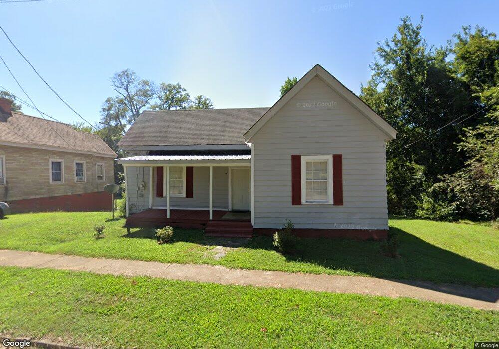
6 Whiting St Lagrange, GA 30241
Estimated Value: $84,000 - $164,000
3
Beds
1
Bath
1,263
Sq Ft
$92/Sq Ft
Est. Value
About This Home
This home is located at 6 Whiting St, Lagrange, GA 30241 and is currently estimated at $115,969, approximately $91 per square foot. 6 Whiting St is a home located in Troup County with nearby schools including Franklin Forest Elementary School, Hollis Hand Elementary School, and Ethel W. Kight Elementary School.
Ownership History
Date
Name
Owned For
Owner Type
Purchase Details
Closed on
Apr 27, 2018
Sold by
Anderson Investment Grp Ll
Bought by
Reyes Rigoberto
Current Estimated Value
Purchase Details
Closed on
Nov 6, 2002
Sold by
Newton Anderson and Newton
Bought by
Anderson Investment Group Llc
Purchase Details
Closed on
Jun 28, 2000
Sold by
Wanda Wanda B and Wanda Ka
Bought by
Newton Anderson and Newton
Purchase Details
Closed on
Jul 1, 1986
Sold by
Billy Letha and Billy Bartlett
Bought by
Wanda Wanda B and Wanda Ka
Purchase Details
Closed on
Jan 1, 1960
Sold by
Nick A Smith
Bought by
Billy Letha and Billy Bartlett
Create a Home Valuation Report for This Property
The Home Valuation Report is an in-depth analysis detailing your home's value as well as a comparison with similar homes in the area
Purchase History
| Date | Buyer | Sale Price | Title Company |
|---|---|---|---|
| Reyes Rigoberto | $36,000 | -- | |
| Anderson Investment Group Llc | -- | -- | |
| Newton Anderson | $30,000 | -- | |
| Wanda Wanda B | -- | -- | |
| Billy Letha | -- | -- |
Source: Public Records
Tax History
| Year | Tax Paid | Tax Assessment Tax Assessment Total Assessment is a certain percentage of the fair market value that is determined by local assessors to be the total taxable value of land and additions on the property. | Land | Improvement |
|---|---|---|---|---|
| 2025 | $1,013 | $37,160 | $6,680 | $30,480 |
| 2024 | $945 | $34,640 | $6,680 | $27,960 |
| 2023 | $772 | $28,320 | $6,680 | $21,640 |
| 2022 | $744 | $26,640 | $6,680 | $19,960 |
| 2021 | $648 | $21,480 | $5,720 | $15,760 |
| 2020 | $648 | $21,480 | $5,720 | $15,760 |
| 2019 | $434 | $20,120 | $5,720 | $14,400 |
| 2018 | $650 | $21,540 | $5,460 | $16,080 |
| 2017 | $650 | $21,540 | $5,460 | $16,080 |
| 2016 | $633 | $20,997 | $5,460 | $15,537 |
| 2015 | $634 | $20,997 | $5,460 | $15,537 |
| 2014 | $611 | $20,179 | $5,460 | $14,719 |
| 2013 | -- | $21,439 | $5,460 | $15,979 |
Source: Public Records
Map
Nearby Homes
- 5 Curran Ave
- 87 Youngs Mill Rd
- 4 1/2 Barnard Ave
- 204 Cleveland Dr
- 212 Cleveland Dr
- 224 Rutland Cir
- 121 de Groat St
- 616 S Harlem Cir
- 203 Bonaventure Dr
- 2 Louise St
- 15 Fulton St
- 115 Clara Jean Ct
- 131 Foch St
- 706 N Harlem Cir
- 110 Lenox Cir
- 0 N Barnard Ave
- 0 E Render St
- 210 Hearthstone Dr
- 107 N Barnard Ave
- 228 E Render St
Your Personal Tour Guide
Ask me questions while you tour the home.