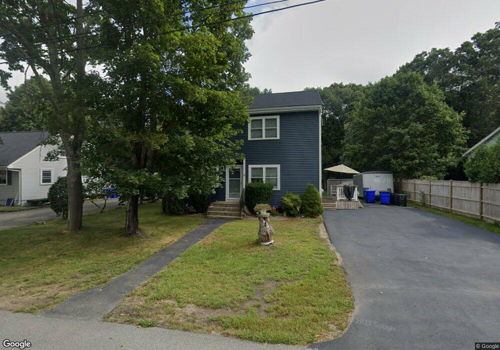
6 Winslow St Buzzards Bay, MA 02532
Estimated Value: $574,202 - $623,000
3
Beds
2
Baths
1,528
Sq Ft
$389/Sq Ft
Est. Value
About This Home
This home is located at 6 Winslow St, Buzzards Bay, MA 02532 and is currently estimated at $594,301, approximately $388 per square foot. 6 Winslow St is a home located in Barnstable County with nearby schools including Bourne High School, St Margaret Regional School, and Cadence Academy Preschool - Bourne.
Ownership History
Date
Name
Owned For
Owner Type
Purchase Details
Closed on
Oct 13, 2000
Sold by
Prophett Robert E and Prophett Catherine C
Bought by
Munson Julie Ann
Current Estimated Value
Purchase Details
Closed on
Aug 17, 1999
Sold by
Conley Mary M and Conley James J
Bought by
Prophett Robert E and Prophett Catherine C
Create a Home Valuation Report for This Property
The Home Valuation Report is an in-depth analysis detailing your home's value as well as a comparison with similar homes in the area
Home Values in the Area
Average Home Value in this Area
Purchase History
| Date | Buyer | Sale Price | Title Company |
|---|---|---|---|
| Munson Julie Ann | $124,000 | -- | |
| Munson Julie Ann | $124,000 | -- | |
| Prophett Robert E | $86,150 | -- | |
| Prophett Robert E | $86,150 | -- |
Source: Public Records
Mortgage History
| Date | Status | Borrower | Loan Amount |
|---|---|---|---|
| Open | Prophett Robert E | $100,000 | |
| Open | Prophett Robert E | $205,000 |
Source: Public Records
Tax History Compared to Growth
Tax History
| Year | Tax Paid | Tax Assessment Tax Assessment Total Assessment is a certain percentage of the fair market value that is determined by local assessors to be the total taxable value of land and additions on the property. | Land | Improvement |
|---|---|---|---|---|
| 2025 | $3,720 | $476,300 | $225,300 | $251,000 |
| 2024 | $3,637 | $453,500 | $214,600 | $238,900 |
| 2023 | $3,455 | $392,200 | $189,900 | $202,300 |
| 2022 | $3,337 | $330,700 | $168,000 | $162,700 |
| 2021 | $3,244 | $301,200 | $152,900 | $148,300 |
| 2020 | $3,169 | $295,100 | $151,500 | $143,600 |
| 2019 | $2,984 | $283,900 | $151,500 | $132,400 |
| 2018 | $2,867 | $272,000 | $144,300 | $127,700 |
| 2017 | $2,774 | $269,300 | $142,900 | $126,400 |
| 2016 | $2,513 | $247,300 | $142,900 | $104,400 |
Source: Public Records
Map
Nearby Homes
- 90-92 Sandwich Rd Unit 9C
- 90-92 Sandwich Rd Unit 2
- 60 Sandwich Rd
- 38 Old Bridge Rd
- 44 Cotuit Rd
- 304 Main St
- 85 Waterhouse Rd
- 85 Waterhouse Rd
- 14 Great Rock Rd
- 24 Ships View Terrace
- 27 Ships View Terrace
- 405 Village Dr
- 405 Village Dr Unit 405
- 4 Mainstay Ln
- 7 Mizzen Ln
- 5 Sea Knoll Ct
- 29 Weather Deck Rd
- 46 Holt Rd
- 46 Holt Rd Unit A
- 13 Laurel Hill Ct