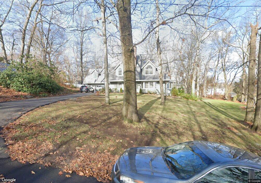
6 Woodacre Rd Norwalk, CT 06850
Broad River NeighborhoodEstimated Value: $1,206,000 - $1,456,000
3
Beds
3
Baths
3,654
Sq Ft
$353/Sq Ft
Est. Value
About This Home
This home is located at 6 Woodacre Rd, Norwalk, CT 06850 and is currently estimated at $1,288,441, approximately $352 per square foot. 6 Woodacre Rd is a home located in Fairfield County with nearby schools including Silvermine Elementary School, West Rocks Middle School, and Norwalk High School.
Ownership History
Date
Name
Owned For
Owner Type
Purchase Details
Closed on
Dec 18, 2024
Sold by
Wellen Richard B
Bought by
Richard B Wellen T B and Richard Wellen
Current Estimated Value
Purchase Details
Closed on
Nov 1, 2022
Sold by
Wellen Richard B and Bartron Karen
Bought by
Richard B Wellen T B and Richard Wellen
Create a Home Valuation Report for This Property
The Home Valuation Report is an in-depth analysis detailing your home's value as well as a comparison with similar homes in the area
Home Values in the Area
Average Home Value in this Area
Purchase History
| Date | Buyer | Sale Price | Title Company |
|---|---|---|---|
| Richard B Wellen T B | -- | None Available | |
| Richard B Wellen T B | -- | None Available | |
| Wellen Richard B | -- | None Available | |
| Wellen Richard B | -- | None Available | |
| Richard B Wellen T B | -- | None Available | |
| Richard B Wellen T | -- | None Available | |
| Richard B Wellen T B | -- | None Available |
Source: Public Records
Tax History Compared to Growth
Tax History
| Year | Tax Paid | Tax Assessment Tax Assessment Total Assessment is a certain percentage of the fair market value that is determined by local assessors to be the total taxable value of land and additions on the property. | Land | Improvement |
|---|---|---|---|---|
| 2025 | $16,151 | $680,320 | $231,550 | $448,770 |
| 2024 | $15,902 | $680,320 | $231,550 | $448,770 |
| 2023 | $14,070 | $563,580 | $202,990 | $360,590 |
| 2022 | $13,849 | $563,580 | $202,990 | $360,590 |
| 2021 | $11,784 | $563,580 | $202,990 | $360,590 |
| 2020 | $13,304 | $563,580 | $202,990 | $360,590 |
| 2019 | $12,848 | $563,580 | $202,990 | $360,590 |
| 2018 | $12,440 | $479,770 | $230,390 | $249,380 |
| 2017 | $12,006 | $479,770 | $230,390 | $249,380 |
| 2016 | $12,205 | $479,770 | $230,390 | $249,380 |
| 2015 | $10,963 | $479,770 | $230,390 | $249,380 |
| 2014 | $12,013 | $479,770 | $230,390 | $249,380 |
Source: Public Records
Map
Nearby Homes
- 46 Silvermine Ave
- 8 Lloyd Rd
- 34 Lakeview Dr
- 7 Lycett Ct
- 5 Maher Dr
- 5 Tower Dr
- 36 Styles Ln
- 10 Parallel St
- 14 Sniffen St
- 13 Slocum St
- 230 New Canaan Ave Unit 2
- 31 June Ave
- 15 Perry Ave Unit 10A
- 4 Fullmar Ln
- 12 Camelot Dr Unit B1
- 150 Fillow St
- 28 Aiken St
- 25 Grand St Unit 204
- 50 Aiken St Unit 312
- 50 Aiken St Unit 241
- 2 Woodacre Rd
- 8 Woodacre Rd
- 33 Hillwood Place
- 37 Bartlett Ave
- 31 Hillwood Place
- 39 Bartlett Ave
- 35 Hillwood Place
- 29 Hillwood Place
- 37 Hillwood Place
- 35 Bartlett Ave
- 1 Woodacre Rd
- 31 Bartlett Ave
- 41 Bartlett Ave
- 27 Hills Ln
- 27 Hillwood Place
- 27 Hills Ln Unit 27
- 10 Hillwood Place
- 7 Woodacre Rd
- 1 Hillwood Place
- 24 Mills St