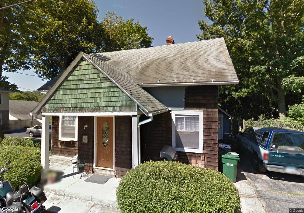
6 Woodland Grove Waterford, CT 06385
Estimated Value: $167,000 - $316,000
3
Beds
2
Baths
1,739
Sq Ft
$152/Sq Ft
Est. Value
About This Home
This home is located at 6 Woodland Grove, Waterford, CT 06385 and is currently estimated at $264,095, approximately $151 per square foot. 6 Woodland Grove is a home located in New London County with nearby schools including Clark Lane Middle School, Waterford High School, and St. Joseph School.
Ownership History
Date
Name
Owned For
Owner Type
Purchase Details
Closed on
Nov 21, 2008
Sold by
Florant Barbara J Est and Florant
Bought by
Lorking Maria
Current Estimated Value
Purchase Details
Closed on
Sep 1, 1988
Sold by
Christina Frank
Bought by
Vanwart Mark
Home Financials for this Owner
Home Financials are based on the most recent Mortgage that was taken out on this home.
Original Mortgage
$108,800
Interest Rate
10.38%
Mortgage Type
Purchase Money Mortgage
Create a Home Valuation Report for This Property
The Home Valuation Report is an in-depth analysis detailing your home's value as well as a comparison with similar homes in the area
Home Values in the Area
Average Home Value in this Area
Purchase History
| Date | Buyer | Sale Price | Title Company |
|---|---|---|---|
| Lorking Maria | $100,000 | -- | |
| Vanwart Mark | $136,000 | -- |
Source: Public Records
Mortgage History
| Date | Status | Borrower | Loan Amount |
|---|---|---|---|
| Previous Owner | Vanwart Mark | $108,800 |
Source: Public Records
Tax History Compared to Growth
Tax History
| Year | Tax Paid | Tax Assessment Tax Assessment Total Assessment is a certain percentage of the fair market value that is determined by local assessors to be the total taxable value of land and additions on the property. | Land | Improvement |
|---|---|---|---|---|
| 2025 | $2,772 | $118,650 | $45,860 | $72,790 |
| 2024 | $2,646 | $118,650 | $45,860 | $72,790 |
| 2023 | $2,515 | $118,650 | $45,860 | $72,790 |
| 2022 | $2,699 | $97,930 | $43,420 | $54,510 |
| 2021 | $2,707 | $97,930 | $43,420 | $54,510 |
| 2020 | $2,729 | $97,930 | $43,420 | $54,510 |
| 2019 | $2,740 | $97,930 | $43,420 | $54,510 |
| 2018 | $2,685 | $97,930 | $43,420 | $54,510 |
| 2017 | $2,351 | $86,980 | $31,020 | $55,960 |
| 2016 | $2,329 | $86,980 | $31,020 | $55,960 |
| 2015 | $2,247 | $86,980 | $31,020 | $55,960 |
| 2014 | $2,157 | $86,980 | $31,020 | $55,960 |
Source: Public Records
Map
Nearby Homes
- 12 Pine St
- 24 Pine St
- 35 Pine St
- 68 Clark Ln
- 2 Faye St
- 152 Blydenburg Ave
- 54 Rope Ferry Rd Unit C55
- 54 Rope Ferry Rd Unit D72
- 54 Rope Ferry Rd Unit C45
- 77 Colman St
- 835 Bank St
- 213 Boston Post Rd
- 26 Jefferson Ave
- 16 Bellevue Place
- 34 Ivy Hill Rd
- 7 Ivy Hill Rd
- 142 Montauk Ave
- 32 Moore Ave
- 18 W Pleasant St
- 26 Ivy Hill Rd
- 89 Boston Post Rd
- 87 Boston Post Rd
- 93 Boston Post Rd
- 91 Boston Post Rd
- 14 Woodland Grove
- 14 Woodland Dr
- 0091 Boston Post Rd
- 83 Boston Post Rd
- 95 Boston Post Rd
- 9 Woodland Grove
- 18 Woodland Dr
- 14 Ferri Dr
- 30 Terrace Dr
- 18 Ferri Dr
- 32 Terrace Dr
- 12 Ferri Dr
- 20 Ferri Dr
- 34 Terrace Dr
- 23 Woodland Dr
- 21 Woodland Dr