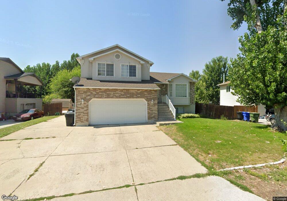
60 1370 Place S Logan, UT 84321
Woodruff NeighborhoodEstimated Value: $354,036 - $389,000
4
Beds
1
Bath
1,881
Sq Ft
$201/Sq Ft
Est. Value
About This Home
This home is located at 60 1370 Place S, Logan, UT 84321 and is currently estimated at $377,259, approximately $200 per square foot. 60 1370 Place S is a home located in Cache County with nearby schools including Hillcrest Elementary School, Mount Logan Middle School, and Logan High School.
Ownership History
Date
Name
Owned For
Owner Type
Purchase Details
Closed on
Aug 29, 2002
Sold by
Arredondo Jose G
Bought by
Pyfer Kenneth Aaron
Current Estimated Value
Home Financials for this Owner
Home Financials are based on the most recent Mortgage that was taken out on this home.
Original Mortgage
$109,302
Interest Rate
6.52%
Mortgage Type
FHA
Purchase Details
Closed on
Aug 19, 2002
Sold by
Arredondo Jose
Bought by
Arredondo Jose G
Home Financials for this Owner
Home Financials are based on the most recent Mortgage that was taken out on this home.
Original Mortgage
$109,302
Interest Rate
6.52%
Mortgage Type
FHA
Purchase Details
Closed on
Jan 2, 2002
Sold by
Colling David H and Colling Cynthia R
Bought by
Arredondo Jose
Home Financials for this Owner
Home Financials are based on the most recent Mortgage that was taken out on this home.
Original Mortgage
$109,820
Interest Rate
6.73%
Mortgage Type
FHA
Create a Home Valuation Report for This Property
The Home Valuation Report is an in-depth analysis detailing your home's value as well as a comparison with similar homes in the area
Home Values in the Area
Average Home Value in this Area
Purchase History
| Date | Buyer | Sale Price | Title Company |
|---|---|---|---|
| Pyfer Kenneth Aaron | -- | Northern Title Company | |
| Arredondo Jose G | -- | Northern Title Company | |
| Arredondo Jose | -- | Northern Title Company |
Source: Public Records
Mortgage History
| Date | Status | Borrower | Loan Amount |
|---|---|---|---|
| Closed | Arredondo Jose G | $109,302 | |
| Previous Owner | Arredondo Jose | $109,820 |
Source: Public Records
Tax History Compared to Growth
Tax History
| Year | Tax Paid | Tax Assessment Tax Assessment Total Assessment is a certain percentage of the fair market value that is determined by local assessors to be the total taxable value of land and additions on the property. | Land | Improvement |
|---|---|---|---|---|
| 2025 | $1,302 | $168,455 | $0 | $0 |
| 2024 | $1,345 | $168,455 | $0 | $0 |
| 2023 | $1,406 | $167,905 | $0 | $0 |
| 2022 | $1,506 | $167,905 | $0 | $0 |
| 2021 | $1,476 | $254,225 | $50,000 | $204,225 |
| 2020 | $1,354 | $209,896 | $50,000 | $159,896 |
| 2019 | $1,415 | $209,896 | $50,000 | $159,896 |
| 2018 | $1,307 | $177,040 | $38,000 | $139,040 |
| 2017 | $1,263 | $90,420 | $0 | $0 |
| 2016 | $1,309 | $90,420 | $0 | $0 |
| 2015 | $1,246 | $85,925 | $0 | $0 |
| 2014 | $1,126 | $85,925 | $0 | $0 |
| 2013 | -- | $88,045 | $0 | $0 |
Source: Public Records
Map
Nearby Homes
- 168 W 1275 S
- 130 W 1260 S
- 1206 S 900 W
- 593 W 300 S
- 268 W 1030 S
- 866 Riverwood Dr
- 265 W 1010 S
- 238 W 1010 S Unit 43
- 233 W 1010 S
- 475 W 60 S Unit L304
- 460 W 15 S Unit G202
- 470 W 15 S Unit F301
- 460 W 15 S Unit G201
- 460 W 15 S Unit G301
- 462 W 40 S Unit 202
- 740 S 350 W
- 439 Meadow Ln
- 427 W 65 S
- 2242 S 1120 W Unit 69
- 2254 S 1120 W Unit 72
- 60 E 1370 South Place
- 52 E 1370 South Place
- 64 E 1370 South Place
- 87 W 1370 Place S
- 55 E 1370 South Place
- 65 E 1370 South Place
- 45 1490 Place S
- 45 E 1490 South Place
- 90 E 1370 South Place
- 49 E 1490 South Place
- 1370 E 1490 South Place
- 20 E 1370 South Place
- 1510 Country Manor Dr
- 67 Ballard Way
- 67 E 1370 South Place
- 33 E 1370 South Place
- 35 E 1490 South Place
- 50 E 1490 South Place
- 48 E 1490 South Place
- 80 E 1370 South Place