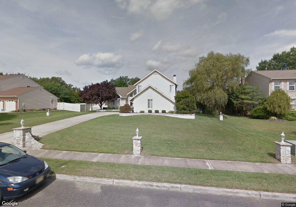
60 Aldridge Way Sewell, NJ 08080
Washington Township NeighborhoodEstimated Value: $611,202 - $696,000
4
Beds
3
Baths
2,638
Sq Ft
$245/Sq Ft
Est. Value
About This Home
This home is located at 60 Aldridge Way, Sewell, NJ 08080 and is currently estimated at $646,551, approximately $245 per square foot. 60 Aldridge Way is a home located in Gloucester County with nearby schools including Washington Township High School, Hurffville Elementary School, and Chestnut Ridge Midle School.
Ownership History
Date
Name
Owned For
Owner Type
Purchase Details
Closed on
Aug 10, 2012
Sold by
Lyons Michael A and Lyons Laura A
Bought by
Lyons Michael A and Dunn Lauren
Current Estimated Value
Purchase Details
Closed on
Jun 28, 2002
Sold by
Dade Donald U and Dade Lillian
Bought by
Lyons Michael A and Lyons Laura A
Home Financials for this Owner
Home Financials are based on the most recent Mortgage that was taken out on this home.
Original Mortgage
$234,000
Interest Rate
6.57%
Purchase Details
Closed on
Feb 18, 1997
Sold by
Dade Donald U and Dade Lillian
Bought by
Dade Lillian
Purchase Details
Closed on
Sep 5, 1996
Sold by
Paparone Corp
Bought by
Dade Donald U and Dade Lillian
Home Financials for this Owner
Home Financials are based on the most recent Mortgage that was taken out on this home.
Original Mortgage
$118,000
Interest Rate
8.11%
Create a Home Valuation Report for This Property
The Home Valuation Report is an in-depth analysis detailing your home's value as well as a comparison with similar homes in the area
Home Values in the Area
Average Home Value in this Area
Purchase History
| Date | Buyer | Sale Price | Title Company |
|---|---|---|---|
| Lyons Michael A | -- | None Available | |
| Lyons Michael A | $292,500 | -- | |
| Dade Lillian | -- | American Title Abstract | |
| Dade Donald U | $215,700 | Chicago Title Insurance Co |
Source: Public Records
Mortgage History
| Date | Status | Borrower | Loan Amount |
|---|---|---|---|
| Previous Owner | Lyons Michael A | $234,000 | |
| Previous Owner | Dade Donald U | $118,000 |
Source: Public Records
Tax History Compared to Growth
Tax History
| Year | Tax Paid | Tax Assessment Tax Assessment Total Assessment is a certain percentage of the fair market value that is determined by local assessors to be the total taxable value of land and additions on the property. | Land | Improvement |
|---|---|---|---|---|
| 2025 | $12,425 | $335,900 | $73,000 | $262,900 |
| 2024 | $12,076 | $335,900 | $73,000 | $262,900 |
| 2023 | $12,076 | $335,900 | $73,000 | $262,900 |
| 2022 | $11,679 | $335,900 | $73,000 | $262,900 |
| 2021 | $8,605 | $335,900 | $73,000 | $262,900 |
| 2020 | $11,357 | $335,900 | $73,000 | $262,900 |
| 2019 | $12,703 | $348,500 | $83,000 | $265,500 |
| 2018 | $12,560 | $348,500 | $83,000 | $265,500 |
| 2017 | $12,403 | $348,500 | $83,000 | $265,500 |
| 2016 | $12,330 | $348,500 | $83,000 | $265,500 |
| 2015 | $12,156 | $348,500 | $83,000 | $265,500 |
| 2014 | $11,772 | $348,500 | $83,000 | $265,500 |
Source: Public Records
Map
Nearby Homes
- 11 Pony Run
- 122, 124 & 126 Salina Rd
- 117 Shire Dr
- 8 Elk Ct
- 224 Hurffville Grenloch Rd
- 11 Samantha Ct
- 735 Sedgewick Ct Unit 735
- 213 Boothby Ct Unit 213
- 18 Lansbrook Ct
- 555 Shetland Ct Unit 555
- 137 Meridian Ln
- 348 Surrey Ct Unit 348
- 111 Belfry Place
- 1 Caserta Dr
- 109 Covered Bridge Ct Unit 109
- 155 Covered Bridge Ct
- 536 Delsea Dr
- 38 Freedom Rd
- 78 Abbington Ln
- 43 Caserta Dr
- 62 Aldridge Way
- 58 Aldridge Way
- 50 Rickland Dr
- 56 Aldridge Way
- 222 Salina Rd
- 57 Aldridge Way
- 218 Salina Rd
- 213 Salina Rd
- 228 Salina Rd
- 49 Aldridge Way
- 54 Aldridge Way
- 52 Aldridge Way
- 46 Rickland Dr
- 220 Salina Rd
- 47 Aldridge Way
- 50 Aldridge Way
- 207 Salina Rd
- 224 Salina Rd
- 44 Rickland Dr
- 232 Salina Rd