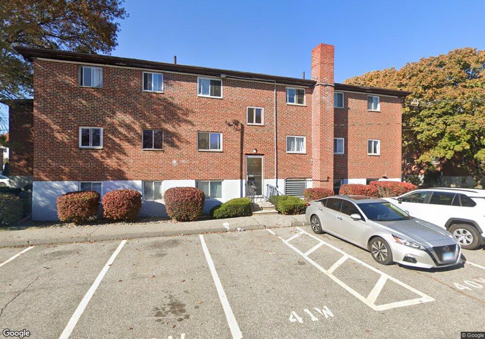
60 Bryon Rd Unit 6 Chestnut Hill, MA 02467
West Roxbury NeighborhoodEstimated Value: $385,000 - $441,000
2
Beds
1
Bath
780
Sq Ft
$529/Sq Ft
Est. Value
About This Home
This home is located at 60 Bryon Rd Unit 6, Chestnut Hill, MA 02467 and is currently estimated at $412,594, approximately $528 per square foot. 60 Bryon Rd Unit 6 is a home located in Middlesex County with nearby schools including Mount Alvernia Academy, Holy Name Parish School, and Beaver Country Day School.
Ownership History
Date
Name
Owned For
Owner Type
Purchase Details
Closed on
Sep 16, 2009
Sold by
So Cindy
Bought by
Wong Freddy
Current Estimated Value
Home Financials for this Owner
Home Financials are based on the most recent Mortgage that was taken out on this home.
Original Mortgage
$100,000
Interest Rate
5.28%
Mortgage Type
Purchase Money Mortgage
Purchase Details
Closed on
Feb 24, 2005
Sold by
So Dominic
Bought by
So Cindy and So Dominic
Purchase Details
Closed on
May 25, 1999
Sold by
Acorn Rt
Bought by
So Dominic
Home Financials for this Owner
Home Financials are based on the most recent Mortgage that was taken out on this home.
Original Mortgage
$50,000
Interest Rate
6.88%
Mortgage Type
Purchase Money Mortgage
Create a Home Valuation Report for This Property
The Home Valuation Report is an in-depth analysis detailing your home's value as well as a comparison with similar homes in the area
Home Values in the Area
Average Home Value in this Area
Purchase History
| Date | Buyer | Sale Price | Title Company |
|---|---|---|---|
| Wong Freddy | $140,000 | -- | |
| So Cindy | -- | -- | |
| So Dominic | $76,000 | -- |
Source: Public Records
Mortgage History
| Date | Status | Borrower | Loan Amount |
|---|---|---|---|
| Closed | So Dominic | $90,000 | |
| Closed | Wong Freddy | $100,000 | |
| Previous Owner | So Dominic | $50,000 |
Source: Public Records
Tax History Compared to Growth
Tax History
| Year | Tax Paid | Tax Assessment Tax Assessment Total Assessment is a certain percentage of the fair market value that is determined by local assessors to be the total taxable value of land and additions on the property. | Land | Improvement |
|---|---|---|---|---|
| 2025 | $4,520 | $390,300 | $0 | $390,300 |
| 2024 | $3,897 | $357,500 | $0 | $357,500 |
| 2023 | $3,727 | $347,000 | $0 | $347,000 |
| 2022 | $3,595 | $330,400 | $0 | $330,400 |
| 2021 | $3,525 | $330,400 | $0 | $330,400 |
| 2020 | $2,961 | $280,400 | $0 | $280,400 |
| 2019 | $2,763 | $262,100 | $0 | $262,100 |
| 2018 | $2,640 | $251,900 | $0 | $251,900 |
| 2017 | $2,565 | $242,200 | $0 | $242,200 |
| 2016 | $2,489 | $226,300 | $0 | $226,300 |
| 2015 | $2,495 | $206,000 | $0 | $206,000 |
| 2014 | -- | $189,000 | $0 | $189,000 |
Source: Public Records
Map
Nearby Homes
- 42 Bryon Rd Unit 6
- 23 Westgate Rd Unit 6
- 21 Westgate Rd Unit 6
- 64 Bryon Rd Unit 1
- 44 Broadlawn Park Unit 22
- 57 Broadlawn Park Unit 4B
- 1307 Lagrange St Unit 1307
- 109 Harwich Rd
- 931 Lagrange St
- 70 Pond Brook Rd
- 139 Newfield St
- 65 Lagrange St
- 865 Lagrange St Unit 5
- 14 Rolling Ln
- 845 Lagrange St Unit 4
- 701 Vfw Pkwy
- 72 Wallis Rd
- 99 Baldpate Hill Rd
- 133 Oak Hill St
- 579 Baker St Unit 579
- 56 Bryon Rd Unit 5
- 56 Bryon Rd Unit 3
- 60 Bryon Rd Unit 2
- 56 Bryon Rd Unit 6
- 56 Bryon Rd Unit 5
- 56 Bryon Rd Unit 2
- 56 Bryon Rd Unit 4
- 60 Bryon Rd Unit 1
- 60 Bryon Rd Unit 3
- 62 Bryon Rd Unit 2
- 56 Bryon Rd Unit 4
- 62 Bryon Rd Unit 4
- 56 Bryon Rd Unit 2
- 60 Bryon Rd Unit 5
- 50 Bryon Rd Unit 3
- 58 Bryon Rd Unit 6
- 58 Bryon Rd Unit 1
- 58 Bryon Rd Unit 4
- 50 Bryon Rd Unit 5
- 58 Bryon Rd Unit 2