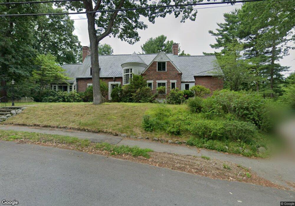
60 Burdean Rd Newton Center, MA 02459
Oak Hill NeighborhoodEstimated Value: $2,354,299 - $3,186,000
6
Beds
5
Baths
3,304
Sq Ft
$799/Sq Ft
Est. Value
About This Home
This home is located at 60 Burdean Rd, Newton Center, MA 02459 and is currently estimated at $2,640,325, approximately $799 per square foot. 60 Burdean Rd is a home located in Middlesex County with nearby schools including Memorial Spaulding Elementary School, Charles E Brown Middle School, and Oak Hill Middle School.
Ownership History
Date
Name
Owned For
Owner Type
Purchase Details
Closed on
Oct 30, 2002
Sold by
Dorn Anthony P
Bought by
Portnoy Jay S and Portnoy Deborah S
Current Estimated Value
Home Financials for this Owner
Home Financials are based on the most recent Mortgage that was taken out on this home.
Original Mortgage
$300,000
Outstanding Balance
$126,304
Interest Rate
6.09%
Mortgage Type
Purchase Money Mortgage
Estimated Equity
$2,514,021
Create a Home Valuation Report for This Property
The Home Valuation Report is an in-depth analysis detailing your home's value as well as a comparison with similar homes in the area
Home Values in the Area
Average Home Value in this Area
Purchase History
| Date | Buyer | Sale Price | Title Company |
|---|---|---|---|
| Portnoy Jay S | $1,235,000 | -- |
Source: Public Records
Mortgage History
| Date | Status | Borrower | Loan Amount |
|---|---|---|---|
| Open | Portnoy Jay S | $300,000 |
Source: Public Records
Tax History Compared to Growth
Tax History
| Year | Tax Paid | Tax Assessment Tax Assessment Total Assessment is a certain percentage of the fair market value that is determined by local assessors to be the total taxable value of land and additions on the property. | Land | Improvement |
|---|---|---|---|---|
| 2025 | $17,960 | $1,832,700 | $1,438,200 | $394,500 |
| 2024 | $17,366 | $1,779,300 | $1,396,300 | $383,000 |
| 2023 | $16,680 | $1,638,500 | $1,106,100 | $532,400 |
| 2022 | $18,670 | $1,774,700 | $997,500 | $777,200 |
| 2021 | $18,014 | $1,674,200 | $941,000 | $733,200 |
| 2020 | $17,479 | $1,674,200 | $941,000 | $733,200 |
| 2019 | $16,985 | $1,625,400 | $913,600 | $711,800 |
| 2018 | $16,633 | $1,537,200 | $825,100 | $712,100 |
| 2017 | $16,126 | $1,450,200 | $778,400 | $671,800 |
| 2016 | $15,423 | $1,355,300 | $727,500 | $627,800 |
| 2015 | $14,705 | $1,266,600 | $679,900 | $586,700 |
Source: Public Records
Map
Nearby Homes
- 65 Levbert Rd
- 59 Deborah Rd
- 56 Cynthia Rd
- 41 Juniper Ln
- 135 Hartman Rd
- 58 Country Club Rd
- 63 Drumlin Rd
- 45 Brandeis Rd
- 99 Baldpate Hill Rd
- 136 Dudley Rd
- 35 Haynes Rd
- 85 Dudley Rd
- 79 Florence St Unit 600S
- 79 Florence St Unit 402S
- 44 Lovett Rd
- 38 Tanglewood Rd
- 80 Louise Rd Unit 82
- 21 Lovett Rd
- 36 Ober Rd
- 19 Selwyn Rd
- 53 Littlefield Rd
- 59 Littlefield Rd
- 58 Burdean Rd
- 15 Winston Rd
- 70 Burdean Rd
- 63 Burdean Rd
- 45 Littlefield Rd
- 62 Littlefield Rd
- 61 Winston Rd
- 45 Burdean Rd
- 40 Burdean Rd
- 56 Littlefield Rd
- 75 Littlefield Rd
- 48 Littlefield Rd
- 48 Littlefield Rd Unit O
- 69 Winston Rd
- 68 Littlefield Rd
- 40 Littlefield Rd
- 37 Burdean Rd
- 20 Winston Rd