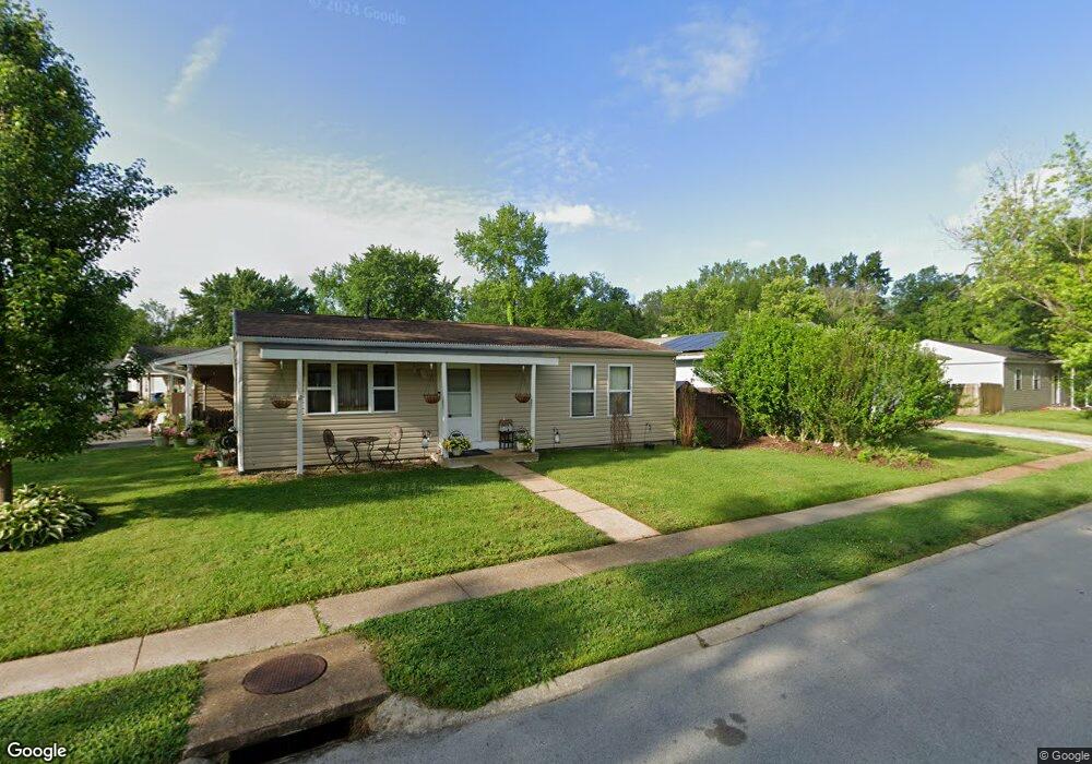
60 Cedar Field Dr Pacific, MO 63069
Estimated Value: $185,000 - $203,415
3
Beds
1
Bath
960
Sq Ft
$203/Sq Ft
Est. Value
About This Home
This home is located at 60 Cedar Field Dr, Pacific, MO 63069 and is currently estimated at $195,354, approximately $203 per square foot. 60 Cedar Field Dr is a home located in Franklin County with nearby schools including Pacific High School and St Bridget Elementary School.
Ownership History
Date
Name
Owned For
Owner Type
Purchase Details
Closed on
Sep 14, 2025
Sold by
Tomnitz-Sucher Genetta M
Bought by
Tomnitz-Sucher Genetta M
Current Estimated Value
Purchase Details
Closed on
Jun 17, 2014
Sold by
Fannie Mae
Bought by
Tomnitz Genetta
Purchase Details
Closed on
Apr 30, 2007
Sold by
Cowsert Scott
Bought by
Freeman Matthew A
Home Financials for this Owner
Home Financials are based on the most recent Mortgage that was taken out on this home.
Original Mortgage
$115,500
Interest Rate
6.73%
Mortgage Type
New Conventional
Create a Home Valuation Report for This Property
The Home Valuation Report is an in-depth analysis detailing your home's value as well as a comparison with similar homes in the area
Home Values in the Area
Average Home Value in this Area
Purchase History
We collect this data history from publicly available records. To have your information removed, we recommend requesting removal directly through your county’s website.
| Date | Buyer | Sale Price | Title Company |
|---|---|---|---|
| Tomnitz-Sucher Genetta M | -- | None Listed On Document | |
| Tomnitz Genetta | -- | -- | |
| Freeman Matthew A | -- | Residential Title Services I |
Source: Public Records
Mortgage History
We collect this data history from publicly available records. To have your information removed, we recommend requesting removal directly through your county’s website.
| Date | Status | Borrower | Loan Amount |
|---|---|---|---|
| Previous Owner | Freeman Matthew A | $115,500 |
Source: Public Records
Tax History
| Year | Tax Paid | Tax Assessment Tax Assessment Total Assessment is a certain percentage of the fair market value that is determined by local assessors to be the total taxable value of land and additions on the property. | Land | Improvement |
|---|---|---|---|---|
| 2025 | $1,862 | $24,706 | $0 | $0 |
| 2024 | $1,862 | $22,874 | $0 | $0 |
| 2023 | $1,727 | $22,874 | $0 | $0 |
| 2022 | $1,494 | $21,533 | $0 | $0 |
| 2021 | $1,487 | $21,533 | $0 | $0 |
| 2020 | $1,369 | $19,808 | $0 | $0 |
| 2019 | $1,367 | $19,808 | $0 | $0 |
| 2018 | $1,262 | $17,913 | $0 | $0 |
| 2017 | $1,253 | $17,913 | $0 | $0 |
| 2016 | $1,291 | $18,269 | $0 | $0 |
| 2015 | $1,256 | $18,269 | $0 | $0 |
| 2014 | $1,197 | $17,708 | $0 | $0 |
Source: Public Records
Map
Nearby Homes
- 668 #12 Highlands Ct Ct
- 667 #9 Highlands Rd
- 652 Ct
- 1942 Kesha Ct
- 6827 Eagles Landing Ct
- 1003 Mitchell Way
- 125 Vincent St
- 107 Vincent St
- 122 Winter Wheat Trail
- 144 Winter Wheat Trail
- 127 Phelan St
- 1829 Ridge Ln
- 1980 Highway N
- 993 Eastridge Dr
- 1632 Westlake Cir
- 1708 Westlake Ct
- 1233 Powell Place
- 1233 Sonoma Way
- 1107 W Congress St
- 1657 Westlake Ct
- 62 Cedar Field Dr
- 52 Cedar Croft Dr
- 54 Cedar Croft Dr
- 54 Cedar Field Dr
- 64 Cedar Field Dr
- 92 Cedar Ridge Dr
- 92 Cedar Ridge * Bonus* Dr
- 50 Cedar Field Dr
- 59 Cedar Field Dr
- 94 Cedar Ridge Dr
- 55 Cedar Croft Dr
- 57 Cedar Field Dr
- 61 Cedar Field Dr
- 56 Cedar Croft Dr
- 55 Cedar Field Dr
- 96 Cedar Ridge Dr
- 63 Cedar Field Dr
- 98 Cedar Ridge Dr
- 57 Cedar Croft Dr
- 58 Cedar Croft Dr
Your Personal Tour Guide
Ask me questions while you tour the home.