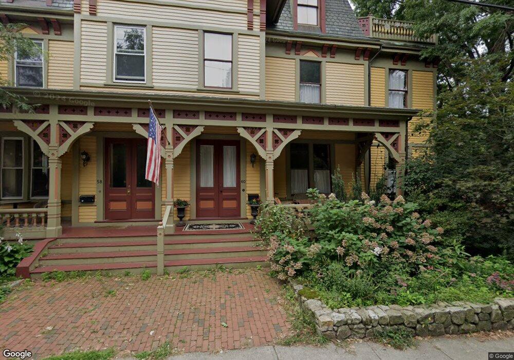
60 Davis Ave Brookline, MA 02445
Brookline Village NeighborhoodEstimated Value: $3,033,000 - $3,471,000
7
Beds
3
Baths
4,360
Sq Ft
$752/Sq Ft
Est. Value
About This Home
This home is located at 60 Davis Ave, Brookline, MA 02445 and is currently estimated at $3,278,828, approximately $752 per square foot. 60 Davis Ave is a home located in Norfolk County with nearby schools including Pierce School, Brookline High School, and St. Mary of the Assumption Elementary School.
Ownership History
Date
Name
Owned For
Owner Type
Purchase Details
Closed on
Oct 4, 1999
Sold by
Farnsworth Joan M
Bought by
Sophie Rt
Current Estimated Value
Home Financials for this Owner
Home Financials are based on the most recent Mortgage that was taken out on this home.
Original Mortgage
$850,000
Interest Rate
7.85%
Mortgage Type
Purchase Money Mortgage
Create a Home Valuation Report for This Property
The Home Valuation Report is an in-depth analysis detailing your home's value as well as a comparison with similar homes in the area
Home Values in the Area
Average Home Value in this Area
Purchase History
| Date | Buyer | Sale Price | Title Company |
|---|---|---|---|
| Sophie Rt | $550,000 | -- |
Source: Public Records
Mortgage History
| Date | Status | Borrower | Loan Amount |
|---|---|---|---|
| Open | Sophie Rt | $857,000 | |
| Closed | Sophie Rt | $989,162 | |
| Closed | Sophie Rt | $850,000 |
Source: Public Records
Tax History
| Year | Tax Paid | Tax Assessment Tax Assessment Total Assessment is a certain percentage of the fair market value that is determined by local assessors to be the total taxable value of land and additions on the property. | Land | Improvement |
|---|---|---|---|---|
| 2025 | $31,775 | $3,219,400 | $1,375,400 | $1,844,000 |
| 2024 | $30,215 | $3,092,600 | $1,322,500 | $1,770,100 |
| 2023 | $28,860 | $2,894,700 | $1,062,700 | $1,832,000 |
| 2022 | $28,092 | $2,756,800 | $1,012,000 | $1,744,800 |
| 2021 | $25,978 | $2,650,800 | $973,100 | $1,677,700 |
| 2020 | $23,993 | $2,538,900 | $884,600 | $1,654,300 |
| 2019 | $22,657 | $2,418,000 | $842,500 | $1,575,500 |
| 2018 | $21,676 | $2,291,300 | $765,900 | $1,525,400 |
| 2017 | $21,236 | $2,149,400 | $722,500 | $1,426,900 |
| 2016 | $20,932 | $2,008,800 | $675,300 | $1,333,500 |
| 2015 | $20,051 | $1,877,400 | $631,100 | $1,246,300 |
| 2014 | $20,969 | $1,841,000 | $573,700 | $1,267,300 |
Source: Public Records
Map
Nearby Homes
- 12 Thayer St
- 75-83 Boylston St Unit R3
- 12 Goodwin Place Unit 12-1
- 12 Goodwin Place Unit 12-2
- 8 Leverett St Unit 3
- 11 Goodwin Place Unit 1
- 11 Goodwin Place Unit 11-1
- 11 Goodwin Place Unit 11-2
- 370 Washington St
- 3 Upland Rd Unit 2
- 69 Walnut St Unit 2
- 69 Walnut St Unit 1
- 401 Washington St Unit 6
- 236 Walnut St
- 6 Juniper St Unit 16
- 38 Juniper St Unit 108
- 58 Kent St Unit 302
- 58 Kent St Unit 301
- 58 Kent St Unit 303
- 58 Kent St Unit 305
- 58 Davis Ave
- 54 Davis Ave
- 55 Davis Ave
- 888 Confidential St
- 50 Davis Ave Unit 52
- 68 Davis Ave
- 68 Davis Ave Unit 1
- 61 White Place
- 53 Davis Ave
- 000 Confidential St
- 70 White Place Unit 70
- 55 White Place
- 49 Davis Ave Unit 2
- 49 Davis Ave Unit 1
- 72 White Place Unit 72
- 72 Davis Ave
- 72 Davis Ave
- 53 White Place
- 64 White Place Unit 3
- 64 White Place Unit 2
Your Personal Tour Guide
Ask me questions while you tour the home.