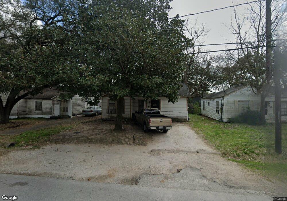
60 De Boll St Houston, TX 77022
Northside-Northline NeighborhoodEstimated Value: $148,309 - $214,000
2
Beds
1
Bath
1,046
Sq Ft
$173/Sq Ft
Est. Value
About This Home
This home is located at 60 De Boll St, Houston, TX 77022 and is currently estimated at $180,827, approximately $172 per square foot. 60 De Boll St is a home located in Harris County with nearby schools including Burbank Elementary School, Burbank Middle School, and Sam Houston Math, Science & Technology Center.
Ownership History
Date
Name
Owned For
Owner Type
Purchase Details
Closed on
Dec 1, 1997
Sold by
Swonke Michael D and Swonke Shirley Ann
Bought by
Maciejeski Bruce P and Maciejeski Janet M
Current Estimated Value
Purchase Details
Closed on
Dec 28, 1994
Sold by
Schermett Ervin W and Schermett Leanne B
Bought by
Swonke Michael Dean and Swonke Shirley Ann
Purchase Details
Closed on
Dec 14, 1994
Sold by
Schermett Ervin W and Schermett Leanne B
Bought by
Swonke Michael Dean and Swonke Shirley Ann
Purchase Details
Closed on
Dec 15, 1993
Sold by
Swonke Michael Dean and Swonke Shirley Ann
Bought by
Schermett Ervin W and Schermett Leann B
Home Financials for this Owner
Home Financials are based on the most recent Mortgage that was taken out on this home.
Original Mortgage
$12,147
Interest Rate
7.06%
Mortgage Type
Seller Take Back
Create a Home Valuation Report for This Property
The Home Valuation Report is an in-depth analysis detailing your home's value as well as a comparison with similar homes in the area
Home Values in the Area
Average Home Value in this Area
Purchase History
| Date | Buyer | Sale Price | Title Company |
|---|---|---|---|
| Maciejeski Bruce P | -- | -- | |
| Swonke Michael Dean | -- | -- | |
| Swonke Michael Dean | -- | -- | |
| Schermett Ervin W | -- | Heritage Title |
Source: Public Records
Mortgage History
| Date | Status | Borrower | Loan Amount |
|---|---|---|---|
| Previous Owner | Schermett Ervin W | $12,147 |
Source: Public Records
Tax History Compared to Growth
Tax History
| Year | Tax Paid | Tax Assessment Tax Assessment Total Assessment is a certain percentage of the fair market value that is determined by local assessors to be the total taxable value of land and additions on the property. | Land | Improvement |
|---|---|---|---|---|
| 2025 | $2,418 | $115,575 | $60,375 | $55,200 |
| 2024 | $2,418 | $115,575 | $60,375 | $55,200 |
| 2023 | $2,418 | $106,880 | $60,375 | $46,505 |
| 2022 | $1,861 | $84,533 | $46,000 | $38,533 |
| 2021 | $1,818 | $78,000 | $46,000 | $32,000 |
| 2020 | $1,773 | $73,198 | $46,000 | $27,198 |
| 2019 | $1,452 | $57,386 | $30,188 | $27,198 |
| 2018 | $1,283 | $50,721 | $30,188 | $20,533 |
| 2017 | $1,283 | $50,721 | $30,188 | $20,533 |
| 2016 | $1,433 | $56,659 | $30,188 | $26,471 |
| 2015 | $1,203 | $46,800 | $30,188 | $16,612 |
| 2014 | $1,203 | $46,800 | $30,188 | $16,612 |
Source: Public Records
Map
Nearby Homes
- 70 Burress St
- 90 Burress St Unit B
- 90 Burress St Unit A
- 44 Farrell St
- 9625 Fulton St
- 61 Trenwood Ln
- 91 Burbank St
- 108 Fichter St
- 45 Wellford St
- 0 Burbank St Unit 9886770
- 56 Wellford St
- 104 Luetta St
- 106 Luetta St
- 108 Luetta St
- 110 Luetta St
- 216 Burress St
- 202 Burbank St
- 9816 Fulton St
- Cypress Plan at Wellford Village
- Willow Plan at Wellford Village