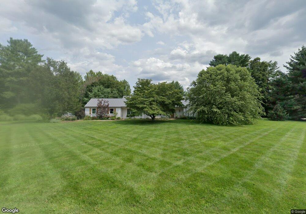
60 Deer Path Kennett Square, PA 19348
Estimated Value: $713,253 - $792,000
3
Beds
3
Baths
2,530
Sq Ft
$295/Sq Ft
Est. Value
About This Home
This home is located at 60 Deer Path, Kennett Square, PA 19348 and is currently estimated at $745,313, approximately $294 per square foot. 60 Deer Path is a home located in Chester County with nearby schools including Kennett Middle School, Kennett High School, and St. Patrick School.
Ownership History
Date
Name
Owned For
Owner Type
Purchase Details
Closed on
Mar 27, 2008
Sold by
Deegan Edward A
Bought by
Stenta Robert Andrew and Stenta Catherine Elizabeth
Current Estimated Value
Home Financials for this Owner
Home Financials are based on the most recent Mortgage that was taken out on this home.
Original Mortgage
$300,000
Outstanding Balance
$193,283
Interest Rate
6.3%
Mortgage Type
Purchase Money Mortgage
Estimated Equity
$552,030
Purchase Details
Closed on
May 25, 1994
Sold by
White Thomas Harold and White Mary Ellen
Bought by
Pnc Bank Delaware
Create a Home Valuation Report for This Property
The Home Valuation Report is an in-depth analysis detailing your home's value as well as a comparison with similar homes in the area
Home Values in the Area
Average Home Value in this Area
Purchase History
| Date | Buyer | Sale Price | Title Company |
|---|---|---|---|
| Stenta Robert Andrew | $400,000 | None Available | |
| Pnc Bank Delaware | -- | -- |
Source: Public Records
Mortgage History
| Date | Status | Borrower | Loan Amount |
|---|---|---|---|
| Open | Stenta Robert Andrew | $300,000 |
Source: Public Records
Tax History
| Year | Tax Paid | Tax Assessment Tax Assessment Total Assessment is a certain percentage of the fair market value that is determined by local assessors to be the total taxable value of land and additions on the property. | Land | Improvement |
|---|---|---|---|---|
| 2025 | $9,619 | $235,880 | $65,340 | $170,540 |
| 2024 | $9,619 | $235,880 | $65,340 | $170,540 |
| 2023 | $9,432 | $235,880 | $65,340 | $170,540 |
| 2022 | $9,181 | $235,880 | $65,340 | $170,540 |
| 2021 | $9,043 | $235,880 | $65,340 | $170,540 |
| 2020 | $8,874 | $235,880 | $65,340 | $170,540 |
| 2019 | $8,755 | $235,880 | $65,340 | $170,540 |
| 2018 | $8,574 | $235,880 | $65,340 | $170,540 |
| 2017 | $7,975 | $235,880 | $65,340 | $170,540 |
| 2016 | $935 | $235,880 | $65,340 | $170,540 |
| 2015 | $935 | $235,880 | $65,340 | $170,540 |
| 2014 | $935 | $235,880 | $65,340 | $170,540 |
Source: Public Records
Map
Nearby Homes
- 38 Fawn Ln
- 116 Deer Path
- 506 Willow Glen Rd
- 962 E Baltimore Pike
- 989 Sills Mill Rd
- 4 W Pennsbury Way
- 821 Burrows Run Rd
- 9 Raven Ln
- 507 Dunbarton Ct Unit 74
- 36 Blue Stone Ct
- 39 E Jonathan Ct
- 818 Burrows Run Rd
- 178 S Orchard Ave
- 712 Wickersham Ln
- 110 Hannah Ln
- 800 Fairville Rd
- 123 Federal Walk
- 30 Penn Dr
- 875 Locust Grove Rd
- 316 Maple Dr
Your Personal Tour Guide
Ask me questions while you tour the home.