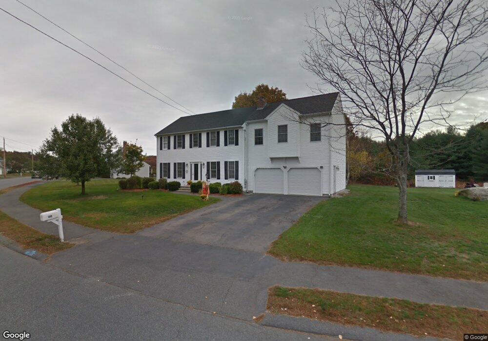
60 Deer Run Rd Bellingham, MA 02019
Estimated Value: $616,000 - $705,000
4
Beds
3
Baths
2,224
Sq Ft
$296/Sq Ft
Est. Value
About This Home
This home is located at 60 Deer Run Rd, Bellingham, MA 02019 and is currently estimated at $658,517, approximately $296 per square foot. 60 Deer Run Rd is a home located in Norfolk County with nearby schools including Joseph F. DiPietro Elementary, Bellingham High School, and Rise Prep Mayoral Academy Middle School.
Ownership History
Date
Name
Owned For
Owner Type
Purchase Details
Closed on
Jun 15, 2023
Sold by
Hall John C and Hall Chanita F
Bought by
Hall Ft and Hall
Current Estimated Value
Purchase Details
Closed on
May 7, 2021
Sold by
Hall John C
Bought by
Hall John C and Hall Chanita F
Purchase Details
Closed on
Dec 19, 1997
Sold by
Gracewood Dev Corp
Bought by
Hall John C
Home Financials for this Owner
Home Financials are based on the most recent Mortgage that was taken out on this home.
Original Mortgage
$164,500
Interest Rate
7.14%
Mortgage Type
Purchase Money Mortgage
Create a Home Valuation Report for This Property
The Home Valuation Report is an in-depth analysis detailing your home's value as well as a comparison with similar homes in the area
Home Values in the Area
Average Home Value in this Area
Purchase History
| Date | Buyer | Sale Price | Title Company |
|---|---|---|---|
| Hall Ft | -- | None Available | |
| Hall John C | -- | None Available | |
| Hall John C | $179,000 | -- | |
| Hall John C | $179,000 | -- |
Source: Public Records
Mortgage History
| Date | Status | Borrower | Loan Amount |
|---|---|---|---|
| Previous Owner | Hall John C | $164,500 |
Source: Public Records
Tax History Compared to Growth
Tax History
| Year | Tax Paid | Tax Assessment Tax Assessment Total Assessment is a certain percentage of the fair market value that is determined by local assessors to be the total taxable value of land and additions on the property. | Land | Improvement |
|---|---|---|---|---|
| 2025 | $7,120 | $566,900 | $171,900 | $395,000 |
| 2024 | $6,776 | $526,900 | $157,000 | $369,900 |
| 2023 | $6,529 | $500,300 | $149,500 | $350,800 |
| 2022 | $6,457 | $458,600 | $127,400 | $331,200 |
| 2021 | $6,231 | $432,400 | $127,400 | $305,000 |
| 2020 | $5,891 | $414,300 | $127,400 | $286,900 |
| 2019 | $5,765 | $405,700 | $127,400 | $278,300 |
| 2018 | $5,466 | $379,300 | $124,000 | $255,300 |
| 2017 | $5,303 | $369,800 | $124,000 | $245,800 |
| 2016 | $5,203 | $364,100 | $132,500 | $231,600 |
| 2015 | $4,989 | $350,100 | $127,400 | $222,700 |
| 2014 | $5,018 | $342,300 | $124,800 | $217,500 |
Source: Public Records
Map
Nearby Homes
- 54 Deer Run Rd
- 61 Deer Run Rd
- 130 Pine Grove Ave
- 57 Deer Run Rd
- 50 Deer Run Rd
- 141 Pine Grove Ave
- 131 Pine Grove Ave
- 53 Deer Run Rd
- 120 Pine Grove Ave
- 46 Deer Run Rd
- 121 Pine Grove Ave
- 49 Deer Run Rd
- 110 Pine Grove Ave
- 111 Pine Grove Ave
- 3 Taylor Rd
- 45 Deer Run Rd
- 7 Taylor Rd
- 42 Deer Run Rd
- 11 Taylor Rd
- 101 Pine Grove Ave