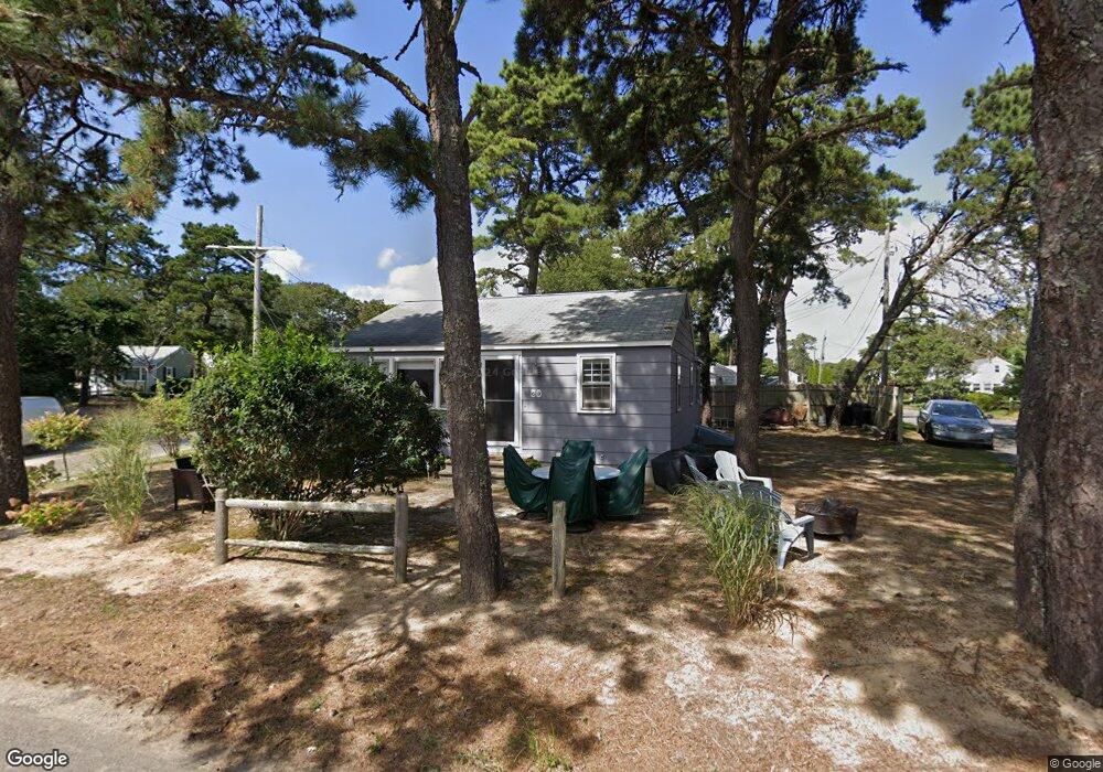
60 Ferncliff Rd Dennis Port, MA 02639
Dennis Port NeighborhoodEstimated Value: $485,000 - $596,842
3
Beds
1
Bath
864
Sq Ft
$637/Sq Ft
Est. Value
About This Home
This home is located at 60 Ferncliff Rd, Dennis Port, MA 02639 and is currently estimated at $549,961, approximately $636 per square foot. 60 Ferncliff Rd is a home located in Barnstable County with nearby schools including Dennis-Yarmouth Regional High School.
Ownership History
Date
Name
Owned For
Owner Type
Purchase Details
Closed on
May 25, 2005
Sold by
Bono Rosemarie
Bought by
Whiting Anthony G and Whiting Gretchen A
Current Estimated Value
Home Financials for this Owner
Home Financials are based on the most recent Mortgage that was taken out on this home.
Original Mortgage
$244,720
Outstanding Balance
$128,417
Interest Rate
5.94%
Mortgage Type
Purchase Money Mortgage
Estimated Equity
$421,544
Purchase Details
Closed on
May 17, 1999
Sold by
Farmington Rt 2
Bought by
Bono Rosemarie
Home Financials for this Owner
Home Financials are based on the most recent Mortgage that was taken out on this home.
Original Mortgage
$40,800
Interest Rate
6.92%
Mortgage Type
Purchase Money Mortgage
Create a Home Valuation Report for This Property
The Home Valuation Report is an in-depth analysis detailing your home's value as well as a comparison with similar homes in the area
Home Values in the Area
Average Home Value in this Area
Purchase History
| Date | Buyer | Sale Price | Title Company |
|---|---|---|---|
| Whiting Anthony G | $305,900 | -- | |
| Bono Rosemarie | $112,000 | -- |
Source: Public Records
Mortgage History
| Date | Status | Borrower | Loan Amount |
|---|---|---|---|
| Open | Whiting Anthony G | $244,720 | |
| Closed | Whiting Anthony G | $30,590 | |
| Previous Owner | Bono Rosemarie | $40,800 |
Source: Public Records
Tax History Compared to Growth
Tax History
| Year | Tax Paid | Tax Assessment Tax Assessment Total Assessment is a certain percentage of the fair market value that is determined by local assessors to be the total taxable value of land and additions on the property. | Land | Improvement |
|---|---|---|---|---|
| 2025 | $2,133 | $492,700 | $271,500 | $221,200 |
| 2024 | $1,988 | $452,900 | $261,100 | $191,800 |
| 2023 | $1,923 | $411,800 | $237,400 | $174,400 |
| 2022 | $1,781 | $318,000 | $187,100 | $130,900 |
| 2021 | $1,749 | $290,000 | $183,400 | $106,600 |
| 2020 | $1,708 | $280,000 | $183,400 | $96,600 |
| 2019 | $1,733 | $280,900 | $195,200 | $85,700 |
| 2018 | $5,491 | $263,800 | $185,900 | $77,900 |
| 2017 | $5,975 | $246,500 | $171,200 | $75,300 |
| 2016 | $1,464 | $224,200 | $161,400 | $62,800 |
| 2015 | $1,435 | $224,200 | $161,400 | $62,800 |
| 2014 | $1,361 | $214,400 | $151,600 | $62,800 |
Source: Public Records
Map
Nearby Homes
- 37-A Beach Hills Rd
- 22 Ferncliff Rd
- 37 Beach Hills Rd
- 102 Sea St
- 262 Old Wharf Rd Unit 67
- 262 Old Wharf Rd Unit 5
- 262 Old Wharf Rd Unit 5
- 262 Old Wharf Rd Unit 20
- 262 Old Wharf Rd Unit 87
- 241 Old Wharf Rd Unit 82
- 241 Old Wharf Rd Unit 127
- 241 Old Wharf Rd Unit 90
- 402 Old Wharf Rd
- 402 Old Wharf Rd
- 405 Old Wharf Rd Unit B204
- 405 Old Wharf Rd Unit B204
- 217 Old Wharf Rd Unit 64
- 31 Easy St
- 9 Chase Ave Unit 6
- 11 Ocean Park W
- 254 Shad Hole Rd
- 61 Ferncliff Rd
- 56 Ferncliff Rd
- 257 Shad Hole Rd
- 250 Shad Hole Rd
- 3 Poor Bob's Ln Unit A
- 44 Myrtle Rd
- 57 Ferncliff Rd
- 264 Shad Hole Rd
- 5 Poor Bob's Ln Unit 5A
- 249 Shad Hole Rd
- 13 Maloney Ln
- 42 Myrtle Rd
- 4 Poor Bob's Ln Unit A
- 4 Poor Bob's Ln
- 53 Ferncliff Rd
- 45 Beach Hills Rd
- 49 Ferncliff Rd
- 246 Shad Hole Rd
- 37 Myrtle Rd