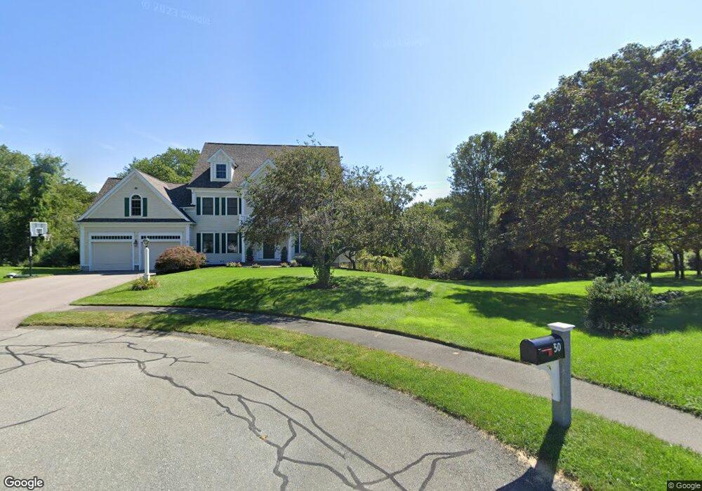
60 Fox Run Rd Wrentham, MA 02093
Estimated Value: $1,030,000 - $1,683,000
4
Beds
3
Baths
3,357
Sq Ft
$382/Sq Ft
Est. Value
About This Home
This home is located at 60 Fox Run Rd, Wrentham, MA 02093 and is currently estimated at $1,282,011, approximately $381 per square foot. 60 Fox Run Rd is a home located in Norfolk County with nearby schools including Delaney Elementary School, Charles E Roderick, and Discovery Daycare Center.
Ownership History
Date
Name
Owned For
Owner Type
Purchase Details
Closed on
Mar 5, 1999
Sold by
Voyager Bldg Corp
Bought by
Biletzerian Keith D
Current Estimated Value
Create a Home Valuation Report for This Property
The Home Valuation Report is an in-depth analysis detailing your home's value as well as a comparison with similar homes in the area
Purchase History
| Date | Buyer | Sale Price | Title Company |
|---|---|---|---|
| Biletzerian Keith D | $480,000 | -- |
Source: Public Records
Mortgage History
| Date | Status | Borrower | Loan Amount |
|---|---|---|---|
| Open | Biletzerian Keith D | $410,000 | |
| Closed | Biletzerian Keith D | $100,000 | |
| Closed | Biletzerian Keith D | $415,000 |
Source: Public Records
Tax History
| Year | Tax Paid | Tax Assessment Tax Assessment Total Assessment is a certain percentage of the fair market value that is determined by local assessors to be the total taxable value of land and additions on the property. | Land | Improvement |
|---|---|---|---|---|
| 2025 | $11,049 | $953,300 | $349,700 | $603,600 |
| 2024 | $10,684 | $890,300 | $349,700 | $540,600 |
| 2023 | $10,766 | $853,100 | $318,500 | $534,600 |
| 2022 | $10,120 | $740,300 | $290,200 | $450,100 |
| 2021 | $9,907 | $704,100 | $290,200 | $413,900 |
| 2020 | $10,028 | $703,700 | $239,900 | $463,800 |
| 2019 | $9,637 | $682,500 | $239,900 | $442,600 |
| 2018 | $10,370 | $728,200 | $235,400 | $492,800 |
| 2017 | $10,199 | $715,700 | $230,800 | $484,900 |
| 2016 | $10,069 | $705,100 | $224,100 | $481,000 |
| 2015 | $10,123 | $675,800 | $215,500 | $460,300 |
| 2014 | $10,034 | $655,400 | $207,300 | $448,100 |
Source: Public Records
Map
Nearby Homes
- 282 Thurston St
- 10 Nature View Dr
- 15 Nature View Dr
- 483 Thurston St
- 576 Dedham St
- 25 Foxboro Rd
- 1 Weber Farm Rd Unit 1
- 135 Creek St Unit 2
- 11 Weber Farm Rd Unit 11
- 3 Earle Stewart Ln
- 8 Weber Farm Rd Unit 8
- 131 Washington St Unit 42
- 131 Washington St Unit 50
- 2 Earle Stewart Ln
- 12 Earle Stewart Ln
- 10 Earle Stewart Ln Unit Lot 5
- 75 Foxboro Rd
- 30 Weber Farm Rd Unit 30
- 8 Conway Ln
- 65 Foxboro Rd
- 25 Fox Run Rd
- 50 Fox Run Rd
- 92 Thurston St
- 40 Fox Run Rd
- 86 Thurston St
- 68 Pheasant Run Ct
- 70 Cobb Rd
- 80 Cobb Rd
- 80 Cobb Rd Unit 2/80
- 90 Cobb Rd
- 138 Thurston St
- 61 Pheasant Run Ct
- 58 Pheasant Run Ct
- 30 Fox Run Rd
- 350 East St
- 80 Thurston St
- 148 Thurston St
- 76 Thurston St
- 119 Thurston St
- 119 Thurston St Unit 1
Your Personal Tour Guide
Ask me questions while you tour the home.