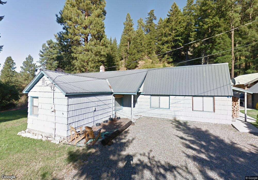
60 Gobblers Knob Rd Cle Elum, WA 98922
Estimated Value: $390,000 - $607,000
2
Beds
2
Baths
1,586
Sq Ft
$311/Sq Ft
Est. Value
About This Home
This home is located at 60 Gobblers Knob Rd, Cle Elum, WA 98922 and is currently estimated at $493,655, approximately $311 per square foot. 60 Gobblers Knob Rd is a home located in Kittitas County with nearby schools including Cle Elum Roslyn Elementary School, Walter Strom Middle School, and Cle Elum Roslyn High School.
Ownership History
Date
Name
Owned For
Owner Type
Purchase Details
Closed on
May 16, 2016
Sold by
Firl Richard
Bought by
Jennings Lane C
Current Estimated Value
Home Financials for this Owner
Home Financials are based on the most recent Mortgage that was taken out on this home.
Original Mortgage
$183,000
Outstanding Balance
$145,348
Interest Rate
3.59%
Mortgage Type
VA
Estimated Equity
$348,307
Create a Home Valuation Report for This Property
The Home Valuation Report is an in-depth analysis detailing your home's value as well as a comparison with similar homes in the area
Home Values in the Area
Average Home Value in this Area
Purchase History
| Date | Buyer | Sale Price | Title Company |
|---|---|---|---|
| Jennings Lane C | $207,400 | Nextitle |
Source: Public Records
Mortgage History
| Date | Status | Borrower | Loan Amount |
|---|---|---|---|
| Open | Jennings Lane C | $183,000 |
Source: Public Records
Tax History Compared to Growth
Tax History
| Year | Tax Paid | Tax Assessment Tax Assessment Total Assessment is a certain percentage of the fair market value that is determined by local assessors to be the total taxable value of land and additions on the property. | Land | Improvement |
|---|---|---|---|---|
| 2025 | $2,408 | $389,320 | $129,450 | $259,870 |
| 2023 | $2,408 | $358,210 | $93,450 | $264,760 |
| 2022 | $2,207 | $304,660 | $92,300 | $212,360 |
| 2021 | $2,107 | $277,110 | $69,800 | $207,310 |
| 2019 | $1,519 | $198,230 | $47,300 | $150,930 |
| 2018 | $1,297 | $160,740 | $44,480 | $116,260 |
| 2017 | $1,297 | $160,740 | $44,480 | $116,260 |
| 2016 | $1,300 | $160,740 | $44,480 | $116,260 |
| 2015 | $1,603 | $160,740 | $44,480 | $116,260 |
| 2013 | -- | $186,330 | $49,800 | $136,530 |
Source: Public Records
Map
Nearby Homes
- 0 XXX Westside Rd
- 0 NKA Milwaukee Ave
- 713 Main St
- 513 Cleveland Ave
- 501 Cleveland Ave
- 811 Lincoln Ave
- 505 6th St
- 911 Westside Rd
- 491 Pease Rd
- 70 Farmhouse Way
- 208 Sage Brook Ln
- 220 Sage Brook Ln
- 31 Groeschell Rd
- 0 XXX Unknown
- 510 Power St
- 641 Mountain Creek Dr
- 41 Panorama Dr
- 406 W 1st St
- 404 W 2nd St
- 601 Roslyn Place
- 41 Gobblers Knob Rd
- 0 Westside Rd Unit 947886
- 0 Lot 1 Westside Rd Unit 947854
- 0 Westside Rd Unit 918994
- 0 Lot 1a Westside Rd Unit 947890
- 0 Westside Rd Unit 834157
- 0 Westside Rd Unit 1170704
- 0 Westside Rd Unit 118695
- 0 Westside Rd Unit 29011560
- 0 Westside Rd Unit 29074203
- 0 Westside Rd Unit 29074205
- 0 Westside Rd Unit 29051298
- 0 Westside Rd Unit 29050707
- 0 Westside Rd Unit 1857849
- 0 Westside Rd Unit 1733425
- 0 Westside Rd Unit 1664261
- 0 Westside Rd Unit 1431757
- 0 XX Westside Rd
- 0 xxxx Westside Rd
- 0 xxxxx Westside Rd