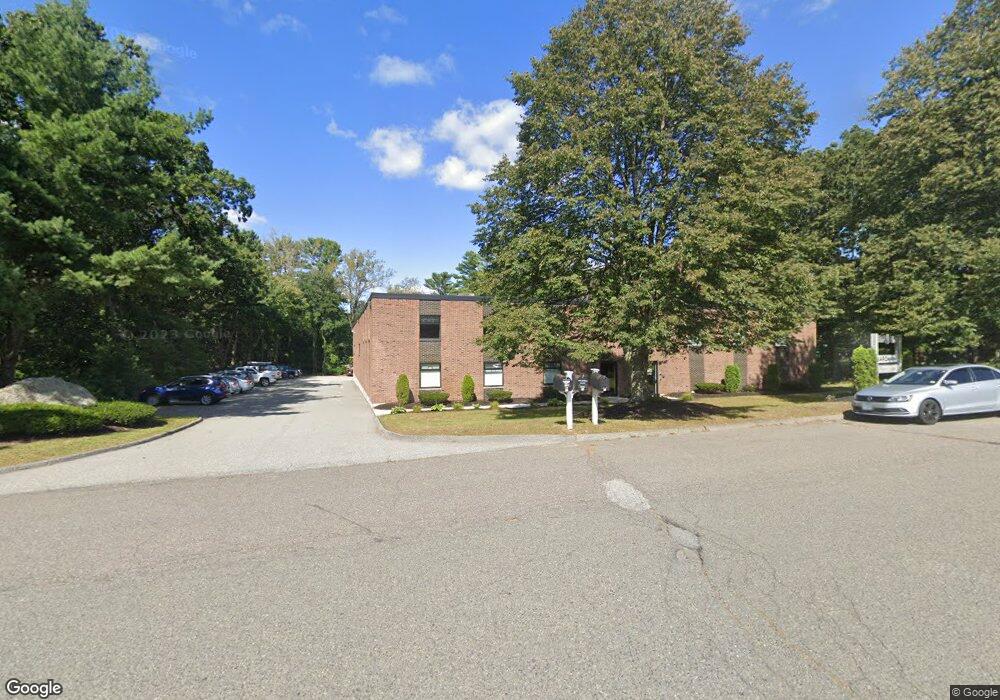
60 Jonspin Rd Wilmington, MA 01887
Estimated Value: $3,017,778
--
Bed
3
Baths
8,250
Sq Ft
$366/Sq Ft
Est. Value
About This Home
This home is located at 60 Jonspin Rd, Wilmington, MA 01887 and is currently estimated at $3,017,778, approximately $365 per square foot. 60 Jonspin Rd is a home located in Middlesex County with nearby schools including Wilmington Middle School, Wilmington High School, and Abundant Life Christian School and Childcare.
Ownership History
Date
Name
Owned For
Owner Type
Purchase Details
Closed on
May 27, 2004
Sold by
Dlj Rt
Bought by
Turner North Llc
Current Estimated Value
Home Financials for this Owner
Home Financials are based on the most recent Mortgage that was taken out on this home.
Original Mortgage
$1,050,000
Outstanding Balance
$509,144
Interest Rate
5.88%
Mortgage Type
Commercial
Estimated Equity
$2,508,634
Create a Home Valuation Report for This Property
The Home Valuation Report is an in-depth analysis detailing your home's value as well as a comparison with similar homes in the area
Home Values in the Area
Average Home Value in this Area
Purchase History
| Date | Buyer | Sale Price | Title Company |
|---|---|---|---|
| Turner North Llc | $1,400,000 | -- |
Source: Public Records
Mortgage History
| Date | Status | Borrower | Loan Amount |
|---|---|---|---|
| Open | Turner North Llc | $1,050,000 |
Source: Public Records
Tax History Compared to Growth
Tax History
| Year | Tax Paid | Tax Assessment Tax Assessment Total Assessment is a certain percentage of the fair market value that is determined by local assessors to be the total taxable value of land and additions on the property. | Land | Improvement |
|---|---|---|---|---|
| 2025 | $39,670 | $1,481,900 | $434,200 | $1,047,700 |
| 2024 | $37,346 | $1,423,800 | $434,200 | $989,600 |
| 2023 | $36,253 | $1,326,000 | $394,400 | $931,600 |
| 2022 | $35,889 | $1,193,900 | $359,000 | $834,900 |
| 2021 | $34,083 | $1,084,400 | $326,800 | $757,600 |
| 2020 | $33,475 | $1,094,300 | $326,800 | $767,500 |
| 2019 | $33,223 | $1,073,800 | $326,800 | $747,000 |
| 2018 | $32,752 | $1,009,000 | $303,100 | $705,900 |
| 2017 | $31,749 | $978,100 | $303,100 | $675,000 |
| 2016 | $32,105 | $967,900 | $303,000 | $664,900 |
| 2015 | $31,263 | $954,900 | $303,000 | $651,900 |
| 2014 | $31,543 | $954,700 | $302,800 | $651,900 |
Source: Public Records
Map
Nearby Homes
- 9 Flash Rd
- 12 Parkview Terrace
- 12 Lockwood Rd
- 2 Clover Cir
- 11 Cogswell Rd
- 10 Hillside Rd
- 300 Martins Landing Unit 107
- 1 Colonial Dr Unit C1-6
- 1 Colonial Dr Unit B1-8
- 30A Colonial Dr Unit 6
- 40 Colonial Dr Unit 8
- 260 Martins Landing Unit 508
- 260 Martins Landing Unit 103
- 220 Martins Landing Unit 309
- 20 Colonial Dr Unit 3
- 18 Burroughs Rd
- 320 Martins Landing Unit 108
- 320 Martins Landing Unit 109
- 320 Martins Landing Unit 110
- 320 Martins Landing Unit 303
- 11 Blueberry Ln
- 2 Cottonwood Cir
- 15 Blueberry Ln
- 17 Blueberry Ln
- 12 Blueberry Ln
- 14 Blueberry Ln
- 3 Cottonwood Cir
- 18 Dogwood Ln Unit 1801
- 19 Blueberry Ln
- 10 Blueberry Ln
- 16 Blueberry Ln
- 1 Cottonwood Cir
- 2 Dogwood Ln
- 2 Dogwood Ln
- 18 Blueberry Ln
- 21 Blueberry Ln
- 6 Ashwood Ave
- 390 Andover St
- 20 Blueberry Ln
- 14 Ashwood Ave