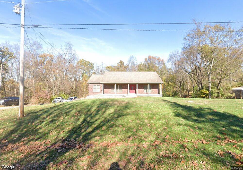
60 Locust Ln Pendleton, KY 40055
Estimated Value: $391,000 - $450,583
3
Beds
2
Baths
1,875
Sq Ft
$219/Sq Ft
Est. Value
About This Home
This home is located at 60 Locust Ln, Pendleton, KY 40055 and is currently estimated at $411,396, approximately $219 per square foot. 60 Locust Ln is a home with nearby schools including Henry County High School.
Ownership History
Date
Name
Owned For
Owner Type
Purchase Details
Closed on
Sep 3, 2015
Sold by
Whitaker Joseph and Whitaker Samantha
Bought by
Tuell Joseph G and Tuell Stacey M
Current Estimated Value
Purchase Details
Closed on
Sep 29, 2011
Sold by
Kays Gary A and Kays Beth A
Bought by
Whitaker Joseph and Crouch Samantha
Purchase Details
Closed on
Feb 12, 2010
Sold by
Gary A and Gary A
Bought by
Kays Larry
Purchase Details
Closed on
Jul 2, 2008
Sold by
Russell Mildred
Bought by
Kays Gary A and Kays Beth A
Purchase Details
Closed on
Mar 5, 2007
Sold by
Redbird Realty Co Inc
Bought by
Russell Mildred
Create a Home Valuation Report for This Property
The Home Valuation Report is an in-depth analysis detailing your home's value as well as a comparison with similar homes in the area
Purchase History
| Date | Buyer | Sale Price | Title Company |
|---|---|---|---|
| Tuell Joseph G | $224,000 | Attorney | |
| Whitaker Joseph | -- | -- | |
| Kays Larry | $22,000 | -- | |
| Kays Gary A | $22,000 | -- | |
| Russell Mildred | -- | -- |
Source: Public Records
Tax History
| Year | Tax Paid | Tax Assessment Tax Assessment Total Assessment is a certain percentage of the fair market value that is determined by local assessors to be the total taxable value of land and additions on the property. | Land | Improvement |
|---|---|---|---|---|
| 2025 | $3,398 | $287,200 | $0 | $0 |
| 2024 | $3,335 | $287,200 | $0 | $0 |
| 2023 | $3,326 | $287,200 | $0 | $0 |
| 2022 | $2,759 | $229,500 | $0 | $0 |
| 2021 | $2,828 | $229,500 | $0 | $0 |
| 2020 | $2,872 | $229,500 | $0 | $0 |
| 2019 | $2,738 | $229,500 | $0 | $0 |
| 2018 | $2,674 | $224,000 | $0 | $0 |
| 2017 | $2,667 | $224,000 | $0 | $0 |
| 2016 | $2,611 | $224,000 | $0 | $0 |
| 2015 | $1,858 | $159,500 | $0 | $0 |
| 2014 | $1,796 | $159,500 | $0 | $0 |
| 2013 | $67 | $159,500 | $0 | $0 |
| 2010 | -- | $22,000 | $22,000 | $0 |
Source: Public Records
Map
Nearby Homes
- 273 Yates Ln
- 60 Magnolia Ct
- 2421 Pendleton Rd
- 442 Oakwood Cir
- 2942 Pendleton Rd
- 2 and 3 L'Esprit Pkwy
- Lot 2 & 3 L'Esprit Pkwy
- 2831 L'Esprit Pkwy
- 960 Brownsboro Rd
- Lot #5 L'Esprit Pkwy
- 5201 Old Sligo Rd Unit Tract 2
- 9521 Sulphur Rd
- 263 L'Esprit Farm Cir
- 2335 Ridge Rd
- 2325 Pattons Creek Rd
- 331 Hidden Creek Rd
- 537 Dawkins Ln
- Tract A Forest View Ln
- 1000 Mount Olivet Rd
- 68 Stauffer Dr
Your Personal Tour Guide
Ask me questions while you tour the home.