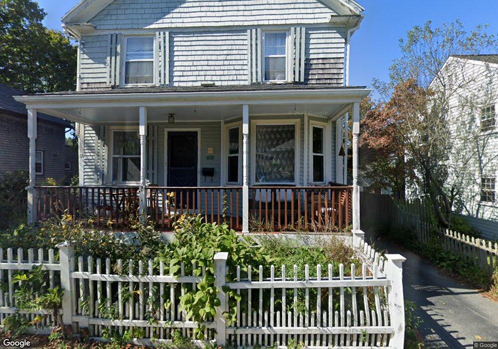
60 Malbone Rd Newport, RI 02840
Estimated Value: $717,000 - $793,000
4
Beds
2
Baths
1,674
Sq Ft
$449/Sq Ft
Est. Value
About This Home
This home is located at 60 Malbone Rd, Newport, RI 02840 and is currently estimated at $751,393, approximately $448 per square foot. 60 Malbone Rd is a home located in Newport County with nearby schools including Rogers High School, St Michael's Country Day School, and All Saints STEAM Academy.
Ownership History
Date
Name
Owned For
Owner Type
Purchase Details
Closed on
Oct 15, 2020
Sold by
Newport City Of
Bought by
Roque J Andrew
Current Estimated Value
Purchase Details
Closed on
Nov 19, 2018
Sold by
Newport City Of
Bought by
Roque J Andrew
Purchase Details
Closed on
Jun 16, 2016
Sold by
Roque Roque J and Roque Kathryn R
Bought by
Roque J Andrew
Create a Home Valuation Report for This Property
The Home Valuation Report is an in-depth analysis detailing your home's value as well as a comparison with similar homes in the area
Home Values in the Area
Average Home Value in this Area
Purchase History
| Date | Buyer | Sale Price | Title Company |
|---|---|---|---|
| Roque J Andrew | $3,281 | None Available | |
| Roque J Andrew | $3,281 | None Available | |
| Roque J Andrew | $3,129 | -- | |
| Roque J Andrew | -- | -- | |
| Roque J Andrew | $3,129 | -- | |
| Roque J Andrew | -- | -- |
Source: Public Records
Mortgage History
| Date | Status | Borrower | Loan Amount |
|---|---|---|---|
| Previous Owner | Roque J Andrew | $95,000 | |
| Previous Owner | Roque J Andrew | $50,000 | |
| Previous Owner | Roque J Andrew | $118,000 |
Source: Public Records
Tax History Compared to Growth
Tax History
| Year | Tax Paid | Tax Assessment Tax Assessment Total Assessment is a certain percentage of the fair market value that is determined by local assessors to be the total taxable value of land and additions on the property. | Land | Improvement |
|---|---|---|---|---|
| 2025 | $5,074 | $584,000 | $169,500 | $414,500 |
| 2024 | $4,800 | $584,000 | $169,500 | $414,500 |
| 2023 | $3,993 | $402,500 | $129,800 | $272,700 |
| 2022 | $3,868 | $402,500 | $129,800 | $272,700 |
| 2021 | $3,755 | $402,500 | $129,800 | $272,700 |
| 2020 | $3,281 | $319,200 | $98,800 | $220,400 |
| 2019 | $3,281 | $319,200 | $98,800 | $220,400 |
| 2018 | $3,189 | $319,200 | $98,800 | $220,400 |
| 2017 | $3,130 | $279,200 | $76,000 | $203,200 |
| 2016 | $3,052 | $279,200 | $76,000 | $203,200 |
| 2015 | $2,979 | $279,200 | $76,000 | $203,200 |
| 2014 | $3,206 | $265,800 | $56,000 | $209,800 |
Source: Public Records
Map
Nearby Homes
- 155 Evarts St
- 7 Sheffield Ave
- 1 Arnold Ave
- 125 Van Zandt Ave Unit 307
- 5 Elliot Place
- 19 Princeton St Unit 21
- 26 Prescott Hall Rd
- 4 Newport Ave Unit B2
- 3 Vicksburg Place
- 53 Warner St
- 117 W Main Rd
- 44 Warner St
- 5 Bowser Ct
- 66 Girard Ave Unit 401
- 17 Lincoln St
- 1 Shangri-La Ln
- 149 W Main Rd
- 17 Warner St
- 6 Sunshine Ct
- 104 Second St
- 62 Malbone Rd
- 58 Malbone Rd
- 8 Garfield St
- 44 Sheffield Ave
- 54 Malbone Rd
- 54 Malbone Rd Unit 1
- 54 Malbone Rd Unit 2
- 59 Malbone Rd
- 10 Garfield St
- 61 Malbone Rd
- 42 Sheffield Ave
- 66 Malbone Rd
- 68 Malbone Rd
- 2 Russell Ave
- 7 Garfield St
- 28 Burdick Ave
- 63 Malbone Rd
- 40 Sheffield Ave
- 46 Russell Ave
- 11 Garfield St