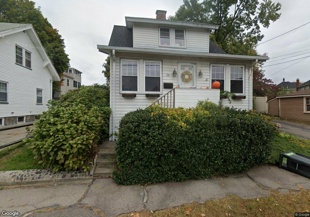
60 Marshall St Quincy, MA 02171
North Quincy NeighborhoodEstimated Value: $652,000 - $734,000
2
Beds
2
Baths
1,254
Sq Ft
$558/Sq Ft
Est. Value
About This Home
This home is located at 60 Marshall St, Quincy, MA 02171 and is currently estimated at $699,928, approximately $558 per square foot. 60 Marshall St is a home located in Norfolk County with nearby schools including Francis W. Parker Elementary School, Atlantic Middle School, and North Quincy High School.
Ownership History
Date
Name
Owned For
Owner Type
Purchase Details
Closed on
Nov 25, 2005
Sold by
Lo Kam S and Ling Mo H L
Bought by
Miller Allison
Current Estimated Value
Home Financials for this Owner
Home Financials are based on the most recent Mortgage that was taken out on this home.
Original Mortgage
$265,600
Outstanding Balance
$146,567
Interest Rate
6.06%
Mortgage Type
Purchase Money Mortgage
Estimated Equity
$553,361
Purchase Details
Closed on
Jun 29, 1995
Sold by
Kenney John F
Bought by
Lo Kam S
Create a Home Valuation Report for This Property
The Home Valuation Report is an in-depth analysis detailing your home's value as well as a comparison with similar homes in the area
Home Values in the Area
Average Home Value in this Area
Purchase History
| Date | Buyer | Sale Price | Title Company |
|---|---|---|---|
| Miller Allison | $332,000 | -- | |
| Lo Kam S | $133,000 | -- |
Source: Public Records
Mortgage History
| Date | Status | Borrower | Loan Amount |
|---|---|---|---|
| Open | Miller Allison | $265,600 | |
| Closed | Miller Allison | $33,200 |
Source: Public Records
Tax History Compared to Growth
Tax History
| Year | Tax Paid | Tax Assessment Tax Assessment Total Assessment is a certain percentage of the fair market value that is determined by local assessors to be the total taxable value of land and additions on the property. | Land | Improvement |
|---|---|---|---|---|
| 2025 | $6,584 | $571,000 | $334,200 | $236,800 |
| 2024 | $6,391 | $567,100 | $334,200 | $232,900 |
| 2023 | $5,833 | $524,100 | $303,800 | $220,300 |
| 2022 | $5,409 | $451,500 | $243,000 | $208,500 |
| 2021 | $5,387 | $443,700 | $243,000 | $200,700 |
| 2020 | $5,326 | $428,500 | $238,300 | $190,200 |
| 2019 | $4,991 | $397,700 | $229,100 | $168,600 |
| 2018 | $5,069 | $380,000 | $218,200 | $161,800 |
| 2017 | $5,001 | $352,900 | $198,400 | $154,500 |
| 2016 | $4,783 | $333,100 | $180,300 | $152,800 |
| 2015 | $4,368 | $299,200 | $163,900 | $135,300 |
| 2014 | $4,064 | $273,500 | $163,900 | $109,600 |
Source: Public Records
Map
Nearby Homes
- 6 Warwick St
- 58 Bayfield Rd S
- 85 E Squantum St Unit 10
- 297 Billings St
- 522 Hancock St
- 101 Beach St
- 201 Billings St
- 17 Holmes St Unit 2
- 17 Holmes St Unit 4
- 11 Earle St
- 38 Walker St
- 25 Hummock Rd
- 143 Arlington St
- 140 Phillips St
- 91 Atlantic St
- 115 W Squantum St Unit 907
- 115 W Squantum St Unit 810
- 175 Quincy Shore Dr Unit B24
- 250 Fayette St
- 212 Quincy Shore Dr
- 58 Marshall St
- 66 Marshall St
- 208 Billings Rd
- 54 Marshall St
- 9 Warwick St Unit 1
- 9 Warwick St
- 9 Warwick St Unit 3
- 9 Warwick St Unit 2
- 218 Billings Rd
- 218 - 220 Billings Rd
- 57 Marshall St
- 202 Billings Rd
- 17 Warwick St
- 222 Billings Rd
- 53 Marshall St
- 198 Billings Rd
- 19 Warwick St
- 47 Marshall St
- 224 Billings Rd Unit 224
- 8 Warwick St