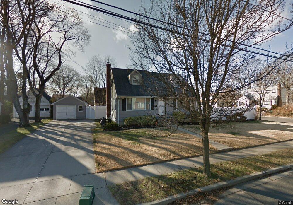
60 Mccord Ave Merrick, NY 11566
Estimated Value: $838,000 - $1,030,305
3
Beds
3
Baths
2,816
Sq Ft
$332/Sq Ft
Est. Value
About This Home
This home is located at 60 Mccord Ave, Merrick, NY 11566 and is currently estimated at $934,153, approximately $331 per square foot. 60 Mccord Ave is a home located in Nassau County with nearby schools including Merrick Avenue Middle School, Sanford H Calhoun High School, and Grace Christian Academy.
Ownership History
Date
Name
Owned For
Owner Type
Purchase Details
Closed on
Dec 30, 2010
Sold by
Martellaro Patrick and Martellaro Natalie
Bought by
Miller Russell F and Miller Rachel
Current Estimated Value
Home Financials for this Owner
Home Financials are based on the most recent Mortgage that was taken out on this home.
Original Mortgage
$387,000
Outstanding Balance
$259,774
Interest Rate
4.46%
Mortgage Type
Purchase Money Mortgage
Estimated Equity
$674,379
Create a Home Valuation Report for This Property
The Home Valuation Report is an in-depth analysis detailing your home's value as well as a comparison with similar homes in the area
Home Values in the Area
Average Home Value in this Area
Purchase History
| Date | Buyer | Sale Price | Title Company |
|---|---|---|---|
| Miller Russell F | $430,000 | -- |
Source: Public Records
Mortgage History
| Date | Status | Borrower | Loan Amount |
|---|---|---|---|
| Open | Miller Russell F | $387,000 |
Source: Public Records
Tax History Compared to Growth
Tax History
| Year | Tax Paid | Tax Assessment Tax Assessment Total Assessment is a certain percentage of the fair market value that is determined by local assessors to be the total taxable value of land and additions on the property. | Land | Improvement |
|---|---|---|---|---|
| 2025 | $12,749 | $638 | $184 | $454 |
| 2024 | $3,114 | $709 | $204 | $505 |
| 2023 | $13,455 | $505 | $238 | $267 |
| 2022 | $13,455 | $477 | $209 | $268 |
| 2021 | $16,393 | $479 | $211 | $268 |
| 2020 | $11,601 | $632 | $596 | $36 |
| 2019 | $10,538 | $719 | $678 | $41 |
| 2018 | $11,361 | $719 | $0 | $0 |
| 2017 | $7,365 | $764 | $509 | $255 |
| 2016 | $10,634 | $1,018 | $678 | $340 |
| 2015 | $4,040 | $1,018 | $675 | $343 |
| 2014 | $4,040 | $1,018 | $675 | $343 |
| 2013 | $3,823 | $1,018 | $678 | $340 |
Source: Public Records
Map
Nearby Homes
- 49 Princeton Place
- 131 Gregory Ave
- 2991 Girard Place
- 2291 Girard Place
- 174 Babylon Turnpike
- 10 Central Pkwy
- 54 Beverly Rd
- 1674 Birch Dr
- 1690 Argyle Rd
- 25 Babylon Turnpike
- 2608 Montauk Ave
- 179 Commonwealth Ave
- 31 Alice St
- 204 Hewlett Ave
- 96 Beach Dr
- 217 Bayview Ave
- 2 Dorothy Ct
- 1931 Miller Place
- 10 Dorothy Ct
- 2077 Byron Rd
- 1808 Princeton Place
- 68 Mccord Ave
- 63 Mccord Ave
- 63 Mccord Ave
- 1 Columbia Place
- 74 Mccord Ave
- 2403 Mccord Ave
- 54 Mccord Ave
- 2395 Mccord Ave
- 1811 Princeton Place
- 1805 Princeton Place
- 1805 Princeton Place
- 51 Mccord Ave
- 67 Mccord Ave
- 2424 Mccord Ave
- 47 Mccord Ave
- 71 Mccord Ave
- 1797 Princeton Place
- 2400 Keeler Ave
- 2 Columbia Place