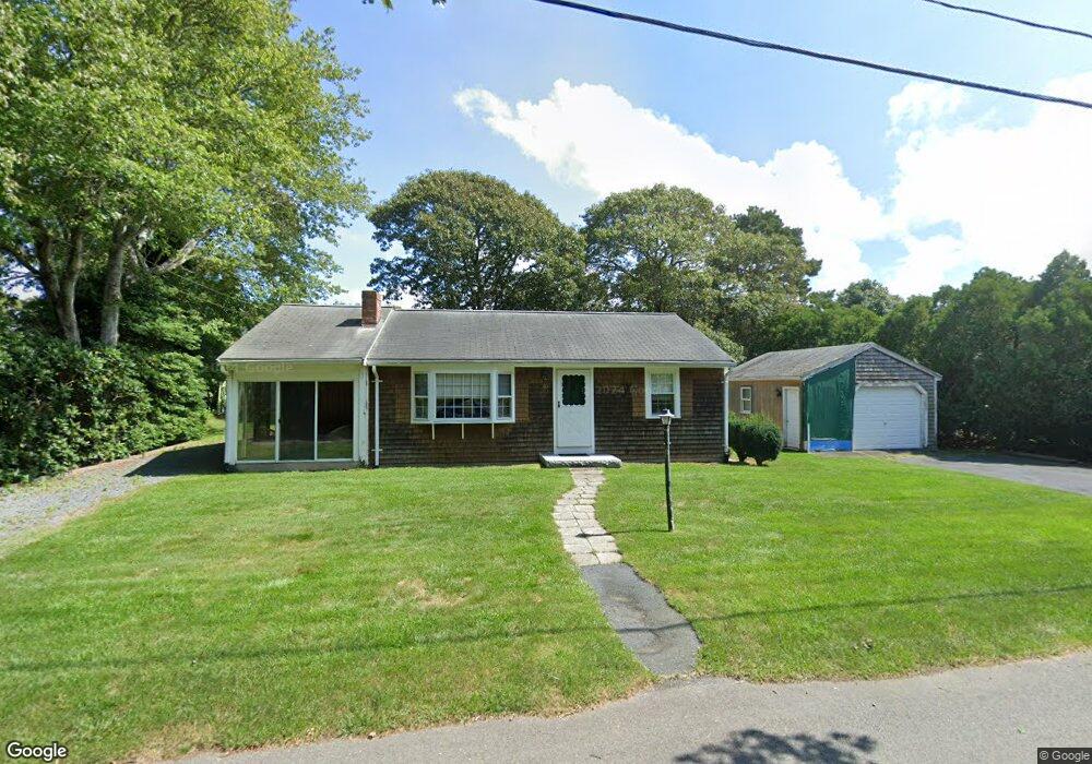
60 Michaels Ave Dennis Port, MA 02639
Dennis Port NeighborhoodEstimated Value: $557,000 - $664,000
3
Beds
1
Bath
1,001
Sq Ft
$611/Sq Ft
Est. Value
About This Home
This home is located at 60 Michaels Ave, Dennis Port, MA 02639 and is currently estimated at $611,686, approximately $611 per square foot. 60 Michaels Ave is a home located in Barnstable County with nearby schools including Dennis-Yarmouth Regional High School and St. Pius X. School.
Ownership History
Date
Name
Owned For
Owner Type
Purchase Details
Closed on
Mar 30, 2004
Sold by
Nee Kathleen M and Nee Stephen J
Bought by
Masci Joseph C and Masci Mary M
Current Estimated Value
Home Financials for this Owner
Home Financials are based on the most recent Mortgage that was taken out on this home.
Original Mortgage
$240,000
Outstanding Balance
$112,862
Interest Rate
5.65%
Mortgage Type
Purchase Money Mortgage
Estimated Equity
$498,824
Purchase Details
Closed on
Oct 18, 2001
Sold by
Nee Michael G and Nee Sheila F
Bought by
Nee Stephen J and Nee Kathleen M
Home Financials for this Owner
Home Financials are based on the most recent Mortgage that was taken out on this home.
Original Mortgage
$180,000
Interest Rate
6.92%
Mortgage Type
Purchase Money Mortgage
Create a Home Valuation Report for This Property
The Home Valuation Report is an in-depth analysis detailing your home's value as well as a comparison with similar homes in the area
Home Values in the Area
Average Home Value in this Area
Purchase History
| Date | Buyer | Sale Price | Title Company |
|---|---|---|---|
| Masci Joseph C | $300,000 | -- | |
| Nee Stephen J | $200,000 | -- |
Source: Public Records
Mortgage History
| Date | Status | Borrower | Loan Amount |
|---|---|---|---|
| Open | Masci Joseph C | $240,000 | |
| Previous Owner | Nee Stephen J | $180,000 |
Source: Public Records
Tax History Compared to Growth
Tax History
| Year | Tax Paid | Tax Assessment Tax Assessment Total Assessment is a certain percentage of the fair market value that is determined by local assessors to be the total taxable value of land and additions on the property. | Land | Improvement |
|---|---|---|---|---|
| 2025 | $2,446 | $565,000 | $205,700 | $359,300 |
| 2024 | $2,284 | $520,200 | $197,800 | $322,400 |
| 2023 | $2,209 | $473,100 | $179,800 | $293,300 |
| 2022 | $2,138 | $381,700 | $162,000 | $219,700 |
| 2021 | $2,515 | $363,000 | $181,500 | $181,500 |
| 2020 | $1,976 | $324,000 | $158,800 | $165,200 |
| 2019 | $5,199 | $303,300 | $155,700 | $147,600 |
| 2018 | $1,783 | $281,300 | $148,200 | $133,100 |
| 2017 | $1,640 | $266,600 | $137,600 | $129,000 |
| 2016 | $1,684 | $257,900 | $148,200 | $109,700 |
| 2015 | $1,651 | $257,900 | $148,200 | $109,700 |
| 2014 | $1,503 | $236,700 | $127,000 | $109,700 |
Source: Public Records
Map
Nearby Homes
- 80 Michaels Ave
- 19 Standish Way
- 12 Spoonbill Rd
- 71 Main St
- 4 Coffey Ln
- 31 Easy St
- 125 Main St Unit 3
- 22 Wixon Rd
- 15 Woodside Park Rd
- 72 Bassett Ln
- 37 Ocean Dr Unit 2
- 61 Trotters Ln
- 268 Main St
- 64 Beaten Rd
- 26 Center St
- 95 Center St
- 112 Old Wharf Rd Unit E4
- 112 Old Wharf Rd Unit E1
- 3 Pinefield Ln
- 154 Old Wharf Rd Unit 26
- 109 Lawrence Rd
- 64 Michaels Ave
- 111 Lawrence Rd
- 105 Lawrence Rd
- 117 Lawrence Rd
- 68 Michaels Ave
- 52 Michaels Ave
- 68 Michael's Ave
- 101 Lawrence Rd
- 106 Lawrence Rd
- 61 Michaels Ave
- 121 Lawrence Rd
- 102 Lawrence Rd
- 112 Lawrence Rd
- 98 Lawrence Rd
- 46 Michaels Ave
- 69 Michaels Ave
- 79 Michael's Ave
- 10 Barnard Rd
- 97 Polly Fisk Ln