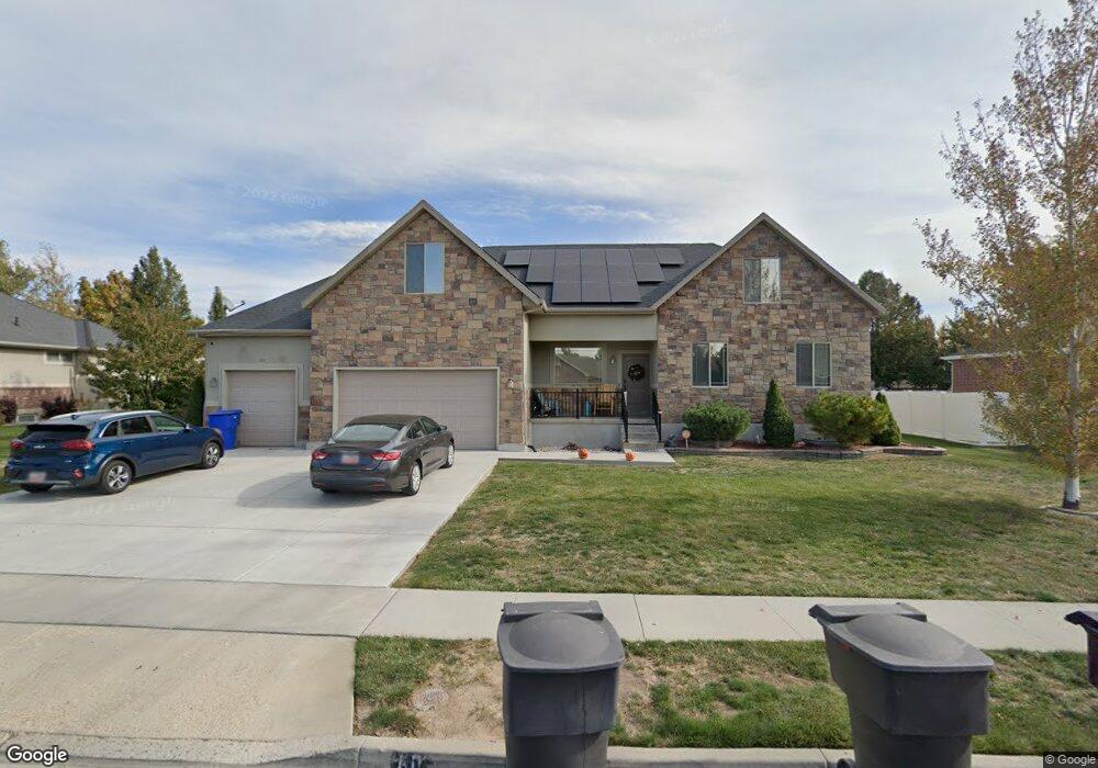
60 N 1750 W Clearfield, UT 84015
Estimated Value: $675,000 - $762,707
8
Beds
4
Baths
4,036
Sq Ft
$179/Sq Ft
Est. Value
About This Home
This home is located at 60 N 1750 W, Clearfield, UT 84015 and is currently estimated at $724,177, approximately $179 per square foot. 60 N 1750 W is a home located in Davis County with nearby schools including Lakeside School, West Point Junior High School, and Syracuse High School.
Ownership History
Date
Name
Owned For
Owner Type
Purchase Details
Closed on
Mar 19, 2021
Sold by
Carter Jerrell L and Carter Helena
Bought by
Highfield Bryce and Highfield Julie
Current Estimated Value
Home Financials for this Owner
Home Financials are based on the most recent Mortgage that was taken out on this home.
Original Mortgage
$552,123
Outstanding Balance
$494,939
Interest Rate
2.7%
Mortgage Type
VA
Estimated Equity
$229,238
Purchase Details
Closed on
Jul 13, 2010
Sold by
Carter Jerrell and Carter Helena
Bought by
Carter Jerrell L and Carter Helena
Home Financials for this Owner
Home Financials are based on the most recent Mortgage that was taken out on this home.
Original Mortgage
$314,425
Interest Rate
4.76%
Mortgage Type
VA
Purchase Details
Closed on
Jul 20, 2007
Sold by
Resmae Mortgage Corp
Bought by
Carter Jerrell and Carter Helena
Home Financials for this Owner
Home Financials are based on the most recent Mortgage that was taken out on this home.
Original Mortgage
$311,450
Interest Rate
6.73%
Mortgage Type
VA
Purchase Details
Closed on
Dec 6, 2006
Sold by
Webb Spencer
Bought by
Resmae Mortgage Corp
Purchase Details
Closed on
Mar 7, 2006
Sold by
Sexton Zoe
Bought by
Webb J Spencer
Home Financials for this Owner
Home Financials are based on the most recent Mortgage that was taken out on this home.
Original Mortgage
$67,900
Interest Rate
5.66%
Mortgage Type
Stand Alone Second
Purchase Details
Closed on
Feb 19, 2005
Sold by
Maple Raymond L
Bought by
Sexton Zoe
Purchase Details
Closed on
Apr 12, 2004
Sold by
Zaugg Construction Inc
Bought by
Maple Raymond L
Home Financials for this Owner
Home Financials are based on the most recent Mortgage that was taken out on this home.
Original Mortgage
$227,500
Interest Rate
5.77%
Mortgage Type
Construction
Create a Home Valuation Report for This Property
The Home Valuation Report is an in-depth analysis detailing your home's value as well as a comparison with similar homes in the area
Home Values in the Area
Average Home Value in this Area
Purchase History
| Date | Buyer | Sale Price | Title Company |
|---|---|---|---|
| Highfield Bryce | -- | First American Titl | |
| Carter Jerrell L | -- | Us Title Company Of Uta | |
| Carter Jerrell | -- | Inwest Title Services Inc | |
| Resmae Mortgage Corp | $278,000 | None Available | |
| Webb J Spencer | -- | Brighton Title | |
| Sexton Zoe | -- | Millcreek Land Title Ins | |
| Maple Raymond L | -- | Security Title Company |
Source: Public Records
Mortgage History
| Date | Status | Borrower | Loan Amount |
|---|---|---|---|
| Open | Highfield Bryce | $552,123 | |
| Previous Owner | Carter Jerrell L | $314,425 | |
| Previous Owner | Carter Jerrell | $311,450 | |
| Previous Owner | Webb J Spencer | $67,900 | |
| Previous Owner | Webb J Spencer | $271,600 | |
| Previous Owner | Maple Raymond L | $227,500 |
Source: Public Records
Tax History Compared to Growth
Tax History
| Year | Tax Paid | Tax Assessment Tax Assessment Total Assessment is a certain percentage of the fair market value that is determined by local assessors to be the total taxable value of land and additions on the property. | Land | Improvement |
|---|---|---|---|---|
| 2025 | $3,985 | $373,450 | $105,148 | $268,302 |
| 2024 | $3,956 | $372,350 | $94,702 | $277,648 |
| 2023 | $3,719 | $644,000 | $115,742 | $528,258 |
| 2022 | $3,894 | $369,050 | $59,572 | $309,478 |
| 2021 | $3,449 | $489,000 | $95,551 | $393,449 |
| 2020 | $2,565 | $413,000 | $79,816 | $333,184 |
| 2019 | $2,565 | $397,000 | $77,572 | $319,428 |
| 2018 | $0 | $371,000 | $78,580 | $292,420 |
| 2016 | $2,496 | $178,640 | $30,360 | $148,280 |
| 2015 | $2,566 | $173,965 | $30,360 | $143,605 |
| 2014 | $2,257 | $155,168 | $30,360 | $124,808 |
| 2013 | $2,240 | $146,155 | $43,221 | $102,934 |
Source: Public Records
Map
Nearby Homes
- 47 N 1750 W
- 1828 W 75 S
- 1648 W 150 S
- 12 N 2000 W Unit 1
- 135 S 1525 W
- 1774 W 400 N
- 16 N 1300 W
- 1652 W 560 N
- 575 N 1350 W Unit 137
- 1350 W 300 N Unit 49
- 1350 W 300 N Unit 38
- 1350 W 300 N Unit 29
- 607 N 2000 W
- 1805 W 675 N
- 563 N 1350 W Unit 139
- 1337 W 550 N Unit 195
- 423 N 1250 W Unit 118
- 303 N Canterbury Way
- 4284 W 350 S Unit 615
- 4296 W 350 S Unit 614