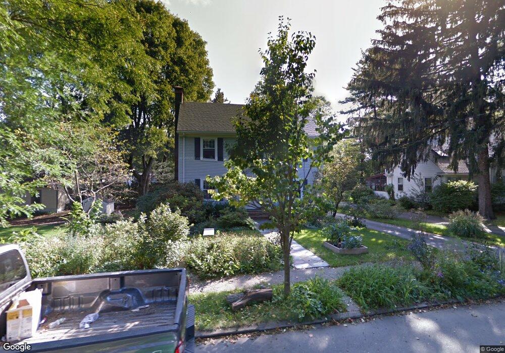
60 Otis St Needham, MA 02492
Estimated Value: $1,050,000 - $1,791,000
4
Beds
3
Baths
1,306
Sq Ft
$1,111/Sq Ft
Est. Value
About This Home
This home is located at 60 Otis St, Needham, MA 02492 and is currently estimated at $1,450,692, approximately $1,110 per square foot. 60 Otis St is a home located in Norfolk County with nearby schools including Mitchell Elementary School, High Rock Middle School, and Pollard Middle School.
Ownership History
Date
Name
Owned For
Owner Type
Purchase Details
Closed on
May 8, 2017
Sold by
Abbott Susan
Bought by
Abbott Ft and Abbott
Current Estimated Value
Purchase Details
Closed on
Aug 20, 1998
Sold by
Treseler Mary
Bought by
Kirk Matthew
Home Financials for this Owner
Home Financials are based on the most recent Mortgage that was taken out on this home.
Original Mortgage
$296,000
Interest Rate
6.86%
Mortgage Type
Purchase Money Mortgage
Create a Home Valuation Report for This Property
The Home Valuation Report is an in-depth analysis detailing your home's value as well as a comparison with similar homes in the area
Home Values in the Area
Average Home Value in this Area
Purchase History
| Date | Buyer | Sale Price | Title Company |
|---|---|---|---|
| Abbott Ft | -- | -- | |
| Kirk Matthew | $370,000 | -- |
Source: Public Records
Mortgage History
| Date | Status | Borrower | Loan Amount |
|---|---|---|---|
| Previous Owner | Kirk Matthew | $296,000 |
Source: Public Records
Tax History
| Year | Tax Paid | Tax Assessment Tax Assessment Total Assessment is a certain percentage of the fair market value that is determined by local assessors to be the total taxable value of land and additions on the property. | Land | Improvement |
|---|---|---|---|---|
| 2025 | $13,862 | $1,307,700 | $985,900 | $321,800 |
| 2024 | $12,061 | $963,300 | $636,100 | $327,200 |
| 2023 | $12,256 | $939,900 | $636,100 | $303,800 |
| 2022 | $11,715 | $876,200 | $583,500 | $292,700 |
| 2021 | $11,417 | $876,200 | $583,500 | $292,700 |
| 2020 | $10,928 | $874,900 | $583,800 | $291,100 |
| 2019 | $10,103 | $815,400 | $530,700 | $284,700 |
| 2018 | $9,687 | $815,400 | $530,700 | $284,700 |
| 2017 | $9,335 | $785,100 | $530,700 | $254,400 |
| 2016 | $8,976 | $777,800 | $530,700 | $247,100 |
| 2015 | $8,781 | $777,800 | $530,700 | $247,100 |
| 2014 | $8,283 | $711,600 | $478,700 | $232,900 |
Source: Public Records
Map
Nearby Homes
- 131 Fair Oaks Park
- 711 Webster St
- 674 Webster St
- 44 Hemlock St
- 238 Harris Ave
- 18 Grant St Unit 2
- 22 Grant St
- 34 Lincoln St Unit 34
- 19 Oakland Ave Unit 19
- 11 Fairlawn St
- 971 Webster St
- 194 Lindbergh Ave
- 535 Great Plain Ave
- 100 Rosemary Way Unit 206
- 100 Rosemary Way Unit 231
- 447 Hillside Ave
- 72 Oakcrest Rd
- 170 West St Unit 170
- 170 West St
- 75 High Rock St
- 66 Otis St
- 377 Manning St
- 763 Great Plain Ave
- 369 Manning St
- 755 Great Plain Ave
- 42 Otis St Unit R
- 389 Manning St
- 59 Otis St
- 780 Webster St
- 776 Webster St
- 65 Otis St
- 786 Webster St
- 40 Otis St Unit L
- 773 Great Plain Ave
- 361 Manning St
- 75 Otis St
- 749 Great Plain Ave
- 762 Webster St
- 357 Manning St
- 781 Great Plain Ave
Your Personal Tour Guide
Ask me questions while you tour the home.