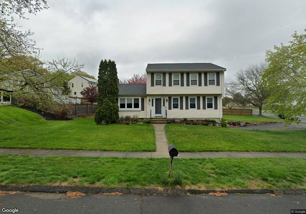
60 Plane Tree Rd Stratford, CT 06614
Estimated Value: $556,000 - $672,000
3
Beds
2
Baths
2,270
Sq Ft
$278/Sq Ft
Est. Value
About This Home
This home is located at 60 Plane Tree Rd, Stratford, CT 06614 and is currently estimated at $631,049, approximately $277 per square foot. 60 Plane Tree Rd is a home located in Fairfield County with nearby schools including Chapel Street Elementary School, Harry B. Flood Middle School, and Bunnell High School.
Ownership History
Date
Name
Owned For
Owner Type
Purchase Details
Closed on
Nov 1, 1996
Sold by
Petrino John and Petrino Mary
Bought by
Schraml James J and Schraml Linda S
Current Estimated Value
Home Financials for this Owner
Home Financials are based on the most recent Mortgage that was taken out on this home.
Original Mortgage
$170,400
Interest Rate
8.07%
Mortgage Type
Unknown
Create a Home Valuation Report for This Property
The Home Valuation Report is an in-depth analysis detailing your home's value as well as a comparison with similar homes in the area
Home Values in the Area
Average Home Value in this Area
Purchase History
| Date | Buyer | Sale Price | Title Company |
|---|---|---|---|
| Schraml James J | $213,000 | -- |
Source: Public Records
Mortgage History
| Date | Status | Borrower | Loan Amount |
|---|---|---|---|
| Closed | Schraml James J | $244,000 | |
| Closed | Schraml James J | $5,000 | |
| Closed | Schraml James J | $170,400 | |
| Previous Owner | Schraml James J | $58,000 |
Source: Public Records
Tax History
| Year | Tax Paid | Tax Assessment Tax Assessment Total Assessment is a certain percentage of the fair market value that is determined by local assessors to be the total taxable value of land and additions on the property. | Land | Improvement |
|---|---|---|---|---|
| 2025 | $9,852 | $245,070 | $104,440 | $140,630 |
| 2024 | $9,852 | $245,070 | $104,440 | $140,630 |
| 2023 | $9,852 | $245,070 | $104,440 | $140,630 |
| 2022 | $9,670 | $245,070 | $104,440 | $140,630 |
| 2021 | $9,673 | $245,070 | $104,440 | $140,630 |
| 2020 | $9,715 | $245,070 | $104,440 | $140,630 |
| 2019 | $9,098 | $228,200 | $87,920 | $140,280 |
| 2018 | $9,105 | $228,200 | $87,920 | $140,280 |
| 2017 | $9,121 | $228,200 | $87,920 | $140,280 |
| 2016 | $8,898 | $228,200 | $87,920 | $140,280 |
| 2015 | $8,439 | $228,200 | $87,920 | $140,280 |
| 2014 | $8,769 | $246,120 | $93,520 | $152,600 |
Source: Public Records
Map
Nearby Homes
- 280 Goldbach Dr
- 175 Post Oak Rd
- 260 Overland Dr
- 2322 Nichols Ave
- 135 Wigwam Ln
- 1414 Huntington Rd
- 120 Barton Dr
- 171 Flagler Ave
- 220 Hilltop Cir
- 165 Douglas St
- 170 Pumpkin Ground Rd
- 670 Wigwam Ln
- 52 Circle Dr
- 130 Wainwright Place
- 168 Sunnybank Ave
- 3 Wheeler Dr
- 700 Huntington Rd
- 3699 Broadbridge Ave Unit 101
- 191 Anson St
- 15 Ferndale Place
- 325 Post Oak Rd
- 345 Quenby Place
- 325 Quenby Place
- 300 Post Oak Rd
- 25 Plane Tree Rd
- 305 Post Oak Rd
- 305 Quenby Place
- 35 Plane Tree Rd
- 280 Post Oak Rd
- 300 Quenby Place
- 45 Plane Tree Rd
- 65 Plane Tree Rd
- 340 Quenby Place
- 285 Post Oak Rd
- 300 Goldbach Dr
- 285 Quenby Place
- 340 Goldbach Dr
- 95 Plane Tree Rd
- 320 Quenby Place
- 265 Post Oak Rd
Your Personal Tour Guide
Ask me questions while you tour the home.