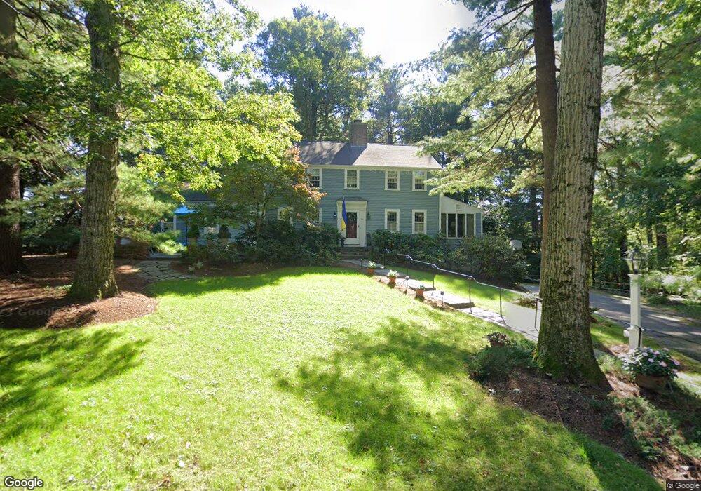
60 Redington Rd Needham, MA 02492
Estimated Value: $1,452,000 - $1,942,000
3
Beds
3
Baths
1,755
Sq Ft
$970/Sq Ft
Est. Value
About This Home
This home is located at 60 Redington Rd, Needham, MA 02492 and is currently estimated at $1,703,133, approximately $970 per square foot. 60 Redington Rd is a home located in Norfolk County with nearby schools including Newman Elementary School, High Rock Middle School, and Pollard Middle School.
Ownership History
Date
Name
Owned For
Owner Type
Purchase Details
Closed on
Nov 21, 2024
Sold by
Ryan John P and Ryan Jeanne-Marie
Bought by
Ryan-Dever Ft and Ryan
Current Estimated Value
Purchase Details
Closed on
Sep 14, 1990
Sold by
Farwell Frank L
Bought by
Ryan John P
Create a Home Valuation Report for This Property
The Home Valuation Report is an in-depth analysis detailing your home's value as well as a comparison with similar homes in the area
Home Values in the Area
Average Home Value in this Area
Purchase History
| Date | Buyer | Sale Price | Title Company |
|---|---|---|---|
| Ryan-Dever Ft | -- | None Available | |
| Ryan-Dever Ft | -- | None Available | |
| Ryan John P | $382,500 | -- | |
| Ryan John P | $382,500 | -- |
Source: Public Records
Mortgage History
| Date | Status | Borrower | Loan Amount |
|---|---|---|---|
| Previous Owner | Ryan John P | $400,000 | |
| Previous Owner | Ryan John P | $300,000 |
Source: Public Records
Tax History
| Year | Tax Paid | Tax Assessment Tax Assessment Total Assessment is a certain percentage of the fair market value that is determined by local assessors to be the total taxable value of land and additions on the property. | Land | Improvement |
|---|---|---|---|---|
| 2025 | $16,528 | $1,559,200 | $1,122,800 | $436,400 |
| 2024 | $14,244 | $1,137,700 | $631,200 | $506,500 |
| 2023 | $14,280 | $1,095,100 | $631,200 | $463,900 |
| 2022 | $13,739 | $1,027,600 | $586,200 | $441,400 |
| 2021 | $13,390 | $1,027,600 | $586,200 | $441,400 |
| 2020 | $13,423 | $1,074,700 | $586,200 | $488,500 |
| 2019 | $12,561 | $1,013,800 | $535,100 | $478,700 |
| 2018 | $12,044 | $1,013,800 | $535,100 | $478,700 |
| 2017 | $11,382 | $957,300 | $535,100 | $422,200 |
| 2016 | $11,047 | $957,300 | $535,100 | $422,200 |
| 2015 | $10,808 | $957,300 | $535,100 | $422,200 |
| 2014 | $10,386 | $892,300 | $488,600 | $403,700 |
Source: Public Records
Map
Nearby Homes
- 120 Wildwood Dr
- 90 Norfolk St
- 1011 Webster St
- 47 Emerson Rd
- 68 Pleasant St Unit 68
- 53 Heather Ln
- 233 Warren St
- 287 High Rock St
- 957 South St
- 73 Maple St Unit 1
- 24 Deerfield Rd
- 26 Pinewood Rd
- 40 Otis St Unit L
- 95 Deerfield Rd
- 193 Garden St
- 178 South St
- 19 Highland Ct Unit 19
- 78 Birds Hill Ave
- 37 Cottage Cir
- 37 Cottage Cir Unit 37
- 50 Hutter Ridge Rd
- 68 Redington Rd
- 48 Redington Rd
- 9 High Rock St
- 44 Hutter Ridge Rd
- 51 Redington Rd
- 75 Redington Rd
- 39 Hutter Ridge Rd
- 1135 Webster St
- 40 Hutter Ridge Rd
- 465 Warren St
- 465 Warren St Unit 1
- 38 Redington Rd
- 33 High Rock St
- 1 Hutter Ridge Rd
- 21 Laurel Cir
- 11 Redington Rd
- 453 Warren St
- 28 Redington Rd
- 25 Hutter Ridge Rd