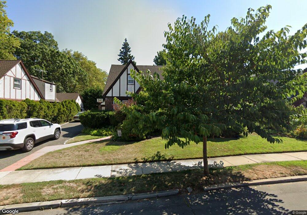
60 Stevenson St Lynbrook, NY 11563
Estimated Value: $834,689 - $932,000
Studio
2
Baths
2,124
Sq Ft
$416/Sq Ft
Est. Value
About This Home
This home is located at 60 Stevenson St, Lynbrook, NY 11563 and is currently estimated at $883,345, approximately $415 per square foot. 60 Stevenson St is a home located in Nassau County with nearby schools including Lynbrook Senior High School, Our Lady Of Peace School, and Our Lady of Lourdes School.
Ownership History
Date
Name
Owned For
Owner Type
Purchase Details
Closed on
Feb 15, 2022
Sold by
Oconnor Robert E
Bought by
Bermiss Daniel Oscar and Bermiss Maura Elizabeth
Current Estimated Value
Home Financials for this Owner
Home Financials are based on the most recent Mortgage that was taken out on this home.
Original Mortgage
$480,000
Outstanding Balance
$446,466
Interest Rate
3.69%
Mortgage Type
New Conventional
Estimated Equity
$436,879
Purchase Details
Closed on
Aug 5, 2017
Sold by
Connor Jophn R O and Connor Ann M O
Bought by
Connor John R O
Purchase Details
Closed on
Mar 16, 2015
Sold by
Oconnor John R and Oconnor Ann M
Bought by
Oconnor John R and Oconnor Ann M
Create a Home Valuation Report for This Property
The Home Valuation Report is an in-depth analysis detailing your home's value as well as a comparison with similar homes in the area
Home Values in the Area
Average Home Value in this Area
Purchase History
| Date | Buyer | Sale Price | Title Company |
|---|---|---|---|
| Bermiss Daniel Oscar | $600,000 | None Available | |
| Connor John R O | -- | None Available | |
| Oconnor John R | -- | Attorney |
Source: Public Records
Mortgage History
| Date | Status | Borrower | Loan Amount |
|---|---|---|---|
| Open | Bermiss Daniel Oscar | $480,000 |
Source: Public Records
Tax History
| Year | Tax Paid | Tax Assessment Tax Assessment Total Assessment is a certain percentage of the fair market value that is determined by local assessors to be the total taxable value of land and additions on the property. | Land | Improvement |
|---|---|---|---|---|
| 2025 | $14,166 | $614 | $275 | $339 |
| 2024 | $1,250 | $580 | $259 | $321 |
Source: Public Records
Map
Nearby Homes
- 42 Hendrickson Ave
- 40 Hendrickson Ave
- 14 Hawthorne St
- 263 Foster Ave
- 64 Hodson Ave
- 127 Smith St
- 35 Carlton St
- 90 Pearsall Ave
- 32 Franklin Ave
- 71 Home St
- 29 Summit Ave
- 63 Central Ave
- 232 Sherman St
- 149 Foster Ave
- 181 Walnut St
- 57 Nieman Ave
- 157 Hempstead Ave Unit B20
- 200 E Euclid St
- 95 Foster Ave
- 145 Cornwell Ave
Your Personal Tour Guide
Ask me questions while you tour the home.