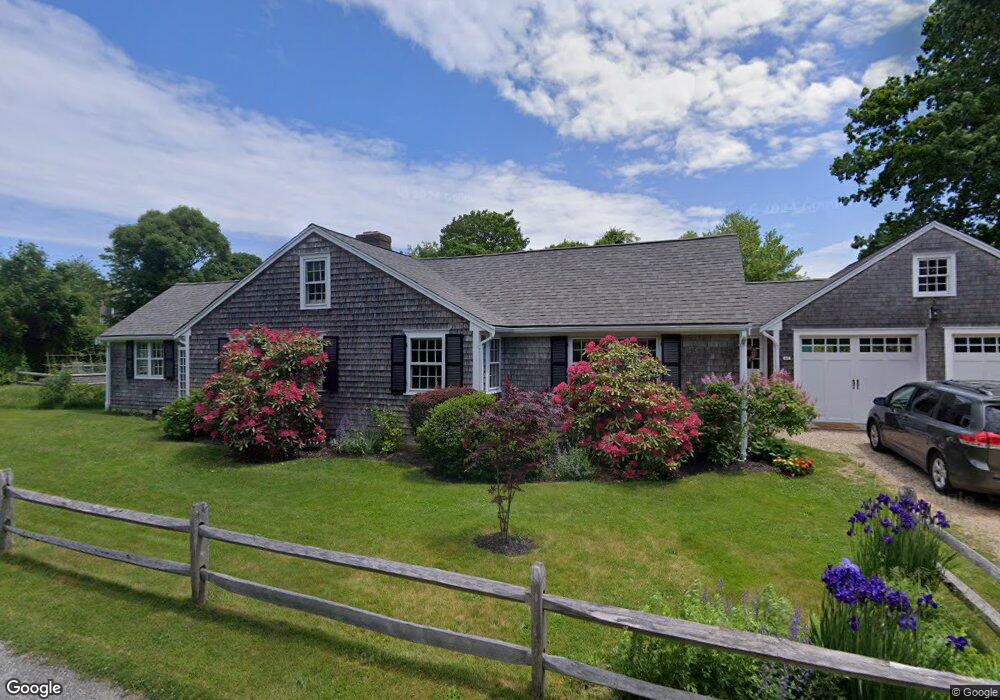
60 Stoney Point Rd Barnstable, MA 2630
Barnstable Village NeighborhoodEstimated Value: $872,000 - $1,177,000
3
Beds
2
Baths
1,779
Sq Ft
$585/Sq Ft
Est. Value
About This Home
This home is located at 60 Stoney Point Rd, Barnstable, MA 2630 and is currently estimated at $1,040,241, approximately $584 per square foot. 60 Stoney Point Rd is a home located in Barnstable County with nearby schools including West Barnstable Elementary School, Barnstable United Elementary School, and Barnstable Intermediate School.
Ownership History
Date
Name
Owned For
Owner Type
Purchase Details
Closed on
Oct 31, 2016
Sold by
Jag Rt and Goldstein
Bought by
Dow William S and Goldstein Julia R
Current Estimated Value
Home Financials for this Owner
Home Financials are based on the most recent Mortgage that was taken out on this home.
Original Mortgage
$315,000
Outstanding Balance
$250,814
Interest Rate
3.5%
Mortgage Type
New Conventional
Estimated Equity
$789,427
Purchase Details
Closed on
Dec 5, 2006
Sold by
Goldstein Bea Marie and Goldstein Jeffrey
Bought by
Jag Rt and Goldstein
Purchase Details
Closed on
Sep 15, 1989
Sold by
Est Ernest Rick Jr
Bought by
Goldstein Jeffrey
Create a Home Valuation Report for This Property
The Home Valuation Report is an in-depth analysis detailing your home's value as well as a comparison with similar homes in the area
Home Values in the Area
Average Home Value in this Area
Purchase History
| Date | Buyer | Sale Price | Title Company |
|---|---|---|---|
| Dow William S | $350,000 | -- | |
| Jag Rt | -- | -- | |
| Goldstein Jeffrey | $125,000 | -- |
Source: Public Records
Mortgage History
| Date | Status | Borrower | Loan Amount |
|---|---|---|---|
| Open | Dow William S | $315,000 | |
| Previous Owner | Goldstein Jeffrey | $95,000 |
Source: Public Records
Tax History
| Year | Tax Paid | Tax Assessment Tax Assessment Total Assessment is a certain percentage of the fair market value that is determined by local assessors to be the total taxable value of land and additions on the property. | Land | Improvement |
|---|---|---|---|---|
| 2025 | $8,936 | $967,100 | $528,600 | $438,500 |
| 2024 | $8,473 | $967,200 | $558,200 | $409,000 |
| 2023 | $6,825 | $760,000 | $393,700 | $366,300 |
| 2022 | $7,239 | $648,700 | $336,800 | $311,900 |
| 2021 | $6,520 | $556,800 | $306,200 | $250,600 |
| 2020 | $6,819 | $556,200 | $327,100 | $229,100 |
| 2019 | $6,448 | $527,700 | $327,100 | $200,600 |
| 2018 | $2,329 | $520,300 | $358,000 | $162,300 |
| 2017 | $6,544 | $523,500 | $371,800 | $151,700 |
| 2016 | $6,366 | $516,300 | $372,000 | $144,300 |
| 2015 | $6,101 | $503,800 | $356,900 | $146,900 |
Source: Public Records
Map
Nearby Homes
- 30 Indian Trail
- 79 Bayberry Ln
- 4390 Main St
- 44 Iris Ln
- 41 Dromoland Ln
- 65 Oakmont Rd
- 3528 Main St
- 18 Sleeping Dog Path
- 100 Spy Glass Hill Rd
- 81 Desert Sands Ln
- 162 Route 6a
- 0 Indian Trail
- 186 Route 6a
- 0 Phinneys Ln
- 371 Route 6a
- 93 Harris Meadow Ln
- 69 Allyn Ln
- 95 Washington Ave
- 28 Mariners Ln
- 61 Coolidge Rd
- 79 Stoney Point Rd
- 79 Stoney Point Rd
- 106 Bone Hill Rd
- 41 Stoney Point Rd
- 65 Stoney Point Rd
- 94 Stoney Point Rd
- 51 Holly Ln
- 21 Stoney Point Rd
- 29 Holly Ln
- 4054 Main Route 6a St
- 4054 Main St
- 4010 Main St
- 15 Bone Hill Rd
- 23 Holly Ln
- 9 Candy Ln
- 111 Stoney Point Rd
- 65 Bone Hill Rd
- 4070 Main St
- 4022 Main St
- 15 Bone Hill Rd
Your Personal Tour Guide
Ask me questions while you tour the home.