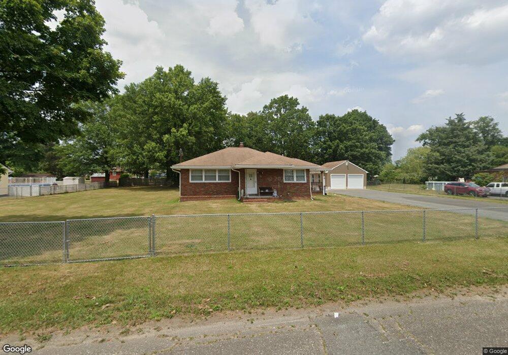
60 Summit St Vineland, NJ 08360
Estimated Value: $229,600 - $314,000
--
Bed
--
Bath
1,157
Sq Ft
$244/Sq Ft
Est. Value
About This Home
This home is located at 60 Summit St, Vineland, NJ 08360 and is currently estimated at $282,400, approximately $244 per square foot. 60 Summit St is a home located in Cumberland County with nearby schools including Max Leuchter Elementary School, T.W. Wallace Middle School, and Vineland Senior High School.
Ownership History
Date
Name
Owned For
Owner Type
Purchase Details
Closed on
Nov 2, 2021
Sold by
Ayala Jorge N
Bought by
Ayala Omayra
Current Estimated Value
Home Financials for this Owner
Home Financials are based on the most recent Mortgage that was taken out on this home.
Original Mortgage
$109,900
Interest Rate
2.99%
Mortgage Type
New Conventional
Purchase Details
Closed on
Mar 23, 2007
Sold by
Ayala Jorge N
Bought by
Ayala Jorge N and Ayala Omayra
Purchase Details
Closed on
Mar 1, 1996
Sold by
Levari Steven A
Bought by
Acevedo Deliz Nereida and Martinez Perez Jose Luis
Home Financials for this Owner
Home Financials are based on the most recent Mortgage that was taken out on this home.
Original Mortgage
$69,900
Interest Rate
9%
Purchase Details
Closed on
Oct 4, 1995
Sold by
Ayala Jorge N
Bought by
Ayala Elizabeth
Create a Home Valuation Report for This Property
The Home Valuation Report is an in-depth analysis detailing your home's value as well as a comparison with similar homes in the area
Home Values in the Area
Average Home Value in this Area
Purchase History
| Date | Buyer | Sale Price | Title Company |
|---|---|---|---|
| Ayala Omayra | -- | None Listed On Document | |
| Ayala Jorge N | -- | -- | |
| Acevedo Deliz Nereida | $79,900 | Commonwealth Land Title Ins | |
| Ayala Elizabeth | -- | -- |
Source: Public Records
Mortgage History
| Date | Status | Borrower | Loan Amount |
|---|---|---|---|
| Previous Owner | Ayala Omayra | $109,900 | |
| Previous Owner | Acevedo Deliz Nereida | $69,900 |
Source: Public Records
Tax History Compared to Growth
Tax History
| Year | Tax Paid | Tax Assessment Tax Assessment Total Assessment is a certain percentage of the fair market value that is determined by local assessors to be the total taxable value of land and additions on the property. | Land | Improvement |
|---|---|---|---|---|
| 2025 | $4,598 | $144,400 | $33,100 | $111,300 |
| 2024 | $4,598 | $144,400 | $33,100 | $111,300 |
| 2023 | $4,567 | $144,400 | $33,100 | $111,300 |
| 2022 | $4,432 | $144,400 | $33,100 | $111,300 |
| 2021 | $4,351 | $144,400 | $33,100 | $111,300 |
| 2020 | $4,227 | $144,400 | $33,100 | $111,300 |
| 2019 | $4,169 | $144,400 | $33,100 | $111,300 |
| 2018 | $4,059 | $144,400 | $33,100 | $111,300 |
| 2017 | $3,855 | $144,400 | $33,100 | $111,300 |
| 2016 | $3,720 | $144,400 | $33,100 | $111,300 |
| 2015 | $3,583 | $144,400 | $33,100 | $111,300 |
| 2014 | $3,388 | $144,400 | $33,100 | $111,300 |
Source: Public Records
Map
Nearby Homes
- 105 Oxford St
- 550 Northwest Ave
- 225 Laurel St
- 663 Wayne Ave
- 317 Oxford St
- 1020 W Oak Rd
- 1032 W Oak Rd
- 1050 W Oak Rd
- 1489 N Delsea Dr
- 108 W Park Ave
- 1252 W Oak Rd
- 515 Boody Dr
- 1230 Almond Rd
- 1378 Venus Dr
- 1111 N Orchard Rd
- 1392 W Oak Rd
- 1267 N East Blvd Unit 16C
- 1887 N Delsea Dr Unit 135 HOLLY HOCK DR.
- 1887 N Delsea Dr Unit 19
- 1887 N Delsea Dr Unit 39