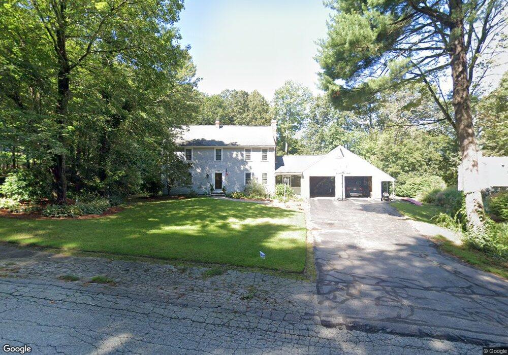
60 Sumner Perry Dr Wrentham, MA 02093
Estimated Value: $728,000 - $942,000
3
Beds
3
Baths
2,468
Sq Ft
$333/Sq Ft
Est. Value
About This Home
This home is located at 60 Sumner Perry Dr, Wrentham, MA 02093 and is currently estimated at $821,127, approximately $332 per square foot. 60 Sumner Perry Dr is a home located in Norfolk County with nearby schools including Delaney Elementary School and Charles E Roderick.
Ownership History
Date
Name
Owned For
Owner Type
Purchase Details
Closed on
May 26, 2000
Sold by
Mahoney Edward J and Mahoney Ann L
Bought by
Bowes Paul R
Current Estimated Value
Create a Home Valuation Report for This Property
The Home Valuation Report is an in-depth analysis detailing your home's value as well as a comparison with similar homes in the area
Purchase History
| Date | Buyer | Sale Price | Title Company |
|---|---|---|---|
| Bowes Paul R | $345,000 | -- |
Source: Public Records
Mortgage History
| Date | Status | Borrower | Loan Amount |
|---|---|---|---|
| Open | Bowes Paul R | $293,000 | |
| Closed | Bowes Paul R | $244,000 |
Source: Public Records
Tax History
| Year | Tax Paid | Tax Assessment Tax Assessment Total Assessment is a certain percentage of the fair market value that is determined by local assessors to be the total taxable value of land and additions on the property. | Land | Improvement |
|---|---|---|---|---|
| 2025 | $8,378 | $722,900 | $263,100 | $459,800 |
| 2024 | $8,060 | $671,700 | $263,100 | $408,600 |
| 2023 | $7,879 | $624,300 | $239,300 | $385,000 |
| 2022 | $7,505 | $549,000 | $215,500 | $333,500 |
| 2021 | $7,024 | $499,200 | $192,500 | $306,700 |
| 2020 | $7,268 | $510,000 | $175,700 | $334,300 |
| 2019 | $7,210 | $510,600 | $191,600 | $319,000 |
| 2018 | $7,514 | $527,700 | $175,900 | $351,800 |
| 2017 | $7,305 | $512,600 | $172,500 | $340,100 |
| 2016 | $7,209 | $504,800 | $167,500 | $337,300 |
| 2015 | $7,177 | $479,100 | $161,000 | $318,100 |
| 2014 | $7,111 | $464,500 | $154,800 | $309,700 |
Source: Public Records
Map
Nearby Homes
- 11 Earle Stewart Ln
- Loty 3-14 Earle Stewart Ln
- 10 Nature View Dr
- 15 Nature View Dr
- 12 Earle Stewart Ln
- Lot 1 - Blueberry 2 Car Plan at King Philip Estates
- Lot 8 - Blueberry 2 Car Plan at King Philip Estates
- Lot 5 - Hughes 2 car Plan at King Philip Estates
- Lot 6 - Blueberry 3 Car Plan at King Philip Estates
- 10 Earle Stewart Ln Unit Lot 5
- Lot 2 - Camden 2 Car Plan at King Philip Estates
- Lot 7 - Cedar Plan at King Philip Estates
- Lot 4 - Hemingway 2 Car Plan at King Philip Estates
- Lot 3 - Blueberry 2 Car Plan at King Philip Estates
- 319 Taunton St
- 155 Clark Rd Unit 155
- 500 Franklin St
- 287 Park St
- 50 Reed Fulton Ave Unit Lot 61
- 483 Thurston St
- 50 Sumner Perry Dr
- 70 Sumner Perry Dr
- 65 Sumner Perry Dr
- 55 Sumner Perry Dr
- 80 Sumner Perry Dr
- 45 Sumner Perry Dr
- 35 Sumner Perry Dr
- 75 Sumner Perry Dr
- 261 South St
- 255 South St
- 85 Sumner Perry Dr
- 15 Sumner Perry Dr
- 267 South St
- 241 South St
- 95 Sumner Perry Dr
- 277 South St
- 279 South St
- 264 South St
- 281 South St
- 100 Randall Rd
Your Personal Tour Guide
Ask me questions while you tour the home.