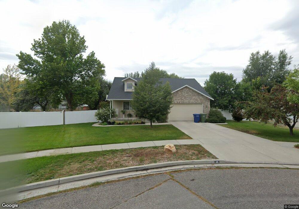
60 Thomas Ct Logan, UT 84321
Woodruff NeighborhoodEstimated Value: $379,677 - $407,000
Studio
--
Bath
1,120
Sq Ft
$351/Sq Ft
Est. Value
About This Home
This home is located at 60 Thomas Ct, Logan, UT 84321 and is currently estimated at $393,669, approximately $351 per square foot. 60 Thomas Ct is a home with nearby schools including Woodruff School, Mount Logan Middle School, and Logan High School.
Ownership History
Date
Name
Owned For
Owner Type
Purchase Details
Closed on
Aug 28, 2025
Sold by
Moe Frances Sharlene
Bought by
Frances Sharlene Moe Inter Vivos Trust and Moe
Current Estimated Value
Home Financials for this Owner
Home Financials are based on the most recent Mortgage that was taken out on this home.
Original Mortgage
$200,000
Outstanding Balance
$197,904
Interest Rate
5.87%
Mortgage Type
New Conventional
Estimated Equity
$195,765
Purchase Details
Closed on
Nov 14, 2008
Sold by
Moe Frances Sharlene
Bought by
Moe Frances Sharlene and Frances Sharlene Moe Inter Viv
Purchase Details
Closed on
Aug 24, 2001
Sold by
Rjt Enterprises #2 Lc
Bought by
Thompson Cody and Thompson Melissa
Home Financials for this Owner
Home Financials are based on the most recent Mortgage that was taken out on this home.
Original Mortgage
$21,000
Interest Rate
7.05%
Mortgage Type
Seller Take Back
Create a Home Valuation Report for This Property
The Home Valuation Report is an in-depth analysis detailing your home's value as well as a comparison with similar homes in the area
Home Values in the Area
Average Home Value in this Area
Purchase History
| Date | Buyer | Sale Price | Title Company |
|---|---|---|---|
| Frances Sharlene Moe Inter Vivos Trust | -- | Lincoln Title | |
| Frances Sharlene Moe Inter Vivos Trust | -- | Lincoln Title | |
| Moe Frances Sharlene | -- | Lincoln Title | |
| Moe Frances Sharlene | -- | Lincoln Title | |
| Moe Frances Sharlene | -- | Cache Title Company | |
| Thompson Cody | -- | Northern Title Company |
Source: Public Records
Mortgage History
| Date | Status | Borrower | Loan Amount |
|---|---|---|---|
| Open | Moe Frances Sharlene | $200,000 | |
| Closed | Moe Frances Sharlene | $200,000 | |
| Previous Owner | Thompson Cody | $21,000 |
Source: Public Records
Tax History
| Year | Tax Paid | Tax Assessment Tax Assessment Total Assessment is a certain percentage of the fair market value that is determined by local assessors to be the total taxable value of land and additions on the property. | Land | Improvement |
|---|---|---|---|---|
| 2025 | $1,635 | $211,515 | $0 | $0 |
| 2024 | $1,679 | $210,350 | $0 | $0 |
| 2023 | $1,736 | $207,275 | $0 | $0 |
| 2022 | $1,519 | $169,325 | $0 | $0 |
| 2021 | $1,480 | $254,890 | $43,000 | $211,890 |
| 2020 | $1,351 | $209,474 | $43,000 | $166,474 |
| 2019 | $1,412 | $209,474 | $43,000 | $166,474 |
| 2018 | $1,387 | $187,760 | $43,000 | $144,760 |
| 2017 | $1,303 | $93,280 | $0 | $0 |
| 2016 | $1,351 | $93,280 | $0 | $0 |
| 2015 | $1,163 | $80,255 | $0 | $0 |
| 2014 | $1,052 | $80,255 | $0 | $0 |
| 2013 | -- | $80,255 | $0 | $0 |
Source: Public Records
Map
Nearby Homes
- 1031 W 350 S
- 370 S 1200 W Unit 2
- 248 Sunstone Ct
- 952 W 330 S
- 1400 S 940 W
- 1099 Three Pointe Ave
- 1033 W 500 S
- 508 S 1215 W Unit 144
- 1227 W 500 S Unit 151
- 521 S 1215 W Unit 126
- 539 S 1215 W Unit 129
- 545 S 1215 W
- 551 S 1215 W Unit 131
- 551 S 1215 W
- 1214 W 575 S
- Hemlock Plan at Sugar Creek - Logan
- Eucalyptus Plan at Sugar Creek - Logan
- Blackberry Plan at Sugar Creek - Logan
- Magnolia Plan at Sugar Creek - Logan
- 1239 W 575 S
Your Personal Tour Guide
Ask me questions while you tour the home.